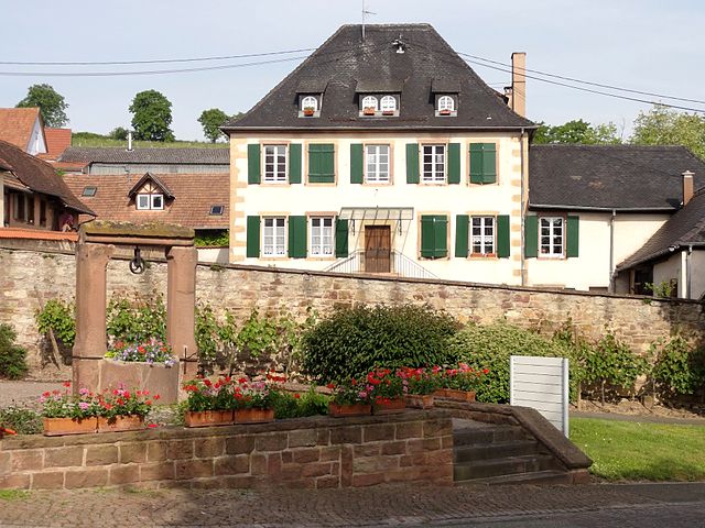
Osthoffen (Osthoffen)

- commune in Bas-Rhin, France
- Country:

- Postal Code: 67990
- Coordinates: 48° 35' 10" N, 7° 33' 19" E


- GPS tracks (wikiloc): [Link]
- Area: 5.11 sq km
- Population: 834
- Wikipedia en: wiki(en)
- Wikipedia: wiki(fr)
- Wikidata storage: Wikidata: Q21374
- Wikipedia Commons Category: [Link]
- Freebase ID: [/m/03m9b0b]
- Freebase ID: [/m/03m9b0b]
- GeoNames ID: Alt: [6441277]
- GeoNames ID: Alt: [6441277]
- SIREN number: [216703637]
- SIREN number: [216703637]
- BnF ID: [152715050]
- BnF ID: [152715050]
- VIAF ID: Alt: [239684060]
- VIAF ID: Alt: [239684060]
- WOEID: [615293]
- WOEID: [615293]
- INSEE municipality code: 67363
- INSEE municipality code: 67363
Shares border with regions:

Dahlenheim
- commune in Bas-Rhin, France
- Country:
- Postal Code: 67310
- Coordinates: 48° 35' 8" N, 7° 30' 26" E
- GPS tracks (wikiloc): [Link]
- Area: 5.35 sq km
- Population: 763

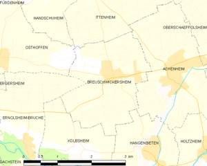
Breuschwickersheim
- commune in Bas-Rhin, France
- Country:
- Postal Code: 67112
- Coordinates: 48° 34' 47" N, 7° 36' 6" E
- GPS tracks (wikiloc): [Link]
- Area: 5.06 sq km
- Population: 1259


Handschuheim
- commune in Bas-Rhin, France
- Country:
- Postal Code: 67117
- Coordinates: 48° 36' 10" N, 7° 34' 38" E
- GPS tracks (wikiloc): [Link]
- Area: 2.4 sq km
- Population: 278


Ittenheim
- commune in Bas-Rhin, France
- Country:
- Postal Code: 67117
- Coordinates: 48° 36' 15" N, 7° 35' 40" E
- GPS tracks (wikiloc): [Link]
- Area: 6.71 sq km
- Population: 2120
- Web site: [Link]

Ernolsheim-Bruche
- commune in Bas-Rhin, France
- Country:
- Postal Code: 67120
- Coordinates: 48° 33' 50" N, 7° 33' 56" E
- GPS tracks (wikiloc): [Link]
- Area: 6.59 sq km
- Population: 1826


Ergersheim
- commune in Bas-Rhin, France
- Country:
- Postal Code: 67120
- Coordinates: 48° 34' 11" N, 7° 31' 37" E
- GPS tracks (wikiloc): [Link]
- Area: 6.51 sq km
- Population: 1293
- Web site: [Link]


Furdenheim
- commune in Bas-Rhin, France
- Country:
- Postal Code: 67117
- Coordinates: 48° 36' 42" N, 7° 33' 40" E
- GPS tracks (wikiloc): [Link]
- AboveSeaLevel: 180 м m
- Area: 5.81 sq km
- Population: 1320
- Web site: [Link]