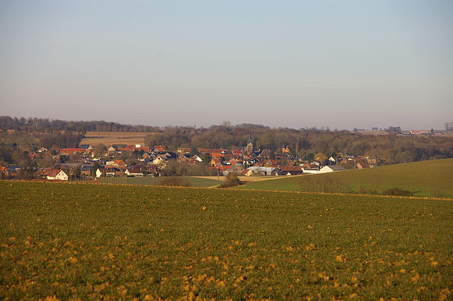
Ovillers-la-Boisselle (Ovillers-la-Boisselle)
- commune in Somme, France
- Country:

- Postal Code: 80300
- Coordinates: 50° 1' 53" N, 2° 41' 52" E


- GPS tracks (wikiloc): [Link]
- AboveSeaLevel: 115 м m
- Area: 9.61 sq km
- Population: 448
- Web site: http://www.paysducoquelicot.com/ovillers-la-boisselle.htm
- Wikipedia en: wiki(en)
- Wikipedia: wiki(fr)
- Wikidata storage: Wikidata: Q489920
- Wikipedia Commons Category: [Link]
- Freebase ID: [/m/0431q2]
- GeoNames ID: Alt: [6444665]
- SIREN number: [218005809]
- BnF ID: [15277091g]
- VIAF ID: Alt: [185003456]
- Library of Congress authority ID: Alt: [no2011135254]
- WOEID: [12667944]
- Chemins de mémoire ID: [la-boisselle]
- INSEE municipality code: 80615
Shares border with regions:


Bécordel-Bécourt
- commune in Somme, France
- Country:

- Postal Code: 80300
- Coordinates: 49° 59' 23" N, 2° 41' 8" E


- GPS tracks (wikiloc): [Link]
- Area: 3.57 sq km
- Population: 162
- Web site: [Link]


Fricourt
- commune in Somme, France
- Country:

- Postal Code: 80300
- Coordinates: 49° 59' 53" N, 2° 42' 54" E


- GPS tracks (wikiloc): [Link]
- Area: 11.3 sq km
- Population: 499
- Web site: [Link]


Grandcourt
- commune in Somme, France
- Country:

- Postal Code: 80300
- Coordinates: 50° 4' 46" N, 2° 42' 34" E


- GPS tracks (wikiloc): [Link]
- Area: 8.38 sq km
- Population: 177
- Web site: [Link]


Albert
- commune in Somme, France
- Country:

- Postal Code: 80300
- Coordinates: 50° 0' 7" N, 2° 39' 8" E


- GPS tracks (wikiloc): [Link]
- AboveSeaLevel: 67 м m
- Area: 13.8 sq km
- Population: 9931
- Web site: [Link]


Aveluy
- commune in Somme, France
- Country:

- Postal Code: 80300
- Coordinates: 50° 1' 24" N, 2° 39' 29" E


- GPS tracks (wikiloc): [Link]
- Area: 6.64 sq km
- Population: 524
- Web site: [Link]


Authuille
- commune in Somme, France
- Country:

- Postal Code: 80300
- Coordinates: 50° 2' 35" N, 2° 40' 6" E


- GPS tracks (wikiloc): [Link]
- Area: 3.58 sq km
- Population: 170
- Web site: [Link]


Pozières
- commune in Somme, France
- Country:

- Postal Code: 80300
- Coordinates: 50° 2' 27" N, 2° 43' 22" E


- GPS tracks (wikiloc): [Link]
- Area: 3.24 sq km
- Population: 259
- Web site: [Link]


Contalmaison
- commune in Somme, France
- Country:

- Postal Code: 80300
- Coordinates: 50° 1' 23" N, 2° 43' 49" E


- GPS tracks (wikiloc): [Link]
- Area: 5.67 sq km
- Population: 119
- Web site: [Link]


Thiepval
- commune in Somme, France
- Country:

- Postal Code: 80300
- Coordinates: 50° 3' 16" N, 2° 41' 20" E


- GPS tracks (wikiloc): [Link]
- Area: 4.4 sq km
- Population: 131
- Web site: [Link]
