
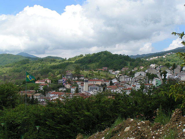
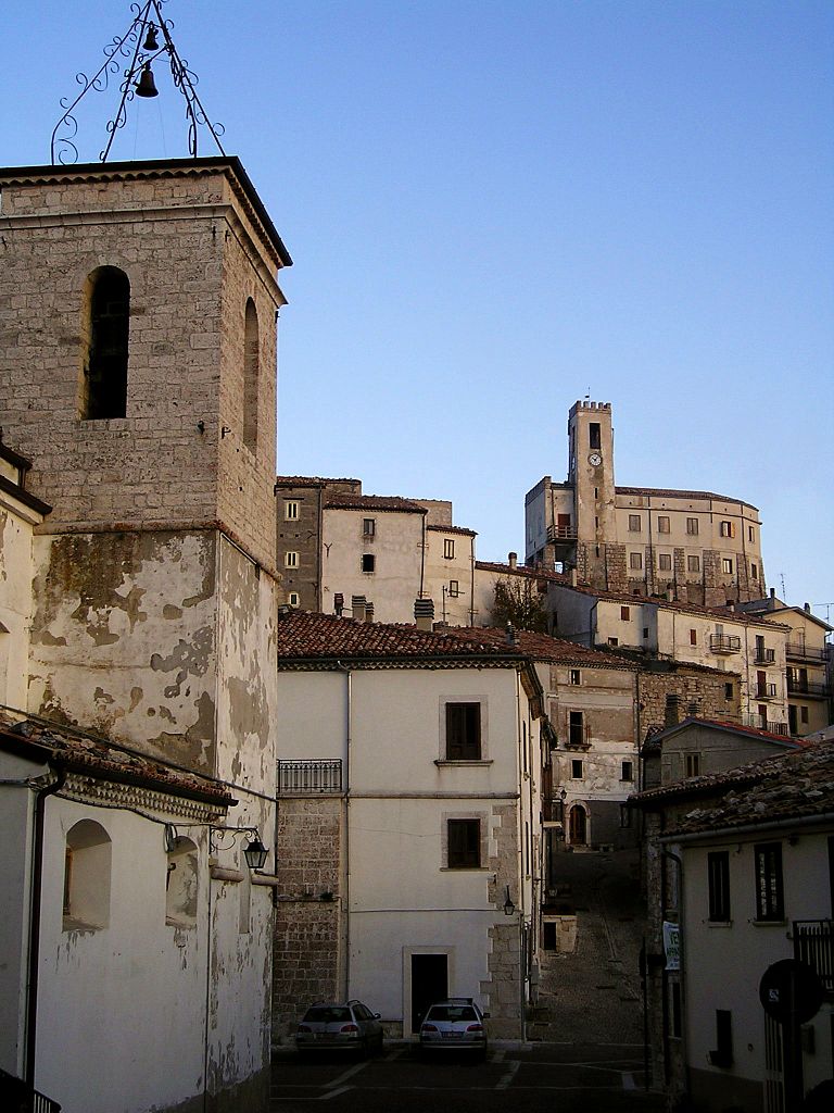
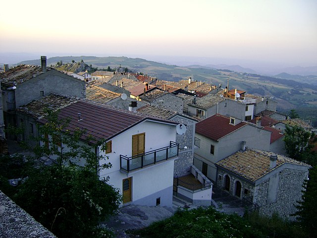
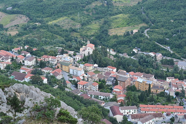
Palena, Abruzzo (Palena)
.svg)
- Italian comune
 Hiking in Palena, Abruzzo
Palena, located in the Abruzzo region of Italy, is a hidden gem for hikers and nature enthusiasts. Nestled in the Majella National Park, it offers stunning landscapes, diverse flora and fauna, and a range of hiking trails suitable for all skill levels.
Key Highlights of Hiking in Palena:
-
Scenic Trails: The area is renowned for its panoramic views, rugged mountains, and lush valleys. Popular trails include:
- Sentiero del Camoscio (Chamois Trail): This trail offers breathtaking views of the surrounding mountains and is known for sightings of the elusive chamois.
- Lago di Scanno: Although a bit further away, this picturesque lake provides opportunities for a loop hike while taking in the stunning natural scenery.
-
Majella National Park: As part of this expansive park, hikers can explore diverse ecosystems, including beech forests, alpine meadows, and rocky highlands. The park also boasts unique geological formations.
-
Wildlife Watching: The area is home to a variety of wildlife, including deer, wolves, and numerous bird species. Early morning or late afternoon hikes may offer the best chances for wildlife spotting.
-
Cultural Experience: While hiking, you can also discover charming villages like Palena itself, which is rich in history and local traditions. Consider visiting local eateries to enjoy Abruzzese cuisine after a day on the trails.
-
Seasonal Considerations: The best times for hiking in Palena are during spring and early fall when the weather is mild and the paths are accessible. Summer can be warm but is still popular for hiking, while winter offers opportunities for snowshoeing and winter trekking.
-
Preparation and Safety: As with any hiking trip, it’s important to prepare well. Make sure to bring plenty of water, snacks, appropriate clothing, and a map or GPS device. Depending on the trail and time of year, conditions can vary significantly.
-
Guided Tours: If you’re unfamiliar with the area, consider joining a guided hiking tour. Local guides can provide valuable insights into the region's ecology and history and ensure a safe and enjoyable adventure.
Overall, hiking in Palena and the surrounding areas of Abruzzo can provide a rewarding experience that combines outdoor adventure, stunning landscapes, and cultural richness. Always remember to follow local guidelines and respect nature while exploring this beautiful environment!
- Country:

- Postal Code: 66017
- Local Dialing Code: 0872
- Licence Plate Code: CH
- Coordinates: 41° 58' 54" N, 14° 8' 3" E


- GPS tracks (wikiloc): [Link]
- AboveSeaLevel: 767 м m
- Area: 93.63 sq km
- Population: 1332
- Web site: http://www.comunedipalena.it/
- Wikipedia en: wiki(en)
- Wikipedia: wiki(it)
- Wikidata storage: Wikidata: Q51258
- Wikipedia Commons Category: [Link]
- Freebase ID: [/m/0fg2dk]
- GeoNames ID: Alt: [6538882]
- OSM relation ID: [41630]
- ISTAT ID: 069060
- Italian cadastre code: G271
Shares border with regions:

Ateleta
- Italian comune
Hiking in Ateleta
Ateleta, a charming town in the Abruzzo region of Italy, offers beautiful hiking opportunities characterized by stunning landscapes, picturesque views, and diverse trails. The surrounding area is part of the larger Maiella National Park, which is known for its rich biodiversity, rugged mountain terrain, and scenic vistas....
- Country:
- Postal Code: 67030
- Local Dialing Code: 0864
- Licence Plate Code: AQ
- Coordinates: 41° 51' 16" N, 14° 11' 56" E
- GPS tracks (wikiloc): [Link]
- AboveSeaLevel: 760 м m
- Area: 41.93 sq km
- Population: 1156
- Web site: [Link]


Campo di Giove
- Italian comune
Hiking in Campo di Giove
Campo di Giove is a beautiful destination located in the Abruzzo region of Italy, nestled in the Apennine Mountains. This area is known for its natural beauty, rich history, and a variety of hiking trails that cater to different skill levels. Here are some key points about hiking in Campo di Giove:...
- Country:
- Postal Code: 67030
- Local Dialing Code: 0864
- Licence Plate Code: AQ
- Coordinates: 42° 0' 40" N, 14° 2' 25" E
- GPS tracks (wikiloc): [Link]
- AboveSeaLevel: 1064 м m
- Area: 28.9 sq km
- Population: 795
- Web site: [Link]


Cansano
- Italian comune
Hiking in Cansano
Cansano is a quaint village situated in the Abruzzo region of Italy, known for its picturesque landscapes and access to a variety of hiking trails. The area is characterized by rolling hills, lush forests, and stunning mountain views, making it a fantastic destination for outdoor enthusiasts....
- Country:
- Postal Code: 67030
- Local Dialing Code: 0864
- Licence Plate Code: AQ
- Coordinates: 42° 0' 19" N, 14° 0' 46" E
- GPS tracks (wikiloc): [Link]
- AboveSeaLevel: 835 м m
- Area: 37.7 sq km
- Population: 244
- Web site: [Link]

Pacentro
- Italian comune
Hiking in Pacentro
Pacentro, located in the Abruzzo region of Italy, is a charming hilltop village known for its stunning views, ancient architecture, and access to beautiful natural landscapes. Hiking in and around Pacentro offers a unique experience, blending culture, history, and nature....
- Country:
- Postal Code: 67030
- Local Dialing Code: 0864
- Licence Plate Code: AQ
- Coordinates: 42° 3' 2" N, 13° 59' 29" E
- GPS tracks (wikiloc): [Link]
- AboveSeaLevel: 653 м m
- Area: 72.59 sq km
- Population: 1140
- Web site: [Link]


Pescocostanzo
- Italian comune
Hiking in Pescocostanzo
Pescocostanzo is a charming village located in the Abruzzo region of Italy, nestled in the Apennine Mountains. It is a fantastic destination for hikers, offering a mix of stunning landscapes, historical sites, and a range of trails suitable for different skill levels....
- Country:
- Postal Code: 67033
- Local Dialing Code: 0864
- Licence Plate Code: AQ
- Coordinates: 41° 53' 14" N, 14° 3' 59" E
- GPS tracks (wikiloc): [Link]
- AboveSeaLevel: 1395 м m
- Area: 55.06 sq km
- Population: 1090
- Web site: [Link]

Gamberale
- Italian comune
Hiking in Gamberale
Gamberale, a charming village located in the Abruzzo region of Italy, offers a fantastic hiking experience surrounded by stunning natural landscapes. The area is characterized by mountainous terrain, lush forests, and picturesque views, making it an excellent destination for outdoor enthusiasts....
- Country:
- Postal Code: 66040
- Local Dialing Code: 0872
- Licence Plate Code: CH
- Coordinates: 41° 54' 0" N, 14° 13' 0" E
- GPS tracks (wikiloc): [Link]
- AboveSeaLevel: 1343 м m
- Area: 15.56 sq km
- Population: 300
- Web site: [Link]
Lettopalena
- Italian comune
Hiking in Lettopalena
Lettopalena is a charming village located in the Abruzzo region of Italy, surrounded by stunning natural landscapes, mountains, and historical sites. Hiking in and around Lettopalena offers a rich experience due to the diverse terrain, scenic views, and opportunities to explore the local flora and fauna....
- Country:
- Postal Code: 66010
- Local Dialing Code: 0872
- Licence Plate Code: CH
- Coordinates: 42° 0' 0" N, 14° 10' 0" E
- GPS tracks (wikiloc): [Link]
- AboveSeaLevel: 680 м m
- Area: 21.13 sq km
- Population: 339
- Web site: [Link]

Montenerodomo
- Italian comune
Hiking in Montenerodomo
Montenerodomo is a charming village located in the Abruzzo region of Italy, surrounded by stunning natural landscapes that are perfect for hiking enthusiasts. Here are some key points to consider if you're thinking about hiking in and around Montenerodomo:...
- Country:
- Postal Code: 66010
- Local Dialing Code: 0872
- Licence Plate Code: CH
- Coordinates: 41° 59' 0" N, 14° 15' 0" E
- GPS tracks (wikiloc): [Link]
- AboveSeaLevel: 1165 м m
- Area: 30 sq km
- Population: 656
- Web site: [Link]

Taranta Peligna
- Italian comune
Hiking in Taranta Peligna
Taranta Peligna is a quaint village located in the Abruzzo region of Italy, surrounded by stunning natural landscapes that make it a great destination for hiking enthusiasts. The area boasts a mix of rolling hills, mountainous terrain, and picturesque views, making it ideal for various hiking experiences....
- Country:
- Postal Code: 66018
- Local Dialing Code: 0872
- Licence Plate Code: CH
- Coordinates: 42° 1' 0" N, 14° 10' 0" E
- GPS tracks (wikiloc): [Link]
- AboveSeaLevel: 460 м m
- Area: 21.9 sq km
- Population: 353
- Web site: [Link]