
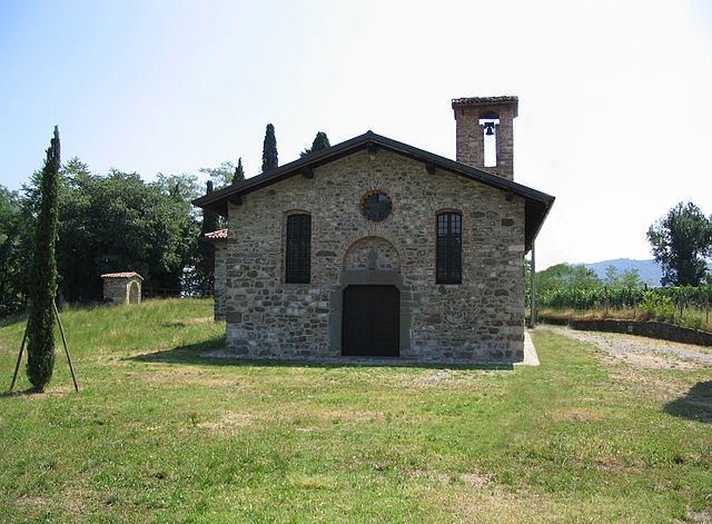
Paratico (Paratico)
.svg)
- Italian comune
 Hiking in Paratico
Paratico is a charming town located on the shores of Lake Iseo in Lombardy, Italy. While it is primarily known for its scenic beauty and proximity to the lake, the surrounding area offers several hiking opportunities that showcase the stunning landscapes of the region.
Hiking Opportunities in and around Paratico:
-
Lake Iseo Pathways:
- The paths around Lake Iseo provide beautiful views of the lake and surrounding mountains. You can follow trails that lead to nearby towns, such as Iseo and Sarnico, giving you a chance to enjoy the local culture.
-
Montisola:
- A short ferry ride from Paratico takes you to Montisola, the largest lake island in Italy. There are several hiking trails on the island that offer panoramic views of the lake and the surrounding hills.
-
Cima Bissolati:
- For more experienced hikers, the trail to Cima Bissolati offers a rewarding hike with breathtaking views. This trail can be accessed from various points in the area and involves some elevation gain.
-
The Corna Trentapassi Trail:
- Located nearby, this trail is known for its stunning views over Lake Iseo. The hike offers a combination of scenic spots and the opportunity to experience the local flora and fauna.
-
Parco Regionale dell'Adamello:
- For more adventurous hikers, the nearby Adamello Park offers extensive trails in a more rugged mountainous environment. It’s best to plan a day trip from Paratico to explore this stunning national park.
Tips for Hiking in Paratico:
- Check the Weather: The weather can change quickly in the area, so make sure to check forecasts and dress accordingly.
- Stay Hydrated: Bring enough water, especially during hotter months.
- Respect Nature: Make sure to follow Leave No Trace principles to keep the trails clean.
- Local Maps: Consider picking up local hiking maps or using a hiking app to help guide you through the trails.
- Footwear: Wear proper hiking shoes to ensure comfort and safety on the trails.
Best Time to Hike:
Spring (April to June) and early fall (September to October) are generally ideal times for hiking in Paratico, thanks to mild temperatures and beautiful landscapes.
Exploring the trails around Paratico provides a wonderful opportunity to experience both nature and the local Italian culture, so don’t forget your camera to capture the breathtaking views along the way!
- Country:

- Postal Code: 25030
- Local Dialing Code: 035
- Licence Plate Code: BS
- Coordinates: 45° 39' 40" N, 9° 57' 12" E


- GPS tracks (wikiloc): [Link]
- AboveSeaLevel: 234 м m
- Area: 6.18 sq km
- Population: 4780
- Web site: http://www.comune.paratico.bs.it
- Wikipedia en: wiki(en)
- Wikipedia: wiki(it)
- Wikidata storage: Wikidata: Q111356
- Wikipedia Commons Category: [Link]
- Freebase ID: [/m/0468qm]
- GeoNames ID: Alt: [6540613]
- VIAF ID: Alt: [243909976]
- OSM relation ID: [45652]
- WOEID: [719959]
- UN/LOCODE: [ITPAR]
- ISTAT ID: 017134
- Italian cadastre code: G327
Shares border with regions:


Sarnico
- Italian comune
Hiking in Sarnico
Sarnico, located on the shores of Lake Iseo in the Lombardy region of northern Italy, offers a beautiful backdrop for hiking enthusiasts. The area is characterized by its picturesque landscapes, charming villages, and scenic lakeside views, making it an ideal destination for outdoor activities....
- Country:
- Postal Code: 24067
- Local Dialing Code: 035
- Licence Plate Code: BG
- Coordinates: 45° 40' 0" N, 9° 57' 0" E
- GPS tracks (wikiloc): [Link]
- AboveSeaLevel: 197 м m
- Area: 6.66 sq km
- Population: 6688
- Web site: [Link]

Villongo
- Italian comune
Hiking in Villongo
Villongo is a charming town in the Lombardy region of Italy, situated near Lake Iseo. While it may not be as widely recognized for hiking as other areas in the Italian Alps or Dolomites, it offers some beautiful trails and a picturesque backdrop for outdoor enthusiasts. Here are some key points regarding hiking in and around Villongo:...
- Country:
- Postal Code: 24060
- Local Dialing Code: 035
- Licence Plate Code: BG
- Coordinates: 45° 40' 0" N, 9° 56' 0" E
- GPS tracks (wikiloc): [Link]
- AboveSeaLevel: 233 м m
- Area: 6.04 sq km
- Population: 8147
- Web site: [Link]

Adro
- Italian comune
Hiking in Adro
Adro, located in the province of Brescia in northern Italy, is not as widely known as some other hiking destinations, but it offers beautiful landscapes and opportunities for outdoor activities....
- Country:
- Postal Code: 25030
- Local Dialing Code: 030
- Licence Plate Code: BS
- Coordinates: 45° 37' 4" N, 9° 57' 45" E
- GPS tracks (wikiloc): [Link]
- AboveSeaLevel: 271 м m
- Area: 14 sq km
- Population: 7140
- Web site: [Link]

Capriolo
- Italian comune
Hiking in Capriolo
Capriolo, located in the province of Brescia in Lombardy, Italy, is a charming area that offers a range of hiking opportunities. The surrounding landscape is characterized by rolling hills, vineyards, and a blend of natural beauty and cultural heritage. Here are some highlights and tips for hiking in Capriolo:...
- Country:
- Postal Code: 25031
- Local Dialing Code: 030
- Licence Plate Code: BS
- Coordinates: 45° 38' 0" N, 9° 55' 55" E
- GPS tracks (wikiloc): [Link]
- AboveSeaLevel: 218 м m
- Area: 13 sq km
- Population: 9467
- Web site: [Link]

Iseo
- Italian comune
Hiking in Iseo
Iseo, located in Lombardy, Italy, is a picturesque area centered around Lake Iseo, surrounded by stunning mountains, quaint villages, and lush greenery. It's a fantastic destination for hiking enthusiasts, offering a variety of trails that cater to different skill levels. Here are some highlights and popular hiking options in the region:...
- Country:
- Postal Code: 25049
- Local Dialing Code: 030
- Licence Plate Code: BS
- Coordinates: 45° 39' 31" N, 10° 3' 13" E
- GPS tracks (wikiloc): [Link]
- AboveSeaLevel: 186 м m
- Area: 28.42 sq km
- Population: 9168
- Web site: [Link]


Credaro
- Italian comune
Hiking in Credaro
Credaro, located in the Lombardy region of Italy, is a charming area known for its scenic landscapes and outdoor activities, including hiking. While it may not be one of the most famous hiking destinations in Italy, it offers beautiful trails that cater to various skill levels....
- Country:
- Postal Code: 24060
- Local Dialing Code: 035
- Licence Plate Code: BG
- Coordinates: 45° 40' 0" N, 9° 56' 0" E
- GPS tracks (wikiloc): [Link]
- AboveSeaLevel: 255 м m
- Area: 3.41 sq km
- Population: 3517
- Web site: [Link]