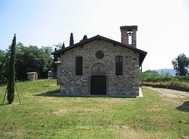
Credaro (Credaro)
.svg)
- Italian comune
 Hiking in Credaro
Credaro, located in the Lombardy region of Italy, is a charming area known for its scenic landscapes and outdoor activities, including hiking. While it may not be one of the most famous hiking destinations in Italy, it offers beautiful trails that cater to various skill levels.
Hiking in Credaro:
-
Scenic Trails: The region features a variety of trails that wind through lush vineyards, rolling hills, and picturesque countryside. You can enjoy the stunning views of the Orobian Alps and the tranquil nature surrounding the area.
-
Difficulty Levels: Trails range from easy walks suitable for families to more challenging hikes for seasoned adventurers. Be sure to assess your skill level and choose a trail that matches your experience.
-
Local Flora and Fauna: As you hike, look out for the diverse plant and wildlife native to the Lombardy region. This area is rich in biodiversity, offering a chance to spot unique species of birds and plants.
-
Cultural Heritage: Some trails may pass by historical sites, charming villages, and local wineries, allowing hikers to immerse themselves in the culture of the region while enjoying the natural beauty.
-
Best Time to Visit: The ideal time for hiking in Credaro is during spring and fall when the weather is mild, and the landscapes are vibrant with colors. Summer can be warm, while winter may bring snow and less accessible trails.
-
Preparation: Always check the weather forecast before setting out, bring sufficient water, snacks, and a good map or GPS device. It's also a good practice to inform someone of your planned route and estimated return time.
-
Local Guides: If you're unfamiliar with the area, consider joining a guided hike. Local guides can enhance your experience with their knowledge of the terrain, safety tips, and insights into the local culture.
Overall, hiking in Credaro can be a delightful experience, blending the enjoyment of nature with the charm of Italian countryside life. Whether you're a novice or an experienced hiker, there's something for everyone in this beautiful region.
- Country:

- Postal Code: 24060
- Local Dialing Code: 035
- Licence Plate Code: BG
- Coordinates: 45° 40' 0" N, 9° 56' 0" E


- GPS tracks (wikiloc): [Link]
- AboveSeaLevel: 255 м m
- Area: 3.41 sq km
- Population: 3517
- Web site: http://www.comune.credaro.bg.it
- Wikipedia en: wiki(en)
- Wikipedia: wiki(it)
- Wikidata storage: Wikidata: Q16912
- Wikipedia Commons Gallery: [Link]
- Wikipedia Commons Category: [Link]
- Freebase ID: [/m/0gj9yg]
- GeoNames ID: Alt: [6543151]
- VIAF ID: Alt: [240547501]
- OSM relation ID: [45651]
- UN/LOCODE: [ITDDE]
- ISTAT ID: 016088
- Italian cadastre code: D139
Shares border with regions:
Castelli Calepio
- Italian comune
Hiking in Castelli Calepio
Castelli Calepio is a charming area located in the province of Bergamo, Northern Italy, known for its beautiful landscapes that blend hills, vineyards, and natural reserves. Hiking in this region offers a great opportunity to experience the stunning scenery and the rich cultural heritage of the area....
- Country:
- Postal Code: 24060
- Local Dialing Code: 035
- Licence Plate Code: BG
- Coordinates: 45° 38' 0" N, 9° 54' 0" E
- GPS tracks (wikiloc): [Link]
- AboveSeaLevel: 259 м m
- Area: 10.15 sq km
- Population: 10453
- Web site: [Link]


Gandosso
- Italian comune
Hiking in Gandosso
Gandosso is a charming village located in the province of Bergamo, in the Lombardy region of Italy. The area is known for its beautiful landscapes, making it a great destination for hiking enthusiasts....
- Country:
- Postal Code: 24060
- Local Dialing Code: 035
- Licence Plate Code: BG
- Coordinates: 45° 39' 0" N, 9° 54' 0" E
- GPS tracks (wikiloc): [Link]
- AboveSeaLevel: 488 м m
- Area: 3.13 sq km
- Population: 1478
- Web site: [Link]


Trescore Balneario
- Italian comune
Hiking in Trescore Balneario
Trescore Balneario, located in the province of Bergamo in northern Italy, is a charming town known for its thermal baths and scenic landscapes. While it's not as widely recognized for hiking as some other areas in the Italian Alps, it can serve as a great base for exploring nearby trails and natural attractions....
- Country:
- Postal Code: 24069
- Local Dialing Code: 035
- Licence Plate Code: BG
- Coordinates: 45° 42' 0" N, 9° 51' 0" E
- GPS tracks (wikiloc): [Link]
- AboveSeaLevel: 271 м m
- Area: 13.51 sq km
- Population: 9814
- Web site: [Link]

Villongo
- Italian comune
Hiking in Villongo
Villongo is a charming town in the Lombardy region of Italy, situated near Lake Iseo. While it may not be as widely recognized for hiking as other areas in the Italian Alps or Dolomites, it offers some beautiful trails and a picturesque backdrop for outdoor enthusiasts. Here are some key points regarding hiking in and around Villongo:...
- Country:
- Postal Code: 24060
- Local Dialing Code: 035
- Licence Plate Code: BG
- Coordinates: 45° 40' 0" N, 9° 56' 0" E
- GPS tracks (wikiloc): [Link]
- AboveSeaLevel: 233 м m
- Area: 6.04 sq km
- Population: 8147
- Web site: [Link]


Zandobbio
- Italian comune
Hiking in Zandobbio
Zandobbio is a charming village located in the province of Bergamo, Italy, nestled in the foothills of the Alps and surrounded by beautiful natural landscapes. Hiking in this region offers a variety of trails that cater to different skill levels, making it an excellent destination for both novice and experienced hikers....
- Country:
- Postal Code: 24060
- Local Dialing Code: 035
- Licence Plate Code: BG
- Coordinates: 45° 41' 18" N, 9° 51' 9" E
- GPS tracks (wikiloc): [Link]
- AboveSeaLevel: 278 м m
- Area: 6.43 sq km
- Population: 2732
- Web site: [Link]

Capriolo
- Italian comune
Hiking in Capriolo
Capriolo, located in the province of Brescia in Lombardy, Italy, is a charming area that offers a range of hiking opportunities. The surrounding landscape is characterized by rolling hills, vineyards, and a blend of natural beauty and cultural heritage. Here are some highlights and tips for hiking in Capriolo:...
- Country:
- Postal Code: 25031
- Local Dialing Code: 030
- Licence Plate Code: BS
- Coordinates: 45° 38' 0" N, 9° 55' 55" E
- GPS tracks (wikiloc): [Link]
- AboveSeaLevel: 218 м m
- Area: 13 sq km
- Population: 9467
- Web site: [Link]

Paratico
- Italian comune
Hiking in Paratico
Paratico is a charming town located on the shores of Lake Iseo in Lombardy, Italy. While it is primarily known for its scenic beauty and proximity to the lake, the surrounding area offers several hiking opportunities that showcase the stunning landscapes of the region....
- Country:
- Postal Code: 25030
- Local Dialing Code: 035
- Licence Plate Code: BS
- Coordinates: 45° 39' 40" N, 9° 57' 12" E
- GPS tracks (wikiloc): [Link]
- AboveSeaLevel: 234 м m
- Area: 6.18 sq km
- Population: 4780
- Web site: [Link]