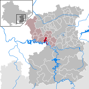
Paska (Paska)
- municipality of Germany
Paska, Germany is not specifically recognized as a well-known hiking destination, so it's possible you may be referring to a smaller village or a region nearby. However, Germany as a whole offers a wealth of hiking opportunities across various landscapes.
If you're looking for hiking in the wider area, here are some general tips and highlights:
-
Diverse Terrain: Germany features a variety of terrains ideal for hiking, from the rugged Bavarian Alps to the serene trails of the Black Forest and the scenic routes along the Rhine River.
-
Trail Networks: Most regions have well-marked trail systems. Popular regions for hiking include the Saxon Switzerland National Park, the Harz Mountains, and the trails along the Moselle River. The long-distance trails, such as the Rheinsteig and the Malerweg, offer extensive routes for more experienced hikers.
-
Wildlife and Nature: Germany's hiking trails often lead you through diverse ecosystems, where you can spot local wildlife, including deer, foxes, and a variety of bird species. The spring and summer months provide opportunities to observe blooming flora.
-
Cultural Experiences: Many trails pass through quaint villages, historic towns, and ancient castles, providing opportunities to explore local culture and history along the way.
-
Local Guidelines and Safety: When hiking, always check local weather conditions, carry enough water and snacks, and ensure you're equipped with proper footwear and gear for the length and difficulty of the trail.
-
Connecting with Local Resources: It's beneficial to look for local hiking clubs, visitor centers, or online forums that can provide specific trail recommendations, maps, and additional safety information.
If you have a specific area or type of hike in mind, please provide further details, and I can offer more tailored advice!
- Country:

- Postal Code: 07381
- Local Dialing Code: 036483
- Licence Plate Code: SOK
- Coordinates: 50° 37' 15" N, 11° 37' 44" E


- GPS tracks (wikiloc): [Link]
- AboveSeaLevel: 440 м m
- Area: 6.59 sq km
- Population: 107
- Web site: http://www.vds-ranis-ziegeneurck.de/
- Wikipedia en: wiki(en)
- Wikipedia: wiki(de)
- Wikidata storage: Wikidata: Q659304
- Wikipedia Commons Category: [Link]
- Freebase ID: [/m/03cd1pk]
- GeoNames ID: Alt: [6550461]
- VIAF ID: Alt: [244308344]
- OSM relation ID: [2179203]
- GND ID: Alt: [4772363-4]
- Historical Gazetteer (GOV) ID: [PASSKAJO50TO]
- German municipality key: 16075079

