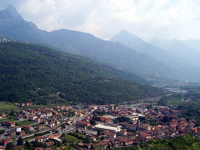
Paspardo (Paspardo)
- Italian comune
Paspardo is a charming village located in the Val Camonica region of northern Italy, known for its beautiful landscapes and opportunities for hiking. The surrounding mountains and valleys offer various trails for hikers of all skill levels. Here are some key points to consider when hiking in the Paspardo area:
Trails
-
Local Trails: There are numerous marked trails around Paspardo, catering to both beginners and experienced hikers. Websites or local tourist information centers often provide maps and route descriptions.
-
Sentiero di Val Camonica: This long-distance trail runs through the entire Val Camonica region, offering stunning views and the chance to explore the area's natural beauty.
-
Monte Guglielmo: A prominent mountain nearby, Monte Guglielmo offers excellent hiking routes with rewarding panoramic views from the summit.
Difficulty Levels
- Easy Trails: Suitable for families or casual hikers, these paths are generally well-maintained and not too steep.
- Moderate to Hard Trails: For more experienced hikers, there are steeper trails and longer routes that may require better fitness levels and some technical skills.
Best Times to Hike
- Spring (April-June): The landscape is lush and flowers bloom, making it a beautiful time for hiking.
- Autumn (September-October): The changing foliage provides stunning scenery, and the weather is generally mild.
Preparation
- Footwear: Sturdy hiking boots are essential, especially for rocky terrain.
- Weather: Check the weather forecast before heading out, as conditions can change rapidly in the mountains.
- Supplies: Bring sufficient water, snacks, a map, and a first aid kit.
Safety Tips
- Always let someone know your hiking plans.
- Be aware of your physical limits and turn back if you're feeling fatigued.
- Wildlife is present in the area, so take necessary precautions.
Additional Activities
Apart from hiking, Paspardo and the surrounding area offer opportunities for rock climbing, mountain biking, and cultural exploration of the local heritage.
If you're planning a trip, consider contacting local hiking associations or guides for organized trekking experiences that may enhance your adventure!
- Country:

- Postal Code: 25050
- Local Dialing Code: 0364
- Licence Plate Code: BS
- Coordinates: 46° 1' 54" N, 10° 22' 19" E


- GPS tracks (wikiloc): [Link]
- AboveSeaLevel: 978 м m
- Area: 11.15 sq km
- Population: 600
- Web site: http://www.comune.paspardo.bs.it
- Wikipedia en: wiki(en)
- Wikipedia: wiki(it)
- Wikidata storage: Wikidata: Q111358
- Wikipedia Commons Gallery: [Link]
- Wikipedia Commons Category: [Link]
- Freebase ID: [/m/046jqb]
- GeoNames ID: Alt: [6537176]
- OSM relation ID: [46767]
- ISTAT ID: 017135
- Italian cadastre code: G354
Shares border with regions:


Capo di Ponte
- Italian comune
Capo di Ponte, located in the province of Brescia in the Lombardy region of northern Italy, is known for its stunning landscapes and rich cultural heritage. The area is part of the larger Adamello Regional Park, which offers a variety of hiking trails suitable for all levels of hikers....
- Country:

- Postal Code: 25044
- Local Dialing Code: 0364
- Licence Plate Code: BS
- Coordinates: 46° 1' 54" N, 10° 20' 46" E


- GPS tracks (wikiloc): [Link]
- AboveSeaLevel: 362 м m
- Area: 18.11 sq km
- Population: 2471
- Web site: [Link]


Cedegolo
- Italian comune
Cedegolo, located in the Lombardy region of Italy, offers beautiful hiking opportunities primarily situated within the scenic boundaries of the Adamello Regional Park. The area is known for its stunning landscapes, diverse flora and fauna, and a rich network of trails suited for various skill levels. Here are some highlights of hiking in Cedegolo:...
- Country:

- Postal Code: 25051
- Local Dialing Code: 0364
- Licence Plate Code: BS
- Coordinates: 46° 4' 39" N, 10° 21' 2" E


- GPS tracks (wikiloc): [Link]
- AboveSeaLevel: 413 м m
- Area: 11.08 sq km
- Population: 1173
- Web site: [Link]


Cimbergo
- Italian comune
Cimbergo, located in the Lombardy region of Italy, is known for its beautiful landscapes and historical significance, which make it an attractive destination for hikers and outdoor enthusiasts. Here are some key points about hiking in Cimbergo:...
- Country:

- Postal Code: 25050
- Local Dialing Code: 0364
- Licence Plate Code: BS
- Coordinates: 46° 1' 30" N, 10° 22' 0" E


- GPS tracks (wikiloc): [Link]
- AboveSeaLevel: 850 м m
- Area: 24.71 sq km
- Population: 539
- Web site: [Link]

