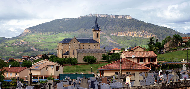
Paulhe (Paulhe)

- commune in Aveyron, France
- Country:

- Postal Code: 12520
- Coordinates: 44° 9' 8" N, 3° 6' 13" E


- GPS tracks (wikiloc): [Link]
- Area: 4.72 sq km
- Population: 393
- Wikipedia en: wiki(en)
- Wikipedia: wiki(fr)
- Wikidata storage: Wikidata: Q1364984
- Wikipedia Commons Category: [Link]
- Freebase ID: [/m/03m94wf]
- GeoNames ID: Alt: [6426985]
- SIREN number: [211201785]
- BnF ID: [15247154x]
- INSEE municipality code: 12178
Shares border with regions:


Compeyre
- commune in Aveyron, France
- Country:
- Postal Code: 12520
- Coordinates: 44° 9' 40" N, 3° 6' 6" E
- GPS tracks (wikiloc): [Link]
- Area: 10.36 sq km
- Population: 533


Aguessac
- commune in Aveyron, France
- Country:
- Postal Code: 12520
- Coordinates: 44° 9' 24" N, 3° 5' 54" E
- GPS tracks (wikiloc): [Link]
- Area: 17.64 sq km
- Population: 864
- Web site: [Link]

La Cresse
- commune in Aveyron, France
- Country:
- Postal Code: 12640
- Coordinates: 44° 10' 39" N, 3° 7' 47" E
- GPS tracks (wikiloc): [Link]
- Area: 19.06 sq km
- Population: 319

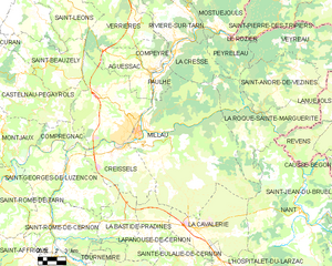
Millau
- commune in Aveyron, France
- Country:
- Postal Code: 12100
- Coordinates: 44° 5' 52" N, 3° 4' 40" E
- GPS tracks (wikiloc): [Link]
- AboveSeaLevel: 379 м m
- Area: 168.23 sq km
- Population: 22234
- Web site: [Link]