Millau (Millau)

- commune in Aveyron, France
- Country:

- Postal Code: 12100
- Coordinates: 44° 5' 52" N, 3° 4' 40" E


- GPS tracks (wikiloc): [Link]
- AboveSeaLevel: 379 м m
- Area: 168.23 sq km
- Population: 22234
- Web site: http://www.millau.fr
- Wikipedia en: wiki(en)
- Wikipedia: wiki(fr)
- Wikidata storage: Wikidata: Q203278
- Wikipedia Commons Gallery: [Link]
- Wikipedia Commons Category: [Link]
- Freebase ID: [/m/032f4b]
- Freebase ID: [/m/032f4b]
- GeoNames ID: Alt: [2993875]
- GeoNames ID: Alt: [2993875]
- SIREN number: [211201454]
- SIREN number: [211201454]
- BnF ID: [15247121z]
- BnF ID: [15247121z]
- VIAF ID: Alt: [145424923]
- VIAF ID: Alt: [145424923]
- GND ID: Alt: [4115154-9]
- GND ID: Alt: [4115154-9]
- archINFORM location ID: [8563]
- archINFORM location ID: [8563]
- Library of Congress authority ID: Alt: [n81055240]
- Library of Congress authority ID: Alt: [n81055240]
- MusicBrainz area ID: [fec10992-81e5-490f-8f1d-51be0aa545b4]
- MusicBrainz area ID: [fec10992-81e5-490f-8f1d-51be0aa545b4]
- WOEID: [12664950]
- WOEID: [12664950]
- Quora topic ID: [Millau]
- Quora topic ID: [Millau]
- Encyclopædia Britannica Online ID: [place/Millau]
- Encyclopædia Britannica Online ID: [place/Millau]
- Pleiades ID: [246353]
- Pleiades ID: [246353]
- INSEE municipality code: 12145
- INSEE municipality code: 12145
Shares border with regions:


Aguessac
- commune in Aveyron, France
- Country:
- Postal Code: 12520
- Coordinates: 44° 9' 24" N, 3° 5' 54" E
- GPS tracks (wikiloc): [Link]
- Area: 17.64 sq km
- Population: 864
- Web site: [Link]

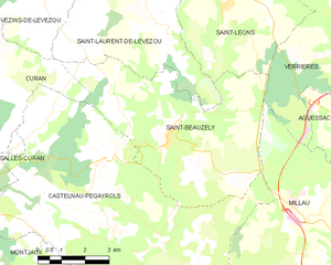
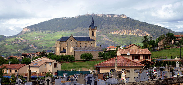
Saint-Beauzély
- commune in Aveyron, France
- Country:
- Postal Code: 12620
- Coordinates: 44° 9' 55" N, 2° 57' 29" E
- GPS tracks (wikiloc): [Link]
- Area: 30.69 sq km
- Population: 573
- Web site: [Link]

La Cresse
- commune in Aveyron, France
- Country:
- Postal Code: 12640
- Coordinates: 44° 10' 39" N, 3° 7' 47" E
- GPS tracks (wikiloc): [Link]
- Area: 19.06 sq km
- Population: 319

Creissels
- commune in Aveyron, France
- Country:
- Postal Code: 12100
- Coordinates: 44° 5' 14" N, 3° 3' 55" E
- GPS tracks (wikiloc): [Link]
- Area: 28.19 sq km
- Population: 1603


Paulhe
- commune in Aveyron, France
- Country:
- Postal Code: 12520
- Coordinates: 44° 9' 8" N, 3° 6' 13" E
- GPS tracks (wikiloc): [Link]
- Area: 4.72 sq km
- Population: 393
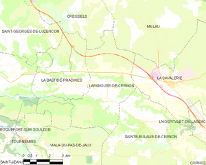
Lapanouse-de-Cernon
- commune in Aveyron, France
- Country:
- Postal Code: 12230
- Coordinates: 43° 59' 45" N, 3° 5' 51" E
- GPS tracks (wikiloc): [Link]
- Area: 22.87 sq km
- Population: 120

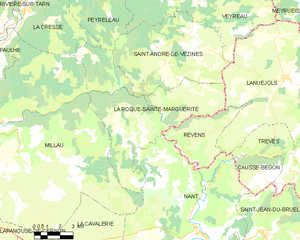
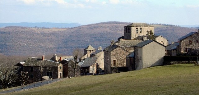
La Roque-Sainte-Marguerite
- commune in Aveyron, France
- Country:
- Postal Code: 12100
- Coordinates: 44° 7' 30" N, 3° 13' 22" E
- GPS tracks (wikiloc): [Link]
- Area: 49.4 sq km
- Population: 185

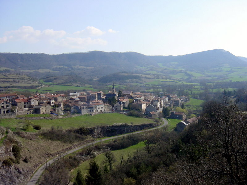
Castelnau-Pégayrols
- commune in Aveyron, France
- Country:
- Postal Code: 12620
- Coordinates: 44° 7' 47" N, 2° 56' 1" E
- GPS tracks (wikiloc): [Link]
- Area: 53.01 sq km
- Population: 340
- Web site: [Link]


Nant
- commune in Aveyron, France
- Country:
- Postal Code: 12230
- Coordinates: 44° 1' 19" N, 3° 18' 4" E
- GPS tracks (wikiloc): [Link]
- Area: 109.4 sq km
- Population: 964
- Web site: [Link]


La Cavalerie
- commune in Aveyron, France
- Country:
- Postal Code: 12230
- Coordinates: 44° 0' 32" N, 3° 9' 34" E
- GPS tracks (wikiloc): [Link]
- Area: 40.56 sq km
- Population: 1076
- Web site: [Link]


Verrières
- commune in Aveyron, France
- Country:
- Postal Code: 12520
- Coordinates: 44° 12' 5" N, 3° 3' 29" E
- GPS tracks (wikiloc): [Link]
- AboveSeaLevel: 480 м m
- Area: 53.01 sq km
- Population: 450
- Web site: [Link]

Comprégnac
- commune in Aveyron, France
- Country:
- Postal Code: 12100
- Coordinates: 44° 4' 59" N, 2° 57' 41" E
- GPS tracks (wikiloc): [Link]
- Area: 11.09 sq km
- Population: 251