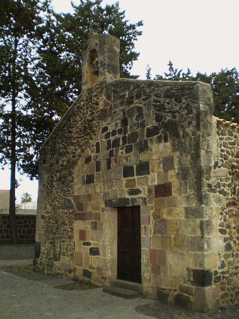
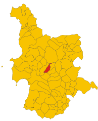
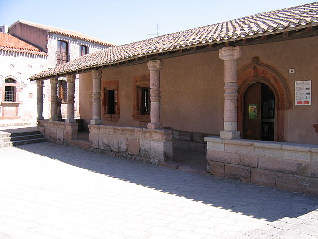
Paulilatino (Paulilatino)
%20-%202016.svg)
- Italian comune
 Hiking in Paulilatino
Paulilatino is a scenic area located in the province of Nuoro on the island of Sardinia, Italy. It's known for its stunning landscapes, rich history, and diverse wildlife, making it an excellent destination for hiking enthusiasts. Here are some key points to consider if you plan to hike in Paulilatino:
Trails and Terrain
- Variety of Trails: Paulilatino has a range of hiking trails that cater to different skill levels, from easy strolls to more challenging treks.
- Scenic Views: Hikers can enjoy beautiful views of the rolling hills, rugged mountains, and picturesque valleys typical of Sardinian landscapes.
- Natural Features: The region features diverse flora and fauna, with opportunities to spot local wildlife, including various bird species.
Historical and Cultural Sites
- Archaeological Sites: The area is rich in history, with several Nuragic sites and ancient ruins that hikers can explore.
- Traditional Villages: Along the trails, you might come across quaint villages where you can experience local culture, cuisine, and hospitality.
Best Times to Hike
- Spring and Autumn: The best times for hiking in Paulilatino are during spring (March to May) and autumn (September to November) when the weather is mild and the landscapes are lush and colorful.
Preparation and Safety
- Weather: Always check the local weather conditions before heading out. The weather can change rapidly in mountainous areas.
- Gear: Wear sturdy hiking boots, and bring plenty of water, snacks, and a first-aid kit. A map or GPS device is also recommended.
- Local Regulations: Respect local regulations and guidelines, especially around protected areas and wildlife.
Guided Tours
- Consider Joining a Guided Tour: If you're unfamiliar with the area, consider joining a guided hiking tour. Local guides can offer invaluable insights into the region’s natural and cultural history.
Overall, hiking in Paulilatino can be a rewarding experience, offering a mix of outdoor adventure, cultural exploration, and breathtaking scenery. Enjoy your hike!
- Country:

- Postal Code: 09070
- Local Dialing Code: 0785
- Licence Plate Code: OR
- Coordinates: 40° 5' 0" N, 8° 46' 0" E


- GPS tracks (wikiloc): [Link]
- AboveSeaLevel: 280 м m
- Area: 103.85 sq km
- Population: 2207
- Web site: http://www.comune.paulilatino.or.it/
- Wikipedia en: wiki(en)
- Wikipedia: wiki(it)
- Wikidata storage: Wikidata: Q387222
- Wikipedia Commons Category: [Link]
- Freebase ID: [/m/0gr0qw]
- GeoNames ID: Alt: [6539368]
- VIAF ID: Alt: [236992789]
- OSM relation ID: [40210]
- ISTAT ID: 095041
- Italian cadastre code: G384
Shares border with regions:
Zerfaliu
- Italian comune
Hiking in Zerfaliu
Zerfaliu is a lesser-known gem located in the region of Sardinia, Italy. It's an area that provides impressive landscapes, traditional culture, and the opportunity for varied hiking experiences. Here are some key points to consider if you're planning to hike in Zerfaliu:...
- Country:
- Postal Code: 09070
- Local Dialing Code: 0783
- Licence Plate Code: OR
- Coordinates: 39° 57' 36" N, 8° 42' 36" E
- GPS tracks (wikiloc): [Link]
- AboveSeaLevel: 15 м m
- Area: 15.56 sq km
- Population: 1075
- Web site: [Link]


Abbasanta
- Italian comune
Hiking in Abbasanta
Abbasanta, located in the province of Oristano in Sardinia, Italy, is a beautiful region with a rich natural and cultural landscape. While it may not be as widely recognized as some other hiking destinations in Sardinia, it offers various trails and scenic views that can be quite rewarding for hikers....
- Country:
- Postal Code: 09071
- Local Dialing Code: 0785
- Licence Plate Code: OR
- Coordinates: 40° 7' 33" N, 8° 49' 10" E
- GPS tracks (wikiloc): [Link]
- AboveSeaLevel: 313 м m
- Area: 39.85 sq km
- Population: 2689
- Web site: [Link]


Bauladu
- Italian comune
Hiking in Bauladu
Bauladu is a small town located in the central part of Sardinia, Italy. While it may not be as widely known as some other hiking destinations, it is surrounded by beautiful natural landscapes that offer various trekking opportunities....
- Country:
- Postal Code: 09070
- Local Dialing Code: 0783
- Licence Plate Code: OR
- Coordinates: 40° 1' 14" N, 8° 40' 19" E
- GPS tracks (wikiloc): [Link]
- AboveSeaLevel: 38 м m
- Area: 24.22 sq km
- Population: 677
- Web site: [Link]


Bonarcado
- Italian comune
Hiking in Bonarcado
Bonarcado is a small village located in the region of Sardinia, Italy. While it may not be as widely recognized for hiking as some of the larger national parks, the surrounding area offers beautiful landscapes and numerous opportunities for outdoor enthusiasts. Here are some key points to consider when hiking in and around Bonarcado:...
- Country:
- Postal Code: 09070
- Local Dialing Code: 0783
- Licence Plate Code: OR
- Coordinates: 40° 1' 14" N, 8° 40' 19" E
- GPS tracks (wikiloc): [Link]
- AboveSeaLevel: 284 м m
- Area: 28.41 sq km
- Population: 1587
- Web site: [Link]

Fordongianus
- Italian comune
Hiking in Fordongianus
Fordongianus, located in the province of Oristano on the island of Sardinia, Italy, is known for its stunning natural landscapes, historical sites, and a rich cultural heritage. Here are a few key points to consider if you're thinking about hiking in this area:...
- Country:
- Postal Code: 09083
- Local Dialing Code: 0783
- Licence Plate Code: OR
- Coordinates: 39° 59' 42" N, 8° 48' 34" E
- GPS tracks (wikiloc): [Link]
- AboveSeaLevel: 35 м m
- Area: 39.48 sq km
- Population: 878
- Web site: [Link]


Ghilarza
- Italian comune
Hiking in Ghilarza
Ghilarza is a charming town located in the Oristano province of Sardinia, Italy, surrounded by beautiful landscapes that are perfect for hiking enthusiasts. The area offers a mix of natural beauty, historical sites, and varying terrain, making it an excellent destination for outdoor activities....
- Country:
- Postal Code: 09074
- Local Dialing Code: 0785
- Licence Plate Code: OR
- Coordinates: 40° 7' 12" N, 8° 50' 6" E
- GPS tracks (wikiloc): [Link]
- AboveSeaLevel: 290 м m
- Area: 55.46 sq km
- Population: 4452
- Web site: [Link]


Santu Lussurgiu
- Italian comune
Hiking in Santu Lussurgiu
Santu Lussurgiu is a beautiful town in the province of Oristano, Sardinia, known for its stunning landscapes and rich cultural heritage. Hiking in and around Santu Lussurgiu offers a fantastic opportunity to explore the natural beauty of the region, including its mountains, forests, and picturesque countryside....
- Country:
- Postal Code: 09075
- Local Dialing Code: 0783
- Licence Plate Code: OR
- Coordinates: 40° 8' 31" N, 8° 39' 7" E
- GPS tracks (wikiloc): [Link]
- AboveSeaLevel: 503 м m
- Area: 99.8 sq km
- Population: 2372
- Web site: [Link]


Solarussa
- Italian comune
Hiking in Solarussa
Solarussa is a charming town located in the Oristano province of Sardinia, Italy. While it may not be as well-known for hiking as some other destinations, the surrounding natural landscapes offer a variety of opportunities for outdoor enthusiasts. Here are some insights about hiking in and around Solarussa:...
- Country:
- Postal Code: 09077
- Local Dialing Code: 0783
- Licence Plate Code: OR
- Coordinates: 39° 57' 16" N, 8° 40' 18" E
- GPS tracks (wikiloc): [Link]
- AboveSeaLevel: 20 м m
- Area: 31.86 sq km
- Population: 2400
- Web site: [Link]


Villanova Truschedu
- Italian comune
Hiking in Villanova Truschedu
Villanova Truschedu is a charming village in the province of Oristano in Sardinia, Italy. Known for its stunning natural beauty and rich history, it's a great destination for hiking enthusiasts. Here are some insights into hiking in and around Villanova Truschedu:...
- Country:
- Postal Code: 09084
- Local Dialing Code: 0783
- Licence Plate Code: OR
- Coordinates: 39° 59' 18" N, 8° 45' 7" E
- GPS tracks (wikiloc): [Link]
- AboveSeaLevel: 56 м m
- Area: 16.61 sq km
- Population: 301
- Web site: [Link]