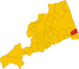
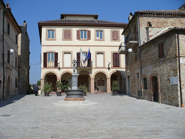
Pedaso (Pedaso)
.svg)
- Italian comune
 Hiking in Pedaso
Pedaso, located on the Adriatic coast in the Marche region of Italy, is a beautiful destination for hiking enthusiasts. The area is characterized by its stunning landscapes, picturesque coastal views, and a blend of rugged terrain and rolling hills. Here are some highlights and tips for hiking in and around Pedaso:
Scenic Trails
-
Coastal Walks: The shoreline near Pedaso offers numerous walking paths that provide breathtaking views of the Adriatic Sea. The coastal trails are relatively easy and perfect for those who enjoy walking by the water.
-
Hills and Countryside: The surrounding countryside is dotted with vineyards, olive groves, and small farms. Trails through this area are often more challenging, with hills that provide stunning panoramic views of the region.
-
Natural Parks: Nearby natural parks, such as the Parco Nazionale dei Monti Sibillini, offer more advanced hiking opportunities. These are ideal for experienced hikers looking for a more rugged adventure.
Points of Interest
- Historical Sites: While hiking, you can explore charming towns and historical sites. Look for old churches, watchtowers, and traditional architecture that give insight into the region's history.
- Wildlife and Flora: The area is rich in biodiversity. Keep an eye out for various bird species and local plants that thrive in the Mediterranean climate.
Tips for Hiking in Pedaso
- Weather Considerations: The best time to hike in Pedaso is during spring (April to June) and fall (September to October) when weather conditions are usually mild and pleasant.
- Footwear: Ensure you have sturdy hiking boots suitable for uneven terrain. Some trails can be rocky, so proper footwear is essential.
- Hydration and Snacks: Carry enough water and snacks, especially if you plan on hiking for several hours. There may not always be places to refill.
- Maps and Guides: Consider using a local hiking guide or map for detailed trail information. Local tourist offices can provide valuable resources.
Safety
- Always inform someone about your hiking plans and expected return time.
- Stay on marked trails to avoid getting lost and to protect the natural environment.
- Check the weather forecast before heading out, as conditions can change rapidly.
By embracing the diverse trails and stunning scenery, hiking in Pedaso can be a memorable outdoor experience. Enjoy your adventure!
- Country:

- Postal Code: 63827
- Local Dialing Code: 0734
- Licence Plate Code: FM
- Coordinates: 43° 5' 51" N, 13° 50' 27" E


- GPS tracks (wikiloc): [Link]
- AboveSeaLevel: 5 м m
- Area: 3.85 sq km
- Population: 2817
- Web site: http://www.comunedipedaso.it/
- Wikipedia en: wiki(en)
- Wikipedia: wiki(it)
- Wikidata storage: Wikidata: Q59278
- Wikipedia Commons Gallery: [Link]
- Wikipedia Commons Category: [Link]
- Freebase ID: [/m/0gl8pz]
- GeoNames ID: Alt: [6536801]
- OSM relation ID: [42326]
- UN/LOCODE: [ITPED]
- Google Maps Customer ID: [16605271628256088482]
- ISTAT ID: 109030
- Italian cadastre code: G403
Shares border with regions:

Altidona
- Italian comune
Hiking in Altidona
Altidona is a picturesque hilltop town located in the Marche region of Italy, known for its stunning views, medieval architecture, and beautiful natural surroundings. Hiking in and around Altidona can offer a wonderful combination of scenic vistas, cultural experiences, and opportunities to connect with nature. Here are some highlights for hiking in this area:...
- Country:
- Postal Code: 63824
- Local Dialing Code: 0734
- Licence Plate Code: FM
- Coordinates: 43° 6' 25" N, 13° 47' 38" E
- GPS tracks (wikiloc): [Link]
- AboveSeaLevel: 224 м m
- Area: 12.97 sq km
- Population: 3452
- Web site: [Link]

Campofilone
- Italian comune
Hiking in Campofilone
Campofilone is a charming town located in the province of Fermo in the Marche region of Italy. Known for its picturesque landscapes and traditional architecture, it offers some great opportunities for hiking enthusiasts who want to explore the natural beauty of the surrounding area....
- Country:
- Postal Code: 63828
- Local Dialing Code: 0734
- Licence Plate Code: FM
- Coordinates: 43° 4' 45" N, 13° 48' 52" E
- GPS tracks (wikiloc): [Link]
- AboveSeaLevel: 210 м m
- Area: 12.21 sq km
- Population: 1918
- Web site: [Link]