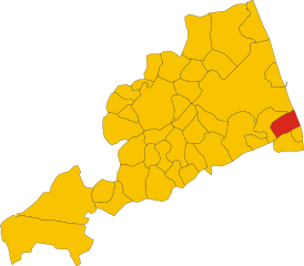
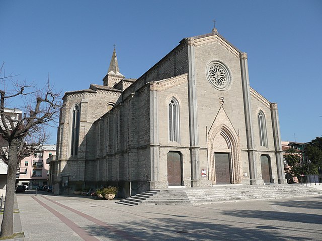
Campofilone (Campofilone)
.svg)
- Italian comune
 Hiking in Campofilone
Campofilone is a charming town located in the province of Fermo in the Marche region of Italy. Known for its picturesque landscapes and traditional architecture, it offers some great opportunities for hiking enthusiasts who want to explore the natural beauty of the surrounding area.
Popular Hiking Routes Near Campofilone
-
The Hills of Marche: The rolling hills around Campofilone provide various trails that include paths through vineyards and olive groves. These trails can be explored at different levels of difficulty, catering to both beginners and experienced hikers.
-
Monte Sibillini National Park: A bit further afield, but well worth the trip, this national park features stunning mountainous terrain. The park has numerous trails showcasing diverse landscapes, from valleys to high peaks. Hikes like the Passo Maniva route provide breathtaking views and experiences.
-
Coastal Trails: The Adriatic coast is only a short distance from Campofilone. There are coastal paths where hikers can enjoy dramatic sea views, especially during sunrise or sunset. The nearby towns of Grottammare and San Benedetto del Tronto also offer beautiful beachfront promenades and coastal hiking options.
Tips for Hiking in Campofilone
-
Prepare for the Terrain: The trails can vary from flat paths to more challenging hills. Wear appropriate footwear, and consider bringing trekking poles for added support.
-
Check the Weather: The weather can change quickly in the Marche region, so it's wise to check forecasts before heading out and dress in layers.
-
Stay Hydrated and Snack Ready: Always carry sufficient water and snacks, especially for longer hikes.
-
Respect Nature and Local Landmarks: The area is not only beautiful, but it's also filled with historical significance. Be sure to tread lightly and respect the natural environment and any cultural sites you may encounter.
-
Local Guides: If you're unfamiliar with the area, consider hiring a local guide, which can enhance your experience and provide valuable insights into the flora, fauna, and history of the region.
Hiking near Campofilone offers a great blend of natural beauty and cultural experience, making it a perfect destination for both hiking and exploring the rich heritage of the Marche region.
- Country:

- Postal Code: 63828
- Local Dialing Code: 0734
- Licence Plate Code: FM
- Coordinates: 43° 4' 45" N, 13° 48' 52" E


- GPS tracks (wikiloc): [Link]
- AboveSeaLevel: 210 м m
- Area: 12.21 sq km
- Population: 1918
- Web site: http://www.comune.campofilone.fm.it
- Wikipedia en: wiki(en)
- Wikipedia: wiki(it)
- Wikidata storage: Wikidata: Q59225
- Wikipedia Commons Gallery: [Link]
- Wikipedia Commons Category: [Link]
- Freebase ID: [/m/0gl7nl]
- GeoNames ID: Alt: [6541608]
- OSM relation ID: [42307]
- UN/LOCODE: [ITC55]
- Google Maps Customer ID: [10362742479499245445]
- ISTAT ID: 109004
- Italian cadastre code: B534
Shares border with regions:
Massignano
- Italian comune
Hiking in Massignano
Massignano is a charming village located in the Marche region of Italy, known for its scenic landscapes and hiking opportunities. The area is characterized by rolling hills, vineyards, olive groves, and a beautiful coastline along the Adriatic Sea. Here are some key features and tips for hiking in and around Massignano:...
- Country:
- Postal Code: 63061
- Local Dialing Code: 0735
- Licence Plate Code: AP
- Coordinates: 43° 3' 3" N, 13° 47' 50" E
- GPS tracks (wikiloc): [Link]
- AboveSeaLevel: 255 м m
- Area: 16.3 sq km
- Population: 1640
- Web site: [Link]


Montefiore dell'Aso
- Italian comune
Hiking in Montefiore dell'Aso
Montefiore dell'Aso is a charming hilltop village located in the Marche region of Italy, known for its beautiful landscapes, historical architecture, and a rich cultural heritage. Hiking in and around Montefiore dell'Aso offers a unique blend of natural beauty and cultural exploration....
- Country:
- Postal Code: 63062
- Local Dialing Code: 0734
- Licence Plate Code: AP
- Coordinates: 43° 3' 6" N, 13° 45' 5" E
- GPS tracks (wikiloc): [Link]
- AboveSeaLevel: 412 м m
- Area: 28.21 sq km
- Population: 2053
- Web site: [Link]

Altidona
- Italian comune
Hiking in Altidona
Altidona is a picturesque hilltop town located in the Marche region of Italy, known for its stunning views, medieval architecture, and beautiful natural surroundings. Hiking in and around Altidona can offer a wonderful combination of scenic vistas, cultural experiences, and opportunities to connect with nature. Here are some highlights for hiking in this area:...
- Country:
- Postal Code: 63824
- Local Dialing Code: 0734
- Licence Plate Code: FM
- Coordinates: 43° 6' 25" N, 13° 47' 38" E
- GPS tracks (wikiloc): [Link]
- AboveSeaLevel: 224 м m
- Area: 12.97 sq km
- Population: 3452
- Web site: [Link]


Lapedona
- Italian comune
Hiking in Lapedona
Lapedona is a charming village located in the Marche region of Italy, known for its picturesque landscapes and natural beauty, making it a great destination for hiking enthusiasts. Here are some key points to consider if you plan to hike in or around Lapedona:...
- Country:
- Postal Code: 63823
- Local Dialing Code: 0734
- Licence Plate Code: FM
- Coordinates: 43° 6' 35" N, 13° 46' 22" E
- GPS tracks (wikiloc): [Link]
- AboveSeaLevel: 264 м m
- Area: 14.93 sq km
- Population: 1189
- Web site: [Link]

Pedaso
- Italian comune
Hiking in Pedaso
Pedaso, located on the Adriatic coast in the Marche region of Italy, is a beautiful destination for hiking enthusiasts. The area is characterized by its stunning landscapes, picturesque coastal views, and a blend of rugged terrain and rolling hills. Here are some highlights and tips for hiking in and around Pedaso:...
- Country:
- Postal Code: 63827
- Local Dialing Code: 0734
- Licence Plate Code: FM
- Coordinates: 43° 5' 51" N, 13° 50' 27" E
- GPS tracks (wikiloc): [Link]
- AboveSeaLevel: 5 м m
- Area: 3.85 sq km
- Population: 2817
- Web site: [Link]