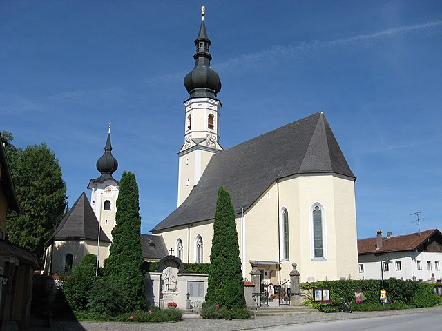
Perwang am Grabensee (Perwang am Grabensee)
- municipality in Austria
 Hiking in Perwang am Grabensee
Perwang am Grabensee is a picturesque village in Austria, located near the shores of Lake Grabensee, which offers a serene environment perfect for hiking enthusiasts. The area boasts stunning natural landscapes, making it a great destination for hikers of all levels.
Hiking Trails
-
Lake Grabensee Circuit: A scenic loop trail around Lake Grabensee that allows hikers to enjoy beautiful views of the lake and surrounding hills. It is relatively flat and suitable for families and beginners.
-
Gaisberg Mountain Trails: Nearby Gaisberg offers more challenging trails with varying levels of difficulty. You can ascend Gaisberg for panoramic views of the Salzkammergut region and the Austrian Alps.
-
Regional Trails: There are several regional hiking paths leading into the surrounding countryside, offering a chance to explore the local flora and fauna, as well as quaint villages.
Tips for Hiking in Perwang am Grabensee
- Suitable Gear: Wear appropriate hiking footwear and clothing, considering the weather, which can change quickly in Austria.
- Hydration and Snacks: Bring plenty of water and snacks, especially if you're planning on longer hikes.
- Navigation: Use a map or a GPS device, as some trails may not be well-marked.
- Respect Nature: Follow the Leave No Trace principles to preserve the natural beauty of the area.
Best Time to Hike
- Late Spring to Early Fall (May to September): This is the best time for hiking, as the weather is usually mild and most trails are accessible.
Local Attractions
After hiking, you might want to explore the village of Perwang or nearby attractions like the charming town of Salzburg, which is only a short drive away, offering historical sites and cultural experiences.
Whether you’re looking for a leisurely walk or more challenging hikes, Perwang am Grabensee provides a beautiful setting for outdoor adventures. Enjoy your hiking experience!
- Country:

- Postal Code: 5166
- Local Dialing Code: 06217
- Licence Plate Code: BR
- Coordinates: 48° 0' 20" N, 13° 5' 0" E


- GPS tracks (wikiloc): [Link]
- AboveSeaLevel: 531 м m
- Area: 6.83 sq km
- Population: 997
- Web site: http://www.perwang.at/
- Wikipedia en: wiki(en)
- Wikipedia: wiki(de)
- Wikidata storage: Wikidata: Q618074
- Wikipedia Commons Category: [Link]
- Freebase ID: [/m/03gv2jy]
- GeoNames ID: Alt: [7871981]
- VIAF ID: Alt: [306270849]
- Austrian municipality key: [40430]
Shares border with regions:
Berndorf bei Salzburg
- municipality in Austria
Hiking in Berndorf bei Salzburg
Berndorf bei Salzburg, located near the city of Salzburg in Austria, is a picturesque area that offers a variety of hiking opportunities for different skill levels. The region is characterized by its stunning landscapes, rolling hills, and beautiful views of the surrounding mountains, making it a great destination for outdoor enthusiasts....
- Country:
- Postal Code: 5165
- Local Dialing Code: 06217
- Licence Plate Code: SL
- Coordinates: 47° 58' 0" N, 13° 4' 0" E
- GPS tracks (wikiloc): [Link]
- AboveSeaLevel: 548 м m
- Area: 14.48 sq km
- Population: 1689
- Web site: [Link]

Nußdorf am Haunsberg
- municipality in Austria
Hiking in Nußdorf am Haunsberg
Nußdorf am Haunsberg is a charming village located in the Salzburg region of Austria, surrounded by stunning natural landscapes and offering various hiking opportunities. Here are some key highlights about hiking in and around Nußdorf am Haunsberg:...
- Country:
- Postal Code: 5151
- Local Dialing Code: 06276
- Licence Plate Code: SL
- Coordinates: 47° 57' 0" N, 13° 0' 0" E
- GPS tracks (wikiloc): [Link]
- AboveSeaLevel: 441 м m
- Area: 35.54 sq km
- Population: 2383
- Web site: [Link]
Kirchberg bei Mattighofen
- municipality in Austria
Hiking in Kirchberg bei Mattighofen
Kirchberg bei Mattighofen is a charming village located in the Austrian state of Upper Austria, surrounded by beautiful landscapes that are ideal for hiking enthusiasts. The region offers a variety of trails, catering to different skill levels and allowing hikers to explore the picturesque countryside, forests, and hills. Here are some highlights to consider for your hiking experience in this area:...
- Country:
- Postal Code: 5232
- Local Dialing Code: 07747
- Licence Plate Code: BR
- Coordinates: 48° 2' 22" N, 13° 6' 2" E
- GPS tracks (wikiloc): [Link]
- AboveSeaLevel: 560 м m
- Area: 15.74 sq km
- Population: 1175
- Web site: [Link]

Palting
- municipality in Austria
Hiking in Palting
It seems there may be a misunderstanding, as "Palting" is not a widely recognized hiking destination. However, if you meant a specific region, trail, or country with a similar name, please clarify, or if you're looking for general hiking information, I’d be happy to help!...
- Country:
- Postal Code: 5163
- Local Dialing Code: 06217
- Licence Plate Code: BR
- Coordinates: 48° 1' 0" N, 13° 7' 40" E
- GPS tracks (wikiloc): [Link]
- AboveSeaLevel: 514 м m
- Area: 11.51 sq km
- Population: 938
- Web site: [Link]

Feldkirchen bei Mattighofen
- municipality in Austria
Hiking in Feldkirchen bei Mattighofen
Feldkirchen bei Mattighofen, located in the Austrian state of Upper Austria, is surrounded by a beautiful landscape ideal for hiking enthusiasts. The region offers a mix of scenic trails that cater to different skill levels, from easy walks to more challenging routes for experienced hikers....
- Country:
- Local Dialing Code: 07748
- Licence Plate Code: BR
- Coordinates: 48° 4' 10" N, 13° 2' 44" E
- GPS tracks (wikiloc): [Link]
- AboveSeaLevel: 509 м m
- Area: 34.64 sq km
- Population: 1978
- Web site: [Link]

Dorfbeuern
- municipality in Austria
Hiking in Dorfbeuern
Dorfbeuern is a charming village located in Austria, known for its picturesque landscapes and ample opportunities for hiking enthusiasts. Situated near the Salzburger Land region, it offers a variety of trails that cater to different skill levels, making it a great destination for both novice and experienced hikers....
- Country:
- Postal Code: 5152
- Local Dialing Code: 06274
- Licence Plate Code: SL
- Coordinates: 48° 1' 0" N, 13° 1' 0" E
- GPS tracks (wikiloc): [Link]
- AboveSeaLevel: 471 м m
- Area: 14.6 sq km
- Population: 1547
- Web site: [Link]