Pico, Lazio (Pico)
.svg)
- Italian comune
 Hiking in Pico, Lazio
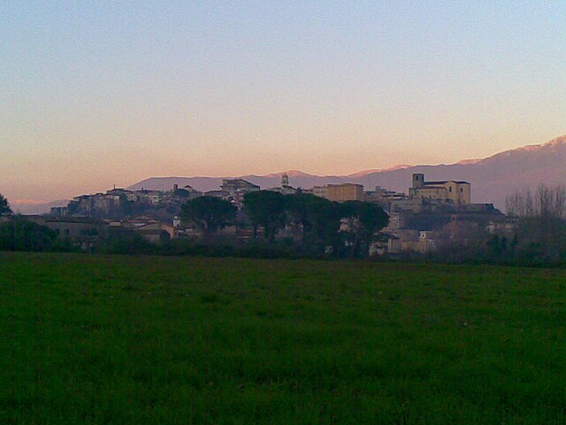
Pico is a charming village in the province of Frosinone, in the Lazio region of Italy. It's situated on the slopes of the Aurunci Mountains and offers various hiking opportunities for both experienced hikers and beginners. Here’s what you need to know about hiking in Pico:
Hiking Trails
-
Monte Semprevisa: One of the most popular hikes in the area, this trail leads to the summit of Monte Semprevisa, which offers panoramic views of the surrounding landscape, including the Aurunci Mountains and the valleys below. The trail can be challenging but is well marked.
-
The Path of the Old Olive Trees: This is a more leisurely hike that takes you through beautiful olive groves and offers insight into the local agricultural practices. It's a great option for families and those who prefer easier walks.
-
Cascate di Isola di Frosinone: A beautiful hike that leads to waterfalls. The trail is moderate and is particularly nice in the spring when the water flow is robust.
-
The Aurunci Mountain Trails: There are various interconnected trails that traverse the Aurunci Mountains, offering hikers the chance to explore diverse landscapes, including forests, rocky outcrops, and breathtaking viewpoints.
Tips for Hiking in Pico
-
Season: The best time for hiking is during spring and early autumn when the weather is mild and the landscape is lush and vibrant.
-
Preparation: Make sure to wear suitable hiking gear, including sturdy shoes, and bring plenty of water, snacks, and a map or GPS device.
-
Wildlife: The area is home to a variety of flora and fauna, so keep an eye out for local wildlife and seasonal flowers.
-
Local Guidance: Consider joining a guided hike if you’re unfamiliar with the area, as local guides can enhance your experience with knowledge about the history, geology, and ecology of the region.
-
Respect Nature: As with all hiking, practice Leave No Trace principles. Stay on marked trails, pack out what you pack in, and respect wildlife and natural features.
Cultural Aspects
Hiking in Pico not only provides stunning natural beauty but also is an opportunity to experience the local culture. You can often find small trattorias offering regional cuisine and the chance to explore the quaint village itself, which is rich in history and charm.
Whether you're looking for a challenging hike or a peaceful stroll through nature, Pico has something to offer every hiker. Enjoy your adventure!
- Country:

- Postal Code: 03020
- Local Dialing Code: 0776
- Licence Plate Code: FR
- Coordinates: 41° 27' 5" N, 13° 33' 42" E


- GPS tracks (wikiloc): [Link]
- AboveSeaLevel: 190 м m
- Area: 32.93 sq km
- Population: 2825
- Web site: http://www.comunedipico.it/
- Wikipedia en: wiki(en)
- Wikipedia: wiki(it)
- Wikidata storage: Wikidata: Q117032
- Wikipedia Commons Category: [Link]
- Freebase ID: [/m/04drw7]
- GeoNames ID: Alt: [6538711]
- OSM relation ID: [41291]
- ISTAT ID: 060051
- Italian cadastre code: G592
Shares border with regions:
Pastena
- Italian comune
Hiking in Pastena
Pastena is a charming town located in the province of Frosinone, in the Lazio region of Italy. It's renowned for its stunning natural landscapes and rich history, making it an excellent destination for hiking enthusiasts. Here are some highlights about hiking in and around Pastena:...
- Country:
- Postal Code: 03020
- Local Dialing Code: 0776
- Licence Plate Code: FR
- Coordinates: 41° 28' 6" N, 13° 29' 28" E
- GPS tracks (wikiloc): [Link]
- AboveSeaLevel: 318 м m
- Area: 42.16 sq km
- Population: 1424
- Web site: [Link]

Pontecorvo
- Italian comune
Hiking in Pontecorvo
Pontecorvo, located in the province of Frosinone in the Lazio region of Italy, is surrounded by picturesque landscapes and offers various hiking opportunities. The town is situated near the Garigliano River, and its surroundings include rolling hills, dense forests, and historical sites....
- Country:
- Postal Code: 03037
- Local Dialing Code: 0776
- Licence Plate Code: FR
- Coordinates: 41° 27' 45" N, 13° 40' 3" E
- GPS tracks (wikiloc): [Link]
- AboveSeaLevel: 97 м m
- Area: 88.23 sq km
- Population: 13125
- Web site: [Link]
San Giovanni Incarico
- Italian comune
Hiking in San Giovanni Incarico
San Giovanni Incarico is a charming town located in the province of Frosinone, in the Lazio region of Italy. It offers beautiful landscapes and a blend of cultural and natural experiences for hikers. Here are some highlights and tips for hiking in and around San Giovanni Incarico:...
- Country:
- Postal Code: 03028
- Local Dialing Code: 0776
- Licence Plate Code: FR
- Coordinates: 41° 30' 0" N, 13° 33' 0" E
- GPS tracks (wikiloc): [Link]
- AboveSeaLevel: 200 м m
- Area: 24.71 sq km
- Population: 3291
- Web site: [Link]


Campodimele
- Italian comune
Hiking in Campodimele
Campodimele, known as the "Village of Longevity," is a picturesque destination in the Italian region of Lazio, particularly in the province of Latina. Not only is it famous for its scenic beauty and rich history, but it also offers a variety of hiking trails that cater to different skill levels....
- Country:
- Postal Code: 04020
- Local Dialing Code: 0771
- Licence Plate Code: LT
- Coordinates: 41° 23' 0" N, 13° 32' 0" E
- GPS tracks (wikiloc): [Link]
- AboveSeaLevel: 647 м m
- Area: 38.38 sq km
- Population: 598
- Web site: [Link]


Lenola, Lazio
- Italian comune
Hiking in Lenola, Lazio
Lenola, located in the province of Latina in the Lazio region of Italy, is an excellent destination for hiking enthusiasts. Nestled in the Aurunci Mountains, this charming town offers a blend of stunning natural beauty, historical sites, and diverse hiking trails....
- Country:
- Postal Code: 04025
- Local Dialing Code: 0771
- Licence Plate Code: LT
- Coordinates: 41° 24' 33" N, 13° 27' 45" E
- GPS tracks (wikiloc): [Link]
- AboveSeaLevel: 425 м m
- Area: 45.24 sq km
- Population: 4184
- Web site: [Link]