Pietravairano (Pietravairano)
.svg)
- Italian comune
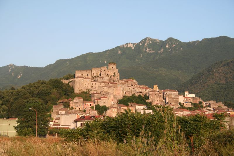
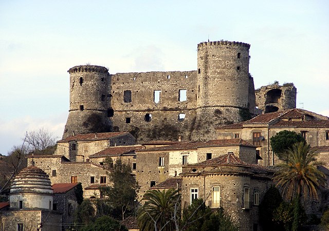
 Hiking in Pietravairano
Pietravairano is a charming town located in the province of Caserta, in the Campania region of Italy. Surrounded by the beautiful Apennine mountains, it offers several hiking opportunities for outdoor enthusiasts. Here’s what you need to know about hiking in and around Pietravairano:
Trails and Routes
-
Monte Maggiore: This is one of the prominent peaks near Pietravairano and offers various hiking trails with varying difficulties. The routes provide stunning panoramic views of the surrounding landscape, including valleys and nearby mountains.
-
Natural Reserves: Explore the nearby natural reserves such as the Regional Park of Matese, where you can find a network of trails suitable for different skill levels. It’s great for both hiking and enjoying local flora and fauna.
-
Cultural Paths: Some trails connect historical sites, including old churches and ruins, providing both nature and cultural exploration. Walking these paths can give you a glimpse into the local heritage.
Best Hiking Practices
-
Prepare for Varying Weather: The weather can change, particularly in mountainous regions, so dress in layers and be prepared for rain or sudden temperature drops.
-
Stay Hydrated: Bring enough water, especially in warmer months, as some trails may not have access to freshwater sources.
-
Navigation: Consider downloading maps or having hiking apps installed on your device, as some trails can be less well-marked. A physical map can be helpful too.
-
Footwear: Wear sturdy hiking boots with good ankle support, especially on uneven terrain.
Local Tips
-
Guided Tours: If you’re unfamiliar with the area, consider hiring a local guide who can take you to hidden gems and ensure a safer experience.
-
Wildlife Watching: Bring binoculars if you’re interested in birdwatching or if you want to enjoy the diverse wildlife in the area.
-
Culinary Stops: Plan your hike to include some stops in local spots to enjoy traditional Campanian cuisine, particularly after a long day on the trails.
Hiking in Pietravairano offers a fantastic opportunity to experience the natural beauty and cultural richness of southern Italy. Always ensure you respect the environment and follow local guidelines to preserve the area’s natural charm. Enjoy your hike!
- Country:

- Postal Code: 81050
- Local Dialing Code: 0823
- Licence Plate Code: CE
- Coordinates: 41° 20' 0" N, 14° 10' 0" E


- GPS tracks (wikiloc): [Link]
- AboveSeaLevel: 258 м m
- Area: 33.49 sq km
- Population: 2965
- Web site: http://www.comune.pietravairano.ce.it
- Wikipedia en: wiki(en)
- Wikipedia: wiki(it)
- Wikidata storage: Wikidata: Q58763
- Wikipedia Commons Category: [Link]
- Freebase ID: [/m/0gm_26]
- GeoNames ID: Alt: [6538724]
- OSM relation ID: [41219]
- Digital Atlas of the Roman Empire ID: [23834]
- ISTAT ID: 061059
- Italian cadastre code: G630
Shares border with regions:
Baia e Latina
- Italian comune
Hiking in Baia e Latina
Baia e Latina, located in the province of Caserta in the Campania region of Italy, is surrounded by natural beauty and offers several outdoor activities, including hiking. Here are some key points to consider when hiking in the area:...
- Country:
- Postal Code: 81010
- Local Dialing Code: 0823
- Licence Plate Code: CE
- Coordinates: 41° 18' 0" N, 14° 15' 0" E
- GPS tracks (wikiloc): [Link]
- AboveSeaLevel: 123 м m
- Area: 24.43 sq km
- Population: 2160
- Web site: [Link]
Pietramelara
- Italian comune
Hiking in Pietramelara
Pietramelara, located in the region of Campania in Italy, offers several hiking opportunities amidst its beautiful natural landscapes. The area is characterized by rolling hills, lush forests, and stunning views of the surrounding countryside. Here are some highlights and tips for hiking in Pietramelara:...
- Country:
- Postal Code: 81051
- Local Dialing Code: 0823
- Licence Plate Code: CE
- Coordinates: 41° 16' 0" N, 14° 11' 0" E
- GPS tracks (wikiloc): [Link]
- AboveSeaLevel: 132 м m
- Area: 23.93 sq km
- Population: 4692
- Web site: [Link]
Raviscanina
- Italian comune
Hiking in Raviscanina
Raviscanina is a picturesque area located in the province of Frosinone, Italy. This region is known for its beautiful landscapes, rich history, and cultural heritage. Hiking in Raviscanina offers opportunities to explore diverse terrains, including lush forests, rolling hills, and picturesque valleys....
- Country:
- Postal Code: 81017
- Local Dialing Code: 0823
- Licence Plate Code: CE
- Coordinates: 41° 22' 0" N, 14° 15' 0" E
- GPS tracks (wikiloc): [Link]
- AboveSeaLevel: 358 м m
- Area: 24.64 sq km
- Population: 1306
- Web site: [Link]
Riardo
- Italian comune
Hiking in Riardo
Riardo is a charming town in the Campania region of Italy, nestled in an area that offers some beautiful hiking opportunities. While it might not be as well-known as some of the larger national parks in Italy, Riardo's surroundings provide a mix of scenic landscapes, historical sites, and local culture that can enhance your hiking experience. Here are a few key points to consider for hiking in and around Riardo:...
- Country:
- Postal Code: 81053
- Local Dialing Code: 0823
- Licence Plate Code: CE
- Coordinates: 41° 16' 0" N, 14° 9' 0" E
- GPS tracks (wikiloc): [Link]
- AboveSeaLevel: 192 м m
- Area: 16.48 sq km
- Population: 2319
- Web site: [Link]
Roccaromana
- Italian comune
Hiking in Roccaromana
Roccaromana, a picturesque town located in the Campania region of Italy, offers hikers a blend of scenic beauty and cultural heritage. Nestled in the foothills of the Apennines, the area is characterized by its rolling hills, lush forests, and breathtaking views....
- Country:
- Postal Code: 81051
- Local Dialing Code: 0823
- Licence Plate Code: CE
- Coordinates: 41° 16' 0" N, 14° 13' 0" E
- GPS tracks (wikiloc): [Link]
- AboveSeaLevel: 180 м m
- Area: 27.71 sq km
- Population: 858
- Web site: [Link]

Sant'Angelo d'Alife
- Italian comune
Hiking in Sant'Angelo d'Alife
Sant'Angelo d'Alife is a charming village located in the Campania region of Italy, nestled among the scenic landscapes of the Matese Regional Park. The area is known for its beautiful natural surroundings, which include mountains, lush forests, and picturesque valleys, making it an excellent destination for hiking enthusiasts....
- Country:
- Postal Code: 81017
- Local Dialing Code: 0823
- Licence Plate Code: CE
- Coordinates: 41° 22' 0" N, 14° 16' 0" E
- GPS tracks (wikiloc): [Link]
- AboveSeaLevel: 385 м m
- Area: 33.52 sq km
- Population: 2233
- Web site: [Link]
Vairano Patenora
- Italian comune
Hiking in Vairano Patenora
Vairano Patenora, located in the province of Caserta in the Campania region of Italy, offers a rich experience for hiking enthusiasts. The area is known for its diverse landscapes, including rolling hills, lush forests, and scenic views of the surrounding countryside....
- Country:
- Postal Code: 81058
- Local Dialing Code: 0823
- Licence Plate Code: CE
- Coordinates: 41° 20' 0" N, 14° 8' 0" E
- GPS tracks (wikiloc): [Link]
- AboveSeaLevel: 168 м m
- Area: 43.52 sq km
- Population: 6515
- Web site: [Link]