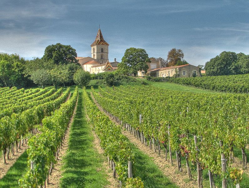
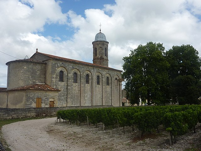
Plassac (Plassac)

- commune in Gironde, France
- Country:

- Postal Code: 33390
- Coordinates: 45° 6' 13" N, 0° 38' 49" E


- GPS tracks (wikiloc): [Link]
- Area: 7.12 sq km
- Population: 865
- Web site: http://plassac.fr
- Wikipedia en: wiki(en)
- Wikipedia: wiki(fr)
- Wikidata storage: Wikidata: Q501897
- Wikipedia Commons Category: [Link]
- Freebase ID: [/m/03ns9mx]
- GeoNames ID: Alt: [6432339]
- SIREN number: [213303258]
- BnF ID: [15256376r]
- PACTOLS thesaurus ID: [pcrt6X7LLXY1P6]
- INSEE municipality code: 33325
Shares border with regions:

Cars
- commune in Gironde, France
- Country:
- Postal Code: 33390
- Coordinates: 45° 7' 45" N, 0° 37' 13" E
- GPS tracks (wikiloc): [Link]
- Area: 11.1 sq km
- Population: 1165
- Web site: [Link]


Villeneuve
- commune in Gironde, France
- Country:
- Postal Code: 33710
- Coordinates: 45° 5' 1" N, 0° 37' 40" E
- GPS tracks (wikiloc): [Link]
- AboveSeaLevel: 5 м m
- Area: 4.63 sq km
- Population: 392


Lamarque
- commune in Gironde, France
- Country:
- Postal Code: 33460
- Coordinates: 45° 5' 46" N, 0° 43' 4" E
- GPS tracks (wikiloc): [Link]
- Area: 8.91 sq km
- Population: 1287
- Web site: [Link]


Soussans
- commune in Gironde, France
- Country:
- Postal Code: 33460
- Coordinates: 45° 3' 21" N, 0° 41' 57" E
- GPS tracks (wikiloc): [Link]
- Area: 13.55 sq km
- Population: 1601

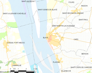
Blaye
- commune in Gironde, France
- Country:
- Postal Code: 33390
- Coordinates: 45° 8' 0" N, 0° 40' 0" E
- GPS tracks (wikiloc): [Link]
- AboveSeaLevel: 7 м m
- Area: 6.42 sq km
- Population: 4813
- Web site: [Link]

Arcins
- commune in Gironde, France
- Country:
- Postal Code: 33460
- Coordinates: 45° 4' 23" N, 0° 43' 29" E
- GPS tracks (wikiloc): [Link]
- Area: 6.77 sq km
- Population: 472
- Web site: [Link]


Berson
- commune in Gironde, France
- Country:
- Postal Code: 33390
- Coordinates: 45° 6' 29" N, 0° 35' 12" E
- GPS tracks (wikiloc): [Link]
- Area: 17.98 sq km
- Population: 1786
- Web site: [Link]


Saint-Ciers-de-Canesse
- commune in Gironde, France
- Country:
- Postal Code: 33710
- Coordinates: 45° 5' 1" N, 0° 36' 33" E
- GPS tracks (wikiloc): [Link]
- Area: 6.8 sq km
- Population: 807