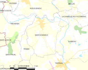
Pleugueneuc (Pleugueneuc)

- commune in Ille-et-Vilaine, France
- Country:

- Postal Code: 35720
- Coordinates: 48° 23' 47" N, 1° 54' 13" E


- GPS tracks (wikiloc): [Link]
- Area: 24.52 sq km
- Population: 1838
- Web site: http://www.pleugueneuc.com
- Wikipedia en: wiki(en)
- Wikipedia: wiki(fr)
- Wikidata storage: Wikidata: Q224251
- Wikipedia Commons Category: [Link]
- Freebase ID: [/m/03m98yz]
- Freebase ID: [/m/03m98yz]
- Freebase ID: [/m/03m98yz]
- GeoNames ID: Alt: [6432790]
- GeoNames ID: Alt: [6432790]
- GeoNames ID: Alt: [6432790]
- SIREN number: [213502263]
- SIREN number: [213502263]
- SIREN number: [213502263]
- BnF ID: [15257168t]
- BnF ID: [15257168t]
- BnF ID: [15257168t]
- VIAF ID: Alt: [236604781]
- VIAF ID: Alt: [236604781]
- VIAF ID: Alt: [236604781]
- OSM relation ID: [142956]
- OSM relation ID: [142956]
- OSM relation ID: [142956]
- INSEE municipality code: 35226
- INSEE municipality code: 35226
- INSEE municipality code: 35226
Shares border with regions:


Plesder
- commune in Ille-et-Vilaine, France
- Country:
- Postal Code: 35720
- Coordinates: 48° 24' 49" N, 1° 55' 21" E
- GPS tracks (wikiloc): [Link]
- Area: 11.03 sq km
- Population: 783


Meillac
- commune in Ille-et-Vilaine, France
- Country:
- Postal Code: 35270
- Coordinates: 48° 24' 44" N, 1° 48' 48" E
- GPS tracks (wikiloc): [Link]
- Area: 32.21 sq km
- Population: 1806
- Web site: [Link]

Saint-Domineuc
- commune in Ille-et-Vilaine, France
- Country:
- Postal Code: 35190
- Coordinates: 48° 22' 27" N, 1° 52' 34" E
- GPS tracks (wikiloc): [Link]
- Area: 15.7 sq km
- Population: 2499
- Web site: [Link]


La Chapelle-aux-Filtzméens
- commune in Ille-et-Vilaine, France
- Country:
- Postal Code: 35190
- Coordinates: 48° 23' 1" N, 1° 49' 32" E
- GPS tracks (wikiloc): [Link]
- AboveSeaLevel: 53 м m
- Area: 6.36 sq km
- Population: 825
- Web site: [Link]


Trévérien
- commune in Ille-et-Vilaine, France
- Country:
- Postal Code: 35190
- Coordinates: 48° 22' 15" N, 1° 55' 41" E
- GPS tracks (wikiloc): [Link]
- Area: 12.08 sq km
- Population: 888


Saint-Pierre-de-Plesguen
- former commune in Ille-et-Vilaine, France
- Country:
- Postal Code: 35720
- Coordinates: 48° 26' 50" N, 1° 54' 48" E
- GPS tracks (wikiloc): [Link]
- AboveSeaLevel: 82 м m
- Area: 29.49 sq km
- Population: 2846
- Web site: [Link]