Ploumoguer (Ploumoguer)

- commune in Finistère, France
- Country:

- Postal Code: 29810
- Coordinates: 48° 24' 13" N, 4° 43' 22" E


- GPS tracks (wikiloc): [Link]
- Area: 38.93 sq km
- Population: 1995
- Web site: http://www.ploumoguer.bzh
- Wikipedia en: wiki(en)
- Wikipedia: wiki(fr)
- Wikidata storage: Wikidata: Q210696
- Wikipedia Commons Gallery: [Link]
- Wikipedia Commons Category: [Link]
- Freebase ID: [/m/03gyqqk]
- GeoNames ID: Alt: [6431009]
- SIREN number: [212902019]
- BnF ID: [15254545j]
- INSEE municipality code: 29201
Shares border with regions:

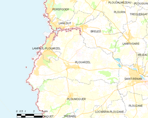
Plouarzel
- commune in Finistère, Brittany
- Country:
- Postal Code: 29810
- Coordinates: 48° 26' 0" N, 4° 43' 57" E
- GPS tracks (wikiloc): [Link]
- Area: 42.83 sq km
- Population: 3690
- Web site: [Link]


Plougonvelin
- commune in Finistère, France
- Country:
- Postal Code: 29217
- Coordinates: 48° 20' 34" N, 4° 42' 41" E
- GPS tracks (wikiloc): [Link]
- Area: 18.69 sq km
- Population: 4083
- Web site: [Link]


Saint-Renan
- commune in Finistère, France
- Country:
- Postal Code: 29290
- Coordinates: 48° 26' 2" N, 4° 37' 17" E
- GPS tracks (wikiloc): [Link]
- Area: 13.31 sq km
- Population: 8101
- Web site: [Link]


Le Conquet
- commune in Finistère, France
- Country:
- Postal Code: 29217
- Coordinates: 48° 21' 37" N, 4° 46' 15" E
- GPS tracks (wikiloc): [Link]
- Area: 8.45 sq km
- Population: 2662
- Web site: [Link]


Locmaria-Plouzané
- commune in Finistère, France
- Country:
- Postal Code: 29280
- Coordinates: 48° 22' 29" N, 4° 38' 37" E
- GPS tracks (wikiloc): [Link]
- Area: 23.16 sq km
- Population: 4987
- Web site: [Link]


Plouzané
- commune in Finistère, France
- Country:
- Postal Code: 29280
- Coordinates: 48° 22' 48" N, 4° 36' 2" E
- GPS tracks (wikiloc): [Link]
- Area: 33.14 sq km
- Population: 12543
- Web site: [Link]


Trébabu
- commune in Finistère, France
- Country:
- Postal Code: 29217
- Coordinates: 48° 22' 14" N, 4° 44' 7" E
- GPS tracks (wikiloc): [Link]
- Area: 4.36 sq km
- Population: 338