Plouray (Plouray)

- commune in Morbihan, France
- Country:

- Postal Code: 56770
- Coordinates: 48° 8' 45" N, 3° 23' 17" E


- GPS tracks (wikiloc): [Link]
- Area: 39.09 sq km
- Population: 1142
- Wikipedia en: wiki(en)
- Wikipedia: wiki(fr)
- Wikidata storage: Wikidata: Q113967
- Wikipedia Commons Category: [Link]
- Freebase ID: [/m/03c7g3f]
- GeoNames ID: Alt: [6437342]
- SIREN number: [215601709]
- BnF ID: [152654195]
- MusicBrainz area ID: [767e2d9c-04ec-46fa-920d-60dc54474bba]
- INSEE municipality code: 56170
Shares border with regions:


Ploërdut
- commune in Morbihan, France
- Country:
- Postal Code: 56160
- Coordinates: 48° 5' 15" N, 3° 17' 8" E
- GPS tracks (wikiloc): [Link]
- Area: 75.83 sq km
- Population: 1216
- Web site: [Link]


Saint-Tugdual
- commune in Morbihan, France
- Country:
- Postal Code: 56540
- Coordinates: 48° 5' 56" N, 3° 20' 20" E
- GPS tracks (wikiloc): [Link]
- AboveSeaLevel: 190 м m
- Area: 19.97 sq km
- Population: 374


Priziac
- commune in Morbihan, France
- Country:
- Postal Code: 56320
- Coordinates: 48° 4' 0" N, 3° 25' 0" E
- GPS tracks (wikiloc): [Link]
- Area: 44.63 sq km
- Population: 986
- Web site: [Link]


Langonnet
- commune in Morbihan, France
- Country:
- Postal Code: 56630
- Coordinates: 48° 6' 20" N, 3° 29' 36" E
- GPS tracks (wikiloc): [Link]
- Area: 85.4 sq km
- Population: 1858
- Web site: [Link]

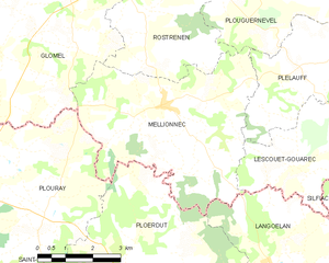
Mellionnec
- commune in Côtes-d'Armor, France
- Country:
- Postal Code: 22110
- Coordinates: 48° 10' 29" N, 3° 17' 47" E
- GPS tracks (wikiloc): [Link]
- Area: 24.22 sq km
- Population: 421


Glomel
- commune in Côtes-d'Armor, France
- Country:
- Postal Code: 22110
- Coordinates: 48° 13' 22" N, 3° 23' 47" E
- GPS tracks (wikiloc): [Link]
- AboveSeaLevel: 220.5 м m
- Area: 79.93 sq km
- Population: 1412
- Web site: [Link]