Langonnet (Langonnet)

- commune in Morbihan, France
- Country:

- Postal Code: 56630
- Coordinates: 48° 6' 20" N, 3° 29' 36" E


- GPS tracks (wikiloc): [Link]
- Area: 85.4 sq km
- Population: 1858
- Web site: http://www.langonnet.fr
- Wikipedia en: wiki(en)
- Wikipedia: wiki(fr)
- Wikidata storage: Wikidata: Q71331
- Wikipedia Commons Category: [Link]
- Freebase ID: [/m/03c642q]
- GeoNames ID: Alt: [3007687]
- SIREN number: [215601006]
- BnF ID: [15265349t]
- WOEID: [601254]
- INSEE municipality code: 56100
Shares border with regions:

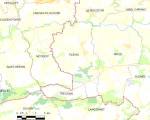
Plévin
- commune in Côtes-d'Armor, France
- Country:
- Postal Code: 22340
- Coordinates: 48° 13' 35" N, 3° 30' 19" E
- GPS tracks (wikiloc): [Link]
- Area: 27.36 sq km
- Population: 772


Paule
- commune in Côtes-d'Armor, France
- Country:
- Postal Code: 22340
- Coordinates: 48° 14' 10" N, 3° 26' 43" E
- GPS tracks (wikiloc): [Link]
- Area: 37.56 sq km
- Population: 726


Plouray
- commune in Morbihan, France
- Country:
- Postal Code: 56770
- Coordinates: 48° 8' 45" N, 3° 23' 17" E
- GPS tracks (wikiloc): [Link]
- Area: 39.09 sq km
- Population: 1142


Le Saint
- commune in Morbihan, France
- Country:
- Postal Code: 56110
- Coordinates: 48° 5' 22" N, 3° 33' 44" E
- GPS tracks (wikiloc): [Link]
- Area: 31.03 sq km
- Population: 599


Priziac
- commune in Morbihan, France
- Country:
- Postal Code: 56320
- Coordinates: 48° 4' 0" N, 3° 25' 0" E
- GPS tracks (wikiloc): [Link]
- Area: 44.63 sq km
- Population: 986
- Web site: [Link]


Le Faouët
- commune in Morbihan, France
- Country:
- Postal Code: 56320
- Coordinates: 48° 1' 59" N, 3° 29' 29" E
- GPS tracks (wikiloc): [Link]
- Area: 34.03 sq km
- Population: 2815
- Web site: [Link]

Gourin
- commune in Morbihan, France
- Country:
- Postal Code: 56110
- Coordinates: 48° 8' 22" N, 3° 36' 27" E
- GPS tracks (wikiloc): [Link]
- Area: 74.72 sq km
- Population: 3972
- Web site: [Link]


Tréogan
- commune in Côtes-d'Armor, France
- Country:
- Postal Code: 22340
- Coordinates: 48° 11' 21" N, 3° 31' 12" E
- GPS tracks (wikiloc): [Link]
- Area: 7.1 sq km
- Population: 100


Glomel
- commune in Côtes-d'Armor, France
- Country:
- Postal Code: 22110
- Coordinates: 48° 13' 22" N, 3° 23' 47" E
- GPS tracks (wikiloc): [Link]
- AboveSeaLevel: 220.5 м m
- Area: 79.93 sq km
- Population: 1412
- Web site: [Link]