Pluméliau (Pluméliau)

- commune in Morbihan, France
- Country:

- Postal Code: 56930
- Coordinates: 47° 57' 28" N, 2° 58' 24" E


- GPS tracks (wikiloc): [Link]
- Area: 67.72 sq km
- Population: 3646
- Web site: http://www.plumeliau.fr
- Wikipedia en: wiki(en)
- Wikipedia: wiki(fr)
- Wikidata storage: Wikidata: Q128215
- Wikipedia Commons Category: [Link]
- Freebase ID: [/m/03c7p6c]
- GeoNames ID: Alt: [2986610]
- SIREN number: [215601733]
- BnF ID: [152654222]
- VIAF ID: Alt: [144209322]
- Library of Congress authority ID: Alt: [n00031994]
- PACTOLS thesaurus ID: [pcrtrAt9Er4SPB]
- INSEE municipality code: 56173
Shares border with regions:


Saint-Barthélemy
- commune in Morbihan, France
- Country:
- Postal Code: 56150
- Coordinates: 47° 55' 33" N, 3° 2' 43" E
- GPS tracks (wikiloc): [Link]
- Area: 21.9 sq km
- Population: 1191


Remungol
- former commune in Morbihan, France
- Country:
- Postal Code: 56500
- Coordinates: 47° 56' 2" N, 2° 53' 57" E
- GPS tracks (wikiloc): [Link]
- Area: 26.93 sq km
- Population: 983
- Web site: [Link]

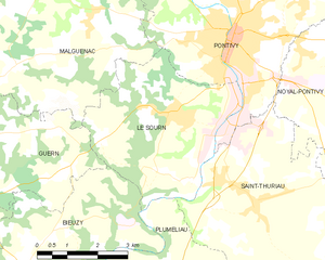
Le Sourn
- commune in Morbihan, France
- Country:
- Postal Code: 56300
- Coordinates: 48° 2' 35" N, 2° 59' 23" E
- GPS tracks (wikiloc): [Link]
- Area: 16.05 sq km
- Population: 2117
- Web site: [Link]


Saint-Thuriau
- commune in Morbihan, France
- Country:
- Postal Code: 56300
- Coordinates: 48° 1' 2" N, 2° 57' 1" E
- GPS tracks (wikiloc): [Link]
- Area: 21.47 sq km
- Population: 1854
- Web site: [Link]

Bieuzy
- commune in Morbihan, France
- Country:
- Postal Code: 56310
- Coordinates: 47° 59' 0" N, 3° 4' 0" E
- GPS tracks (wikiloc): [Link]
- Area: 18.98 sq km
- Population: 769
- Web site: [Link]


Guénin
- commune in Morbihan, France
- Country:
- Postal Code: 56150
- Coordinates: 47° 54' 27" N, 2° 58' 46" E
- GPS tracks (wikiloc): [Link]
- Area: 28.71 sq km
- Population: 1718


Melrand
- commune in Morbihan, France
- Country:
- Postal Code: 56310
- Coordinates: 47° 58' 49" N, 3° 6' 42" E
- GPS tracks (wikiloc): [Link]
- Area: 40.39 sq km
- Population: 1501
- Web site: [Link]
Moustoir-Remungol
- former commune in Morbihan, France
- Country:
- Postal Code: 56500
- Coordinates: 47° 59' 47" N, 2° 54' 10" E
- GPS tracks (wikiloc): [Link]
- Area: 12.42 sq km
- Population: 684
- Web site: [Link]