Ponches-Estruval (Ponches-Estruval)

- commune in Somme, France
- Country:

- Postal Code: 80150
- Coordinates: 50° 18' 34" N, 1° 53' 42" E


- GPS tracks (wikiloc): [Link]
- Area: 7.04 sq km
- Population: 111
- Wikipedia en: wiki(en)
- Wikipedia: wiki(fr)
- Wikidata storage: Wikidata: Q587223
- Wikipedia Commons Category: [Link]
- Freebase ID: [/m/03qmrfp]
- GeoNames ID: Alt: [6444674]
- SIREN number: [218005965]
- BnF ID: [152771071]
- OSM relation ID: [1806492]
- INSEE municipality code: 80631
Shares border with regions:


Ligescourt
- commune in Somme, France
- Country:
- Postal Code: 80150
- Coordinates: 50° 17' 21" N, 1° 52' 33" E
- GPS tracks (wikiloc): [Link]
- Area: 5.12 sq km
- Population: 226

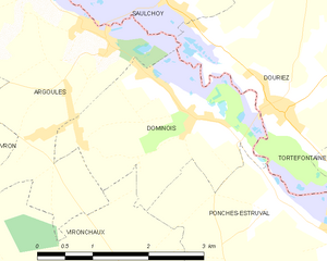
Dominois
- commune in Somme, France
- Country:
- Postal Code: 80120
- Coordinates: 50° 19' 53" N, 1° 51' 9" E
- GPS tracks (wikiloc): [Link]
- Area: 6.15 sq km
- Population: 181


Dompierre-sur-Authie
- commune in Somme, France
- Country:
- Postal Code: 80150
- Coordinates: 50° 18' 12" N, 1° 55' 5" E
- GPS tracks (wikiloc): [Link]
- Area: 22.73 sq km
- Population: 412


Tortefontaine
- commune in Pas-de-Calais, France
- Country:
- Postal Code: 62140
- Coordinates: 50° 19' 19" N, 1° 55' 14" E
- GPS tracks (wikiloc): [Link]
- Area: 11.81 sq km
- Population: 237

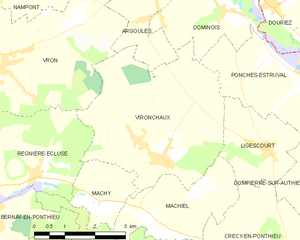
Vironchaux
- commune in Somme, France
- Country:
- Postal Code: 80150
- Coordinates: 50° 17' 20" N, 1° 49' 19" E
- GPS tracks (wikiloc): [Link]
- Area: 16.14 sq km
- Population: 478


Douriez
- commune in Pas-de-Calais, France
- Country:
- Postal Code: 62870
- Coordinates: 50° 19' 56" N, 1° 52' 39" E
- GPS tracks (wikiloc): [Link]
- Area: 8.84 sq km
- Population: 335