Ponsampère (Ponsampère)

- commune in Gers, France
- Country:

- Postal Code: 32300
- Coordinates: 43° 27' 19" N, 0° 22' 36" E


- GPS tracks (wikiloc): [Link]
- Area: 8.9 sq km
- Population: 134
- Wikipedia en: wiki(en)
- Wikipedia: wiki(fr)
- Wikidata storage: Wikidata: Q1004851
- Wikipedia Commons Category: [Link]
- Freebase ID: [/m/0cs6sg]
- GeoNames ID: Alt: [6432062]
- SIREN number: [213203235]
- BnF ID: [152559091]
- MusicBrainz area ID: [de53fea6-9b50-4420-af22-d83591b45c94]
- INSEE municipality code: 32323
Shares border with regions:
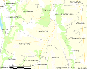
Saint-Michel
- commune in Gers, France
- Country:
- Postal Code: 32300
- Coordinates: 43° 25' 44" N, 0° 24' 54" E
- GPS tracks (wikiloc): [Link]
- AboveSeaLevel: 120 м m
- Area: 16.56 sq km
- Population: 261

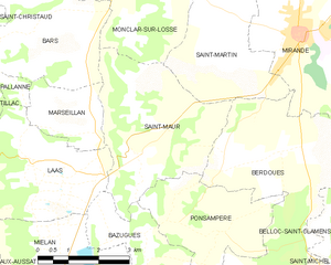
Saint-Maur
- commune in Gers, France
- Country:
- Postal Code: 32300
- Coordinates: 43° 28' 40" N, 0° 20' 35" E
- GPS tracks (wikiloc): [Link]
- AboveSeaLevel: 289 м m
- Area: 13.84 sq km
- Population: 149


Bazugues
- commune in Gers, France
- Country:
- Postal Code: 32170
- Coordinates: 43° 26' 54" N, 0° 20' 39" E
- GPS tracks (wikiloc): [Link]
- Area: 5.36 sq km
- Population: 62


Berdoues
- commune in Gers, France
- Country:
- Postal Code: 32300
- Coordinates: 43° 28' 57" N, 0° 24' 25" E
- GPS tracks (wikiloc): [Link]
- Area: 17.65 sq km
- Population: 466