Pont-à-Mousson (Pont-à-Mousson)

- commune in Meurthe-et-Moselle, France
- Country:

- Postal Code: 54700
- Coordinates: 48° 54' 16" N, 6° 3' 15" E


- GPS tracks (wikiloc): [Link]
- AboveSeaLevel: 183 м m
- Area: 21.6 sq km
- Population: 14901
- Web site: http://www.ville-pont-a-mousson.fr
- Wikipedia en: wiki(en)
- Wikipedia: wiki(fr)
- Wikidata storage: Wikidata: Q461413
- Wikipedia Commons Category: [Link]
- Freebase ID: [/m/03040v]
- Freebase ID: [/m/03040v]
- GeoNames ID: Alt: [2986306]
- GeoNames ID: Alt: [2986306]
- SIREN number: [215404310]
- SIREN number: [215404310]
- BnF ID: [15264500s]
- BnF ID: [15264500s]
- VIAF ID: Alt: [131357432]
- VIAF ID: Alt: [131357432]
- GND ID: Alt: [4103209-3]
- GND ID: Alt: [4103209-3]
- archINFORM location ID: [8787]
- archINFORM location ID: [8787]
- Library of Congress authority ID: Alt: [n81052381]
- Library of Congress authority ID: Alt: [n81052381]
- MusicBrainz area ID: [5d8ea895-7f3c-48b5-976a-0fb53d0bd718]
- MusicBrainz area ID: [5d8ea895-7f3c-48b5-976a-0fb53d0bd718]
- SUDOC authorities ID: [034737308]
- SUDOC authorities ID: [034737308]
- EMLO location ID: [59a0d98b-8521-4c41-a615-5140b4e62019]
- EMLO location ID: [59a0d98b-8521-4c41-a615-5140b4e62019]
- INSEE municipality code: 54431
- INSEE municipality code: 54431
Shares border with regions:


Champey-sur-Moselle
- commune in Meurthe-et-Moselle, France
- Country:
- Postal Code: 54700
- Coordinates: 48° 57' 26" N, 6° 3' 28" E
- GPS tracks (wikiloc): [Link]
- Area: 2.42 sq km
- Population: 351

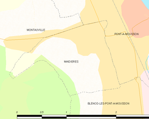
Maidières
- commune in Meurthe-et-Moselle, France
- Country:
- Postal Code: 54700
- Coordinates: 48° 53' 59" N, 6° 2' 17" E
- GPS tracks (wikiloc): [Link]
- Area: 1.81 sq km
- Population: 1526


Lesménils
- commune in Meurthe-et-Moselle, France
- Country:
- Postal Code: 54700
- Coordinates: 48° 55' 53" N, 6° 5' 56" E
- GPS tracks (wikiloc): [Link]
- Area: 10.84 sq km
- Population: 498


Mousson
- commune in Meurthe-et-Moselle, France
- Country:
- Postal Code: 54700
- Coordinates: 48° 54' 19" N, 6° 4' 45" E
- GPS tracks (wikiloc): [Link]
- Area: 5.73 sq km
- Population: 111
- Web site: [Link]

Blénod-lès-Pont-à-Mousson
- commune in Meurthe-et-Moselle, France
- Country:
- Postal Code: 54700
- Coordinates: 48° 53' 0" N, 6° 2' 50" E
- GPS tracks (wikiloc): [Link]
- Area: 9.58 sq km
- Population: 4563


Atton
- commune in Meurthe-et-Moselle, France
- Country:
- Postal Code: 54700
- Coordinates: 48° 53' 26" N, 6° 5' 26" E
- GPS tracks (wikiloc): [Link]
- Area: 15.38 sq km
- Population: 804


Vandières
- commune in Meurthe-et-Moselle, France
- Country:
- Postal Code: 54121
- Coordinates: 48° 57' 15" N, 6° 2' 11" E
- GPS tracks (wikiloc): [Link]
- Area: 12.35 sq km
- Population: 924


Norroy-lès-Pont-à-Mousson
- commune in Meurthe-et-Moselle, France
- Country:
- Postal Code: 54700
- Coordinates: 48° 56' 3" N, 6° 1' 43" E
- GPS tracks (wikiloc): [Link]
- Area: 5.89 sq km
- Population: 1223


Bouxières-sous-Froidmont
- commune in Meurthe-et-Moselle, France
- Country:
- Postal Code: 54700
- Coordinates: 48° 57' 18" N, 6° 5' 30" E
- GPS tracks (wikiloc): [Link]
- AboveSeaLevel: 386 м m
- Area: 7.71 sq km
- Population: 330


Montauville
- commune in Meurthe-et-Moselle, France
- Country:
- Postal Code: 54700
- Coordinates: 48° 54' 3" N, 6° 1' 15" E
- GPS tracks (wikiloc): [Link]
- Area: 16.19 sq km
- Population: 1086