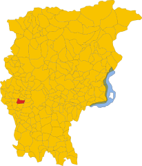
Ponte San Pietro (Ponte San Pietro)
.svg)
- Italian comune
 Hiking in Ponte San Pietro
Ponte San Pietro, located in the province of Bergamo in Lombardy, Italy, is a picturesque area that serves as a gateway to various hiking opportunities in the surrounding region. Here are some aspects to consider if you're planning to hike in and around Ponte San Pietro:
Scenic Surroundings
- Natural Landscapes: The region features beautiful landscapes, including hills, forests, and rivers, making it ideal for nature enthusiasts. The nearby Brembo River adds to the scenic beauty.
- Views of the Alps: On clear days, hikers can enjoy stunning views of the Alps, which are relatively close to the area.
Hiking Trails
- Local Trails: There are several local trails that can be accessed directly from Ponte San Pietro. These trails vary in difficulty, offering options for both beginner hikers and those looking for more challenging climbs.
- Connections to Larger Networks: The area serves as a starting point for longer hikes leading into the nearby Bergamo mountains, such as the Parco dei Colli di Bergamo, which offers numerous trails with varying difficulty levels and lengths.
Park and Natural Reserves
- Parco dei Colli di Bergamo: This natural park nearby is a great place for hiking, with numerous marked trails that allow you to explore its rich biodiversity, including various flora and fauna.
- Cultural and Historical Sites: While hiking, you might encounter historical remnants, small chapels, and local villages that tell the story of the region.
Accessibility
Ponte San Pietro has good public transportation links to Bergamo and other nearby towns, making it an accessible location for hikers traveling from larger cities.
Best Seasons
- Spring and Fall: These seasons offer mild temperatures and beautiful wildflowers in spring, while fall showcases stunning foliage.
- Summer: It can get warm, but early morning hikes can be quite pleasant.
- Winter: Some trails may be accessible, especially for those interested in winter hiking or snowshoeing, depending on snowfall.
Preparation and Safety
- Be sure to wear appropriate footwear, carry enough water, and check the weather before heading out.
- Always inform someone about your hiking plans and consider using a map or GPS to navigate the trails efficiently.
Overall, hiking in and around Ponte San Pietro can be a rewarding experience with plenty to explore. If you’re planning a trip, consider dual-purpose hikes that combine physical activity with cultural exploration.
- Country:

- Postal Code: 24036
- Local Dialing Code: 035
- Licence Plate Code: BG
- Coordinates: 45° 42' 21" N, 9° 35' 26" E


- GPS tracks (wikiloc): [Link]
- AboveSeaLevel: 224 м m
- Area: 4.59 sq km
- Population: 11502
- Web site: http://www.comune.pontesanpietro.bg.it/
- Wikipedia en: wiki(en)
- Wikipedia: wiki(it)
- Wikidata storage: Wikidata: Q101426
- Wikipedia Commons Gallery: [Link]
- Wikipedia Commons Category: [Link]
- Freebase ID: [/m/0dzxgr]
- GeoNames ID: Alt: [6539622]
- VIAF ID: Alt: [144140983]
- OSM relation ID: [45761]
- MusicBrainz area ID: [fa47bd76-765e-48d2-bd22-17a3e6dd3afa]
- UN/LOCODE: [ITPSP]
- ISTAT ID: 016170
- Italian cadastre code: G856
Shares border with regions:


Curno
- Italian comune
Hiking in Curno
Curno is a small town located near Bergamo in Northern Italy, offering a pleasant environment for hiking and outdoor activities. While Curno itself might not be known as a major hiking destination, it serves as a great base for exploring the surrounding areas, particularly the regional parks and hills....
- Country:
- Postal Code: 24035
- Local Dialing Code: 035
- Licence Plate Code: BG
- Coordinates: 45° 41' 28" N, 9° 36' 45" E
- GPS tracks (wikiloc): [Link]
- AboveSeaLevel: 239 м m
- Area: 4.7 sq km
- Population: 7574
- Web site: [Link]


Mapello
- Italian comune
Hiking in Mapello
Mapello, located in the Lombardy region of Italy, is a charming area that offers various opportunities for hiking enthusiasts. The landscape surrounding Mapello features rolling hills, woodlands, and scenic views of the surrounding mountains and countryside, making it a great destination for outdoor activities....
- Country:
- Postal Code: 24030
- Local Dialing Code: 035
- Licence Plate Code: BG
- Coordinates: 45° 42' 32" N, 9° 32' 52" E
- GPS tracks (wikiloc): [Link]
- AboveSeaLevel: 255 м m
- Area: 8.66 sq km
- Population: 6840
- Web site: [Link]


Mozzo
- Italian comune
Hiking in Mozzo
Mozzo, a small town located near Bergamo in the Lombardy region of Italy, offers several hiking opportunities for outdoor enthusiasts. While it may not be as well-known as other hiking destinations in the Italian Alps, there are beautiful trails and scenic views to be explored....
- Country:
- Postal Code: 24030
- Local Dialing Code: 035
- Licence Plate Code: BG
- Coordinates: 45° 41' 55" N, 9° 36' 31" E
- GPS tracks (wikiloc): [Link]
- AboveSeaLevel: 252 м m
- Area: 3.64 sq km
- Population: 7425
- Web site: [Link]


Presezzo
- Italian comune
Hiking in Presezzo
Presezzo is a charming municipality located in the province of Bergamo, in the Lombardy region of Italy. While it may not be one of the most famous hiking destinations, it offers several opportunities for nature lovers and outdoor enthusiasts to explore its scenic landscapes, particularly around the nearby hills and forests....
- Country:
- Postal Code: 24030
- Local Dialing Code: 035
- Licence Plate Code: BG
- Coordinates: 45° 41' 29" N, 9° 33' 59" E
- GPS tracks (wikiloc): [Link]
- AboveSeaLevel: 236 м m
- Area: 2.28 sq km
- Population: 4905
- Web site: [Link]


Valbrembo
- Italian comune
Hiking in Valbrembo
Valbrembo is a charming village located in the province of Bergamo, Italy, nestled among the scenic landscapes of the Lombardy region. It offers several hiking opportunities for both beginners and experienced hikers. Here are some key points about hiking in Valbrembo:...
- Country:
- Postal Code: 24030
- Local Dialing Code: 035
- Licence Plate Code: BG
- Coordinates: 45° 43' 8" N, 9° 36' 34" E
- GPS tracks (wikiloc): [Link]
- AboveSeaLevel: 261 м m
- Area: 3.8 sq km
- Population: 4280
- Web site: [Link]

Bonate Sopra
- Italian comune
Hiking in Bonate Sopra
Bonate Sopra, located in the Lombardy region of Italy, offers a variety of picturesque landscapes and opportunities for hiking enthusiasts. Nestled close to the hills of Bergamo, this area is ideal for those who enjoy nature and scenic views....
- Country:
- Postal Code: 24040
- Local Dialing Code: 035
- Licence Plate Code: BG
- Coordinates: 45° 40' 55" N, 9° 33' 31" E
- GPS tracks (wikiloc): [Link]
- AboveSeaLevel: 320 м m
- Area: 6.15 sq km
- Population: 10020
- Web site: [Link]


Brembate di Sopra
- Italian comune
Hiking in Brembate di Sopra
Brembate di Sopra, located in the Lombardy region of Italy, is a charming town that offers access to beautiful hiking trails and the surrounding natural landscape. Here are some key points about hiking in and around Brembate di Sopra:...
- Country:
- Postal Code: 24030
- Local Dialing Code: 035
- Licence Plate Code: BG
- Coordinates: 45° 43' 4" N, 9° 34' 50" E
- GPS tracks (wikiloc): [Link]
- AboveSeaLevel: 267 м m
- Area: 4.14 sq km
- Population: 7868
- Web site: [Link]