Pontorson (Pontorson)

- commune in Manche, France
- Country:

- Postal Code: 50170
- Coordinates: 48° 33' 12" N, 1° 30' 26" E


- GPS tracks (wikiloc): [Link]
- AboveSeaLevel: 18 м m
- Area: 43.01 sq km
- Population: 3836
- Web site: http://www.ville-pontorson.fr
- Wikipedia en: wiki(en)
- Wikipedia: wiki(fr)
- Wikidata storage: Wikidata: Q331426
- Wikipedia Commons Category: [Link]
- Freebase ID: [/m/0c_y71]
- Freebase ID: [/m/0c_y71]
- GeoNames ID: Alt: [2986136]
- GeoNames ID: Alt: [2986136]
- BnF ID: [15262384m]
- BnF ID: [15262384m]
- VIAF ID: Alt: [239990333]
- VIAF ID: Alt: [239990333]
- OSM relation ID: [5812079]
- OSM relation ID: [5812079]
- GND ID: Alt: [4249522-2]
- GND ID: Alt: [4249522-2]
- British Museum person-institution: [127274]
- British Museum person-institution: [127274]
- INSEE municipality code: 50410
- INSEE municipality code: 50410
Shares border with regions:


Beauvoir
- commune in Manche, France
- Country:
- Postal Code: 50170
- Coordinates: 48° 35' 50" N, 1° 30' 17" E
- GPS tracks (wikiloc): [Link]
- Area: 14.29 sq km
- Population: 410

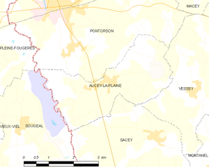
Aucey-la-Plaine
- commune in Manche, France
- Country:
- Postal Code: 50170
- Coordinates: 48° 31' 38" N, 1° 28' 41" E
- GPS tracks (wikiloc): [Link]
- Area: 9.39 sq km
- Population: 439

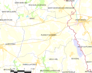
Pleine-Fougères
- commune in Ille-et-Vilaine, France
- Country:
- Postal Code: 35610
- Coordinates: 48° 32' 1" N, 1° 33' 51" E
- GPS tracks (wikiloc): [Link]
- Area: 31.98 sq km
- Population: 1967
- Web site: [Link]


Macey
- former commune in Manche, France
- Country:
- Postal Code: 50170
- Coordinates: 48° 33' 42" N, 1° 26' 9" E
- GPS tracks (wikiloc): [Link]
- Area: 5.87 sq km
- Population: 125


Tanis
- commune in Manche, France
- Country:
- Postal Code: 50170
- Coordinates: 48° 35' 32" N, 1° 26' 30" E
- GPS tracks (wikiloc): [Link]
- Area: 7.49 sq km
- Population: 309

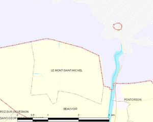
Le Mont-Saint-Michel
- island commune in Manche, Normandy, France
- Country:
- Postal Code: 50170
- Coordinates: 48° 38' 9" N, 1° 30' 37" E
- GPS tracks (wikiloc): [Link]
- Area: 3.97 sq km
- Population: 33
- Web site: [Link]


Saint-Georges-de-Gréhaigne
- commune in Ille-et-Vilaine, France
- Country:
- Postal Code: 35610
- Coordinates: 48° 34' 5" N, 1° 32' 57" E
- GPS tracks (wikiloc): [Link]
- Area: 12.15 sq km
- Population: 375


Sougéal
- commune in Ille-et-Vilaine, France
- Country:
- Postal Code: 35610
- Coordinates: 48° 30' 36" N, 1° 31' 22" E
- GPS tracks (wikiloc): [Link]
- Area: 14.15 sq km
- Population: 640


Huisnes-sur-Mer
- commune in Manche, France
- Country:
- Postal Code: 50170
- Coordinates: 48° 36' 30" N, 1° 27' 1" E
- GPS tracks (wikiloc): [Link]
- Area: 6.75 sq km
- Population: 189


Vessey
- former commune in Manche, France
- Country:
- Postal Code: 50170
- Coordinates: 48° 31' 30" N, 1° 25' 54" E
- GPS tracks (wikiloc): [Link]
- Area: 12.59 sq km
- Population: 403