Pouilly-lès-Feurs (Pouilly-lès-Feurs)

- commune in Loire, France
- Country:

- Postal Code: 42110
- Coordinates: 45° 47' 54" N, 4° 13' 55" E


- GPS tracks (wikiloc): [Link]
- Area: 13.03 sq km
- Population: 1254
- Wikipedia en: wiki(en)
- Wikipedia: wiki(fr)
- Wikidata storage: Wikidata: Q1116353
- Wikipedia Commons Category: [Link]
- Freebase ID: [/m/03nw82r]
- Freebase ID: [/m/03nw82r]
- GeoNames ID: Alt: [6615026]
- GeoNames ID: Alt: [6615026]
- SIREN number: [214201758]
- SIREN number: [214201758]
- BnF ID: [15259743m]
- BnF ID: [15259743m]
- VIAF ID: Alt: [126799320]
- VIAF ID: Alt: [126799320]
- Library of Congress authority ID: Alt: [n90683260]
- Library of Congress authority ID: Alt: [n90683260]
- INSEE municipality code: 42175
- INSEE municipality code: 42175
Shares border with regions:


Civens
- commune in Loire, France
- Country:
- Postal Code: 42110
- Coordinates: 45° 46' 48" N, 4° 15' 9" E
- GPS tracks (wikiloc): [Link]
- Area: 13.1 sq km
- Population: 1376


Néronde
- commune in Loire, France
- Country:
- Postal Code: 42510
- Coordinates: 45° 50' 18" N, 4° 14' 13" E
- GPS tracks (wikiloc): [Link]
- Area: 8.57 sq km
- Population: 462
Épercieux-Saint-Paul
- commune in Loire, France
- Country:
- Postal Code: 42110
- Coordinates: 45° 47' 30" N, 4° 12' 43" E
- GPS tracks (wikiloc): [Link]
- Area: 7.92 sq km
- Population: 715


Rozier-en-Donzy
- commune in Loire, France
- Country:
- Postal Code: 42810
- Coordinates: 45° 47' 53" N, 4° 16' 40" E
- GPS tracks (wikiloc): [Link]
- Area: 9.51 sq km
- Population: 1444
- Web site: [Link]

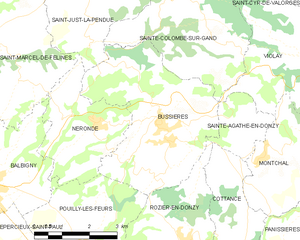
Bussières
- commune in Loire, France
- Country:
- Postal Code: 42510
- Coordinates: 45° 50' 15" N, 4° 16' 6" E
- GPS tracks (wikiloc): [Link]
- Area: 16.76 sq km
- Population: 1576
- Web site: [Link]


Balbigny
- commune in Loire, France
- Country:
- Postal Code: 42510
- Coordinates: 45° 49' 5" N, 4° 11' 14" E
- GPS tracks (wikiloc): [Link]
- Area: 16.98 sq km
- Population: 2989
- Web site: [Link]