Rozier-en-Donzy (Rozier-en-Donzy)

- commune in Loire, France
- Country:

- Postal Code: 42810
- Coordinates: 45° 47' 53" N, 4° 16' 40" E


- GPS tracks (wikiloc): [Link]
- Area: 9.51 sq km
- Population: 1444
- Web site: https://www.mairie-rozier-en-donzy.fr
- Wikipedia en: wiki(en)
- Wikipedia: wiki(fr)
- Wikidata storage: Wikidata: Q1107335
- Wikipedia Commons Category: [Link]
- Freebase ID: [/m/03nw84t]
- Freebase ID: [/m/03nw84t]
- GeoNames ID: Alt: [2982305]
- GeoNames ID: Alt: [2982305]
- SIREN number: [214201931]
- SIREN number: [214201931]
- BnF ID: [15259761j]
- BnF ID: [15259761j]
- VIAF ID: Alt: [211141889]
- VIAF ID: Alt: [211141889]
- SUDOC authorities ID: [077430360]
- SUDOC authorities ID: [077430360]
- INSEE municipality code: 42193
- INSEE municipality code: 42193
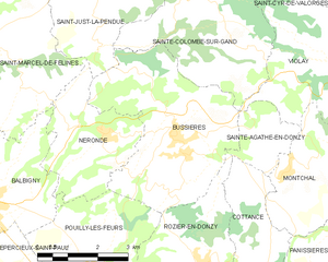
Shares border with regions:


Civens
- commune in Loire, France
- Country:
- Postal Code: 42110
- Coordinates: 45° 46' 48" N, 4° 15' 9" E
- GPS tracks (wikiloc): [Link]
- Area: 13.1 sq km
- Population: 1376


Pouilly-lès-Feurs
- commune in Loire, France
- Country:
- Postal Code: 42110
- Coordinates: 45° 47' 54" N, 4° 13' 55" E
- GPS tracks (wikiloc): [Link]
- Area: 13.03 sq km
- Population: 1254


Cottance
- commune in Loire, France
- Country:
- Postal Code: 42360
- Coordinates: 45° 47' 37" N, 4° 17' 56" E
- GPS tracks (wikiloc): [Link]
- Area: 13.55 sq km
- Population: 697
- Web site: [Link]

Bussières
- commune in Loire, France
- Country:
- Postal Code: 42510
- Coordinates: 45° 50' 15" N, 4° 16' 6" E
- GPS tracks (wikiloc): [Link]
- Area: 16.76 sq km
- Population: 1576
- Web site: [Link]


Sainte-Agathe-en-Donzy
- commune in Loire, France
- Country:
- Postal Code: 42510
- Coordinates: 45° 50' 16" N, 4° 18' 26" E
- GPS tracks (wikiloc): [Link]
- Area: 3.39 sq km
- Population: 125