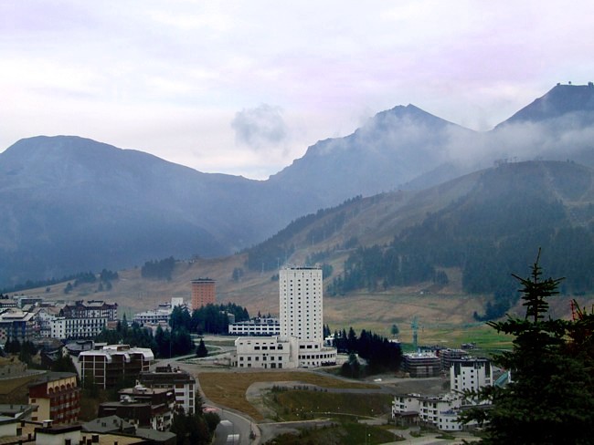
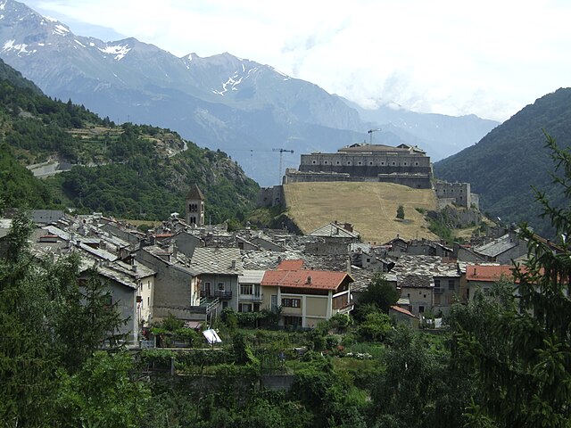
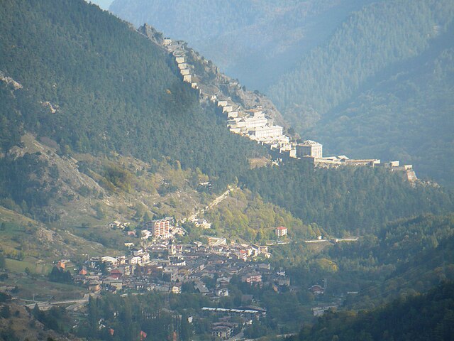
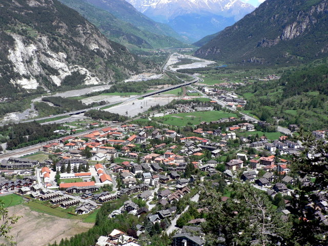
Pragelato (Pragelato)
- Italian comune
Pragelato, located in the Susa Valley in the Piedmont region of Italy, is a fantastic destination for hiking enthusiasts. Nestled in the Alps, it is known for its stunning landscapes, diverse trails, and opportunities for outdoor activities year-round.
Hiking Trails
-
Via Lattea: This extensive network of trails connects Pragelato to other towns in the Milky Way ski area. It offers various routes for different skill levels, ranging from easy walks to challenging hikes with breathtaking views.
-
Gran Paradiso National Park: Just a short distance from Pragelato, this park features numerous trails that lead through lush forests, alpine meadows, and rugged mountains. The park is home to diverse wildlife, including ibex and chamois.
-
Monte Fraiteve: A popular hike that offers panoramic views of the Susa Valley and surrounding peaks. The trail can be accessed from Pragelato and is suitable for intermediate hikers.
-
Lago di Malciaussia: This lake hike offers a serene setting, surrounded by mountains. The trail is moderately challenging and rewards hikers with stunning lake views.
Tips for Hiking in Pragelato
-
Best Time to Hike: Late spring through early fall (May to September) offers the best weather and trail conditions. However, be mindful of snow in late spring at higher elevations.
-
Gear: Wear good hiking boots, and bring layers, as the weather can change quickly in the mountains. A trekking pole can be handy for uneven terrain.
-
Maps and Guides: Consider using a detailed hiking map or a local guide if you're unfamiliar with the area. Local visitor centers often provide useful resources.
-
Hydration and Snacks: Carry enough water and snacks, especially on longer hikes, as facilities can be sparse on the trails.
-
Wildlife Awareness: Be respectful of the local wildlife, and take precautions to avoid encounters with bears, especially in more remote areas.
Conclusion
Hiking in Pragelato is a rewarding experience with its diverse trails and spectacular scenery. Whether you seek a leisurely walk or a challenging trek, the region caters to all levels of hikers. Make sure to enjoy the views, take your time, and immerse yourself in the natural beauty of the Alps!
- Country:

- Postal Code: 10060
- Local Dialing Code: 0122
- Licence Plate Code: TO
- Coordinates: 45° 1' 0" N, 6° 57' 0" E


- GPS tracks (wikiloc): [Link]
- AboveSeaLevel: 1518 м m
- Area: 89.2 sq km
- Population: 786
- Web site: http://www.comune.pragelato.to.it/
- Wikipedia en: wiki(en)
- Wikipedia: wiki(it)
- Wikidata storage: Wikidata: Q10201
- Wikipedia Commons Gallery: [Link]
- Wikipedia Commons Category: [Link]
- Freebase ID: [/m/0bp6p1]
- GeoNames ID: Alt: [3169958]
- VIAF ID: Alt: [132499972]
- OSM relation ID: [43811]
- Library of Congress authority ID: Alt: [n78003973]
- Quora topic ID: [Pragelato]
- TGN ID: [1046177]
- ISTAT ID: 001201
- Italian cadastre code: G973
Shares border with regions:


Prali
- Italian comune
Prali is a beautiful hiking destination located in the Susa Valley in the Piedmont region of Italy. Known for its stunning alpine scenery, rich biodiversity, and preserved natural environment, Prali offers a variety of hiking trails suitable for different skill levels....
- Country:

- Postal Code: 10060
- Local Dialing Code: 0121
- Licence Plate Code: TO
- Coordinates: 44° 53' 0" N, 7° 3' 0" E


- GPS tracks (wikiloc): [Link]
- AboveSeaLevel: 1454 м m
- Area: 72.61 sq km
- Population: 242
- Web site: [Link]


Salbertrand
- Italian comune
Salbertrand is a charming town in the Susa Valley of the Piedmont region in Italy, nestled within the stunning landscape of the Alps. It serves as a wonderful starting point for various hiking adventures, offering trails that range from leisurely walks to more challenging hikes....
- Country:

- Postal Code: 10050
- Local Dialing Code: 0122
- Licence Plate Code: TO
- Coordinates: 45° 4' 20" N, 6° 53' 3" E


- GPS tracks (wikiloc): [Link]
- AboveSeaLevel: 1032 м m
- Area: 38.32 sq km
- Population: 587
- Web site: [Link]


Salza di Pinerolo
- Italian comune
Salza di Pinerolo, located in the Piedmont region of Italy, is a fantastic destination for hiking enthusiasts. Situated within the scenic Susa Valley and surrounded by the stunning backdrop of the Alps, this area offers a range of beautiful trails with varying levels of difficulty....
- Country:

- Postal Code: 10060
- Local Dialing Code: 0121
- Licence Plate Code: TO
- Coordinates: 44° 56' 0" N, 7° 3' 0" E


- GPS tracks (wikiloc): [Link]
- AboveSeaLevel: 1245 м m
- Area: 15.89 sq km
- Population: 75
- Web site: [Link]


Sauze d'Oulx
- Italian comune
Sauze d'Oulx is a charming village located in the Susa Valley of the Piedmont region in Italy, and it's part of the Italian Alps. It's well known for its excellent skiing in the winter, but it also offers fantastic hiking opportunities during the warmer months. Here’s an overview of what to expect when hiking in and around Sauze d'Oulx:...
- Country:

- Postal Code: 10050
- Local Dialing Code: 0122
- Licence Plate Code: TO
- Coordinates: 45° 1' 36" N, 6° 51' 29" E


- GPS tracks (wikiloc): [Link]
- AboveSeaLevel: 1510 м m
- Area: 17.31 sq km
- Population: 1081
- Web site: [Link]
Sauze di Cesana
- Italian comune
Sauze di Cesana is a charming alpine village located in the Susa Valley of Italy's Piedmont region. It's well-known for its stunning scenery, rich history, and a variety of outdoor activities, particularly hiking. Here’s an overview of what you can expect when hiking in this beautiful area:...
- Country:

- Postal Code: 10054
- Local Dialing Code: 0122
- Licence Plate Code: TO
- Coordinates: 44° 56' 0" N, 6° 52' 0" E


- GPS tracks (wikiloc): [Link]
- Area: 78.28 sq km
- Population: 249
- Web site: [Link]


Sestriere
- Italian comune
Sestriere, located in the Italian Alps, is a fantastic destination for hiking enthusiasts. Situated at around 2,035 meters (6,676 feet), it is part of the Via Lattea (Milky Way) ski area and is known for its stunning mountain scenery, charming alpine villages, and extensive network of trails....
- Country:

- Postal Code: 10058
- Local Dialing Code: 0122
- Licence Plate Code: TO
- Coordinates: 44° 57' 0" N, 6° 53' 0" E


- GPS tracks (wikiloc): [Link]
- AboveSeaLevel: 2035 м m
- Area: 25.92 sq km
- Population: 928
- Web site: [Link]


Usseaux
- Italian comune
Usseaux is a charming mountain village located in the Province of Turin, part of the Piedmont region in Italy. Nestled in the Susa Valley, Usseaux is surrounded by the stunning peaks of the Alps, making it a beautiful destination for hiking enthusiasts....
- Country:

- Postal Code: 10060
- Local Dialing Code: 0121
- Licence Plate Code: TO
- Coordinates: 45° 3' 0" N, 7° 2' 0" E


- GPS tracks (wikiloc): [Link]
- AboveSeaLevel: 1416 м m
- Area: 37.97 sq km
- Population: 186
- Web site: [Link]


Exilles
- Italian comune
Exilles, located in the Susa Valley in the Piedmont region of Italy, is surrounded by the stunning landscapes of the Alps, making it an excellent destination for hiking enthusiasts. Here are some highlights and tips for hiking in and around Exilles:...
- Country:

- Postal Code: 10050
- Local Dialing Code: 0122
- Licence Plate Code: TO
- Coordinates: 45° 6' 0" N, 6° 56' 0" E


- GPS tracks (wikiloc): [Link]
- AboveSeaLevel: 870 м m
- Area: 46.55 sq km
- Population: 260
- Web site: [Link]


Fenestrelle
- Italian comune
Fenestrelle, located in the Piedmont region of Italy, is known for its stunning natural beauty and historical significance. The area is particularly famous for the Fort of Fenestrelle, a remarkable fortress that offers a unique backdrop for hiking activities. Here’s an overview of what you can expect when hiking in Fenestrelle:...
- Country:

- Postal Code: 10060
- Local Dialing Code: 0121
- Licence Plate Code: TO
- Coordinates: 45° 2' 0" N, 7° 3' 0" E


- GPS tracks (wikiloc): [Link]
- AboveSeaLevel: 1215 м m
- Area: 49.41 sq km
- Population: 521
- Web site: [Link]


Massello
- Italian comune
Massello is a small village located in the Susa Valley of the Piedmont region in Italy, nestled within the beautiful backdrop of the Alps. It's a fantastic destination for hiking enthusiasts due to its stunning landscapes, diverse trails, and rich natural beauty....
- Country:

- Postal Code: 10060
- Local Dialing Code: 0121
- Licence Plate Code: TO
- Coordinates: 44° 58' 0" N, 7° 3' 0" E


- GPS tracks (wikiloc): [Link]
- Area: 38.26 sq km
- Population: 52
- Web site: [Link]


Oulx
- Italian comune
Oulx is a charming village located in the Susa Valley of the Italian Alps, and it’s a fantastic area for hiking enthusiasts. The region is known for its stunning mountain scenery, diverse trails, and opportunities for outdoor activities....
- Country:

- Postal Code: 10056
- Local Dialing Code: 0122
- Licence Plate Code: TO
- Coordinates: 45° 2' 0" N, 6° 50' 0" E


- GPS tracks (wikiloc): [Link]
- AboveSeaLevel: 1100 м m
- Area: 99.79 sq km
- Population: 3363
- Web site: [Link]

