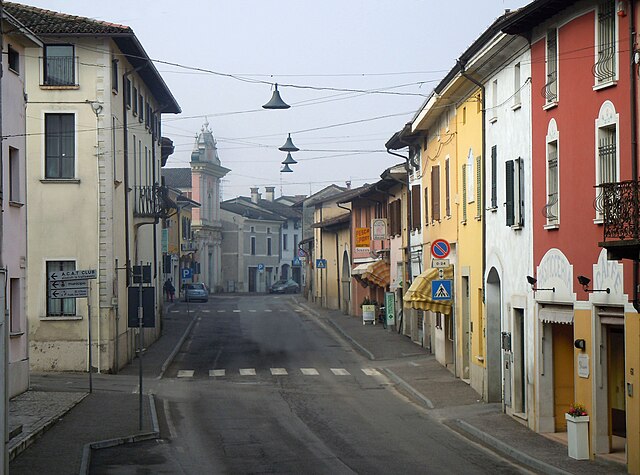
Pralboino (Pralboino)
.svg)
- Italian comune
 Hiking in Pralboino
Pralboino is a small town located in the Lombardy region of Italy. While it may not be as well-known as some of the larger towns in the area, it offers opportunities for hiking and outdoor activities. Here are some insights about hiking in and around Pralboino:
Trails and Surroundings
-
Nature Trails: The landscape surrounding Pralboino is mostly rural and agricultural, which can offer scenic views of fields, small forests, and rivers. While there may not be dedicated hiking trails, you can explore the region by walking along paths that connect different small towns and rural areas.
-
Parco Oglio Sud: This regional park is located not far from Pralboino and offers several walking and hiking paths. The park is characterized by its rich biodiversity, and you can enjoy nature while exploring the trails that run along the Oglio River.
-
Nearby Landmarks: Hiking in the area can also lead to cultural landmarks such as historical churches and local architecture. Exploring the countryside can provide a great opportunity to experience the local culture.
Hiking Considerations
-
Seasonal Weather: The best season for hiking in this region is generally spring through early autumn. Summer can be hot, so be prepared with water and sun protection.
-
Local Regulations: Always check for local regulations regarding hiking, as some areas may have restrictions or guidelines to follow.
-
Safety: While hiking, make sure you are well-equipped with proper footwear, a map or GPS device, and sufficient supplies, particularly if venturing into less developed areas.
Recommendations
-
Explore Nearby Areas: Consider extending your hiking trips to nearby towns such as Castel Goffredo or Montichiari, which may offer more established hiking routes and facilities.
-
Join a Local Group: If you’re looking for companionship or guided hikes, consider seeking out local hiking clubs or groups, which can enhance your experience and provide safety in numbers.
Overall, while Pralboino may not be the primary hiking destination, its surrounding areas provide opportunities for outdoor enthusiasts to explore the beautiful Lombardy landscape. As always, make sure to plan your hikes according to your skill level and preferences!
- Country:

- Postal Code: 25020
- Local Dialing Code: 030
- Licence Plate Code: BS
- Coordinates: 45° 16' 6" N, 10° 13' 6" E


- GPS tracks (wikiloc): [Link]
- AboveSeaLevel: 47 м m
- Area: 17.16 sq km
- Population: 2938
- Web site: http://www.comune.pralboino.bs.it/
- Wikipedia en: wiki(en)
- Wikipedia: wiki(it)
- Wikidata storage: Wikidata: Q111479
- Wikipedia Commons Category: [Link]
- Freebase ID: [/m/047dbr]
- GeoNames ID: Alt: [6537178]
- VIAF ID: Alt: [234358517]
- OSM relation ID: [44557]
- archINFORM location ID: [6363]
- ISTAT ID: 017152
- Italian cadastre code: G977
Shares border with regions:
Gambara
- Italian comune
Hiking in Gambara
Gambara is a small town located in the Lombardy region of Italy, known for its picturesque countryside, charming landscapes, and proximity to various natural areas suitable for hiking. While Gambara itself may not have extensive hiking trails, it serves as a great gateway to explore the surrounding areas that offer beautiful hiking experiences....
- Country:
- Postal Code: 25020
- Local Dialing Code: 030
- Licence Plate Code: BS
- Coordinates: 45° 15' 22" N, 10° 17' 40" E
- GPS tracks (wikiloc): [Link]
- AboveSeaLevel: 51 м m
- Area: 31.59 sq km
- Population: 4743
- Web site: [Link]

Gottolengo
- Italian comune
Hiking in Gottolengo
Gottolengo is a small town in the Lombardy region of Italy, located in the province of Brescia. While it may not be as famous for hiking as some of the larger national parks or mountains in the area, there are still opportunities to enjoy the beautiful Italian countryside through walking and exploring the scenic surroundings....
- Country:
- Postal Code: 25023
- Local Dialing Code: 030
- Licence Plate Code: BS
- Coordinates: 45° 17' 34" N, 10° 16' 24" E
- GPS tracks (wikiloc): [Link]
- AboveSeaLevel: 53 м m
- Area: 29.28 sq km
- Population: 5184
- Web site: [Link]
Milzano
- Italian comune
Hiking in Milzano
Milzano is a small town located in the Lombardy region of Italy, known for its beautiful landscapes and proximity to the surrounding countryside. While it may not be as widely recognized as a hiking destination compared to larger national parks or mountain ranges, it offers several opportunities for outdoor enthusiasts. Here’s a guide on hiking in and around Milzano:...
- Country:
- Postal Code: 25020
- Local Dialing Code: 030
- Licence Plate Code: BS
- Coordinates: 45° 16' 29" N, 10° 11' 59" E
- GPS tracks (wikiloc): [Link]
- AboveSeaLevel: 49 м m
- Area: 8.49 sq km
- Population: 1764
- Web site: [Link]
Pavone del Mella
- Italian comune
Hiking in Pavone del Mella
Pavone del Mella is a charming municipality located in the Lombardy region of Italy, in the province of Brescia. While it may not be as well-known for hiking as some of the more prominent areas in Italy, there are still opportunities for hiking and enjoying the beautiful natural surroundings....
- Country:
- Postal Code: 25020
- Local Dialing Code: 030
- Licence Plate Code: BS
- Coordinates: 45° 18' 3" N, 10° 12' 31" E
- GPS tracks (wikiloc): [Link]
- AboveSeaLevel: 54 м m
- Area: 11.61 sq km
- Population: 2801
- Web site: [Link]

Seniga
- Italian comune
Hiking in Seniga
Seniga is a charming area located in the Lombardy region of Italy, offering beautiful landscapes and opportunities for hiking enthusiasts. Though it might not be as widely known as some other hiking destinations, it provides a unique blend of scenery, culture, and outdoor activities....
- Country:
- Postal Code: 25020
- Local Dialing Code: 030
- Licence Plate Code: BS
- Coordinates: 45° 14' 36" N, 10° 10' 41" E
- GPS tracks (wikiloc): [Link]
- AboveSeaLevel: 48 м m
- Area: 13.57 sq km
- Population: 1437
- Web site: [Link]

Ostiano
- Italian comune
Hiking in Ostiano
Ostiano, located in the Lombardy region of Italy, offers a unique opportunity for hiking enthusiasts to explore its scenic landscapes and local culture. While Ostiano itself may not be as widely recognized for extensive hiking trails as some other Italian regions, it serves as a gateway to the surrounding areas that are rich in natural beauty and potential hiking routes....
- Country:
- Postal Code: 26032
- Local Dialing Code: 0372
- Licence Plate Code: CR
- Coordinates: 45° 13' 0" N, 10° 15' 0" E
- GPS tracks (wikiloc): [Link]
- AboveSeaLevel: 43 м m
- Area: 19.49 sq km
- Population: 2945
- Web site: [Link]