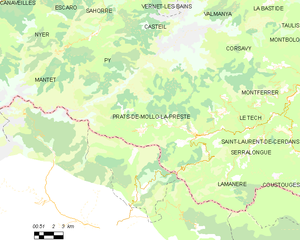
Prats-de-Mollo-la-Preste (Prats-de-Mollo-la-Preste)
- commune in Pyrénées-Orientales, France
- Country:

- Postal Code: 66230
- Coordinates: 42° 24' 14" N, 2° 28' 45" E


- GPS tracks (wikiloc): [Link]
- Area: 145.09 sq km
- Population: 1127
- Web site: http://www.pratsdemollolapreste.com
- Wikipedia en: wiki(en)
- Wikipedia: wiki(fr)
- Wikidata storage: Wikidata: Q828602
- Wikipedia Commons Gallery: [Link]
- Wikipedia Commons Category: [Link]
- Freebase ID: [/m/09ndmp]
- Freebase ID: [/m/09ndmp]
- GeoNames ID: Alt: [6441006]
- GeoNames ID: Alt: [6441006]
- SIREN number: [216601500]
- SIREN number: [216601500]
- BnF ID: [15271059j]
- BnF ID: [15271059j]
- VIAF ID: Alt: [237331640]
- VIAF ID: Alt: [237331640]
- OSM relation ID: [2918640]
- OSM relation ID: [2918640]
- Library of Congress authority ID: Alt: [n88065911]
- Library of Congress authority ID: Alt: [n88065911]
- PACTOLS thesaurus ID: [pcrtDQpNpoT6Si]
- PACTOLS thesaurus ID: [pcrtDQpNpoT6Si]
- Gran Enciclopèdia Catalana ID: [0052611]
- Gran Enciclopèdia Catalana ID: [0052611]
- INSEE municipality code: 66150
- INSEE municipality code: 66150
Shares border with regions:


Serralongue
- commune in Pyrénées-Orientales, France
- Country:

- Postal Code: 66230
- Coordinates: 42° 23' 51" N, 2° 33' 20" E


- GPS tracks (wikiloc): [Link]
- AboveSeaLevel: 699 м m
- Area: 23.04 sq km
- Population: 227


Mantet
- commune in Pyrénées-Orientales, France
- Country:

- Postal Code: 66360
- Coordinates: 42° 29' 0" N, 2° 18' 0" E


- GPS tracks (wikiloc): [Link]
- Area: 32.15 sq km
- Population: 31


Lamanère
- commune in Pyrénées-Orientales, France
- Country:

- Postal Code: 66230
- Coordinates: 42° 21' 37" N, 2° 31' 13" E


- GPS tracks (wikiloc): [Link]
- Area: 23.83 sq km
- Population: 42


Py
- commune in Pyrénées-Orientales, France
- Country:

- Postal Code: 66360
- Coordinates: 42° 29' 45" N, 2° 21' 3" E


- GPS tracks (wikiloc): [Link]
- Area: 50.86 sq km
- Population: 92
- Web site: [Link]


Le Tech
- commune in Pyrénées-Orientales, France
- Country:

- Postal Code: 66230
- Coordinates: 42° 24' 38" N, 2° 32' 40" E


- GPS tracks (wikiloc): [Link]
- Area: 25.18 sq km
- Population: 104


Casteil
- commune in Pyrénées-Orientales, France
- Country:

- Postal Code: 66820
- Coordinates: 42° 31' 51" N, 2° 23' 36" E


- GPS tracks (wikiloc): [Link]
- Area: 29.83 sq km
- Population: 132
- Web site: [Link]
