Py (Py)

- commune in Pyrénées-Orientales, France
- Country:

- Postal Code: 66360
- Coordinates: 42° 29' 45" N, 2° 21' 3" E


- GPS tracks (wikiloc): [Link]
- Area: 50.86 sq km
- Population: 92
- Web site: http://mairiedepy.free.fr
- Wikipedia en: wiki(en)
- Wikipedia: wiki(fr)
- Wikidata storage: Wikidata: Q178846
- Wikipedia Commons Category: [Link]
- Freebase ID: [/m/03h3v8l]
- Freebase ID: [/m/03h3v8l]
- GeoNames ID: Alt: [2984891]
- GeoNames ID: Alt: [2984891]
- SIREN number: [216601559]
- SIREN number: [216601559]
- BnF ID: [152710644]
- BnF ID: [152710644]
- OSM relation ID: [2913745]
- OSM relation ID: [2913745]
- WOEID: [618478]
- WOEID: [618478]
- Gran Enciclopèdia Catalana ID: [0050838]
- Gran Enciclopèdia Catalana ID: [0050838]
- INSEE municipality code: 66155
- INSEE municipality code: 66155
Shares border with regions:


Sahorre
- commune in Pyrénées-Orientales, France
- Country:
- Postal Code: 66360
- Coordinates: 42° 31' 57" N, 2° 21' 43" E
- GPS tracks (wikiloc): [Link]
- Area: 14.88 sq km
- Population: 374
- Web site: [Link]


Mantet
- commune in Pyrénées-Orientales, France
- Country:
- Postal Code: 66360
- Coordinates: 42° 29' 0" N, 2° 18' 0" E
- GPS tracks (wikiloc): [Link]
- Area: 32.15 sq km
- Population: 31


Nyer
- commune in Pyrénées-Orientales, France
- Country:
- Postal Code: 66360
- Coordinates: 42° 32' 1" N, 2° 16' 33" E
- GPS tracks (wikiloc): [Link]
- Area: 37 sq km
- Population: 152

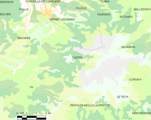
Casteil
- commune in Pyrénées-Orientales, France
- Country:
- Postal Code: 66820
- Coordinates: 42° 31' 51" N, 2° 23' 36" E
- GPS tracks (wikiloc): [Link]
- Area: 29.83 sq km
- Population: 132
- Web site: [Link]
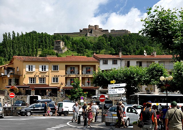
Prats-de-Mollo-la-Preste
- commune in Pyrénées-Orientales, France
- Country:
- Postal Code: 66230
- Coordinates: 42° 24' 14" N, 2° 28' 45" E
- GPS tracks (wikiloc): [Link]
- Area: 145.09 sq km
- Population: 1127
- Web site: [Link]