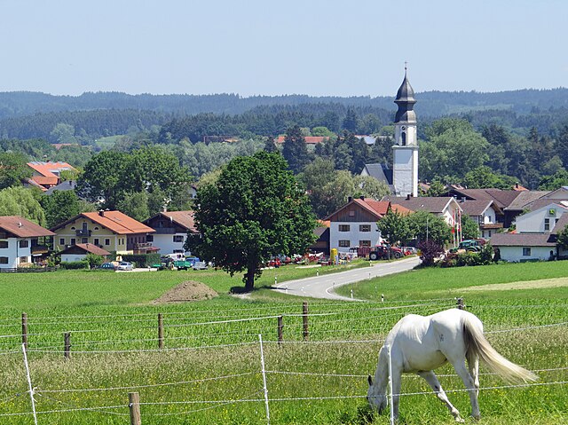
Prutting (Prutting)
- municipality of Germany
Prutting, while not widely known, can refer to several locations or may be a misspelling or lesser-known area. If you meant "Prutting" as a specific spot, please provide more context or check the spelling.
If you are interested in hiking in a specific region and are looking for advice or information on trails, difficulty levels, sights, or visitor information, please provide the correct name or more details about the area you are interested in exploring.
In general, when hiking, remember to consider the following:
-
Trail Difficulty: Choose trails that match your skill level. Trail ratings typically range from easy to very difficult.
-
Preparation: Always check the weather conditions before you set out, wear appropriate footwear, and carry enough water and snacks for the hike.
-
Safety: Carry a map or GPS device, and let someone know your hiking plans.
-
Leave No Trace: Follow sustainable practices by not littering and respecting wildlife.
Let me know if you have a specific hiking area or region in mind!
- Country:

- Postal Code: 83134
- Local Dialing Code: 08036
- Licence Plate Code: RO
- Coordinates: 47° 54' 0" N, 12° 12' 0" E


- GPS tracks (wikiloc): [Link]
- AboveSeaLevel: 496 м m
- Area: 16.22 sq km
- Population: 1769
- Web site: http://www.prutting.de
- Wikipedia en: wiki(en)
- Wikipedia: wiki(de)
- Wikidata storage: Wikidata: Q532859
- Wikipedia Commons Category: [Link]
- Freebase ID: [/m/02q7f7n]
- GeoNames ID: Alt: [2851801]
- VIAF ID: Alt: [247822317]
- OSM relation ID: [2186933]
- GND ID: Alt: [4488070-4]
- Bavarikon ID: [ODB_A00001323]
- German municipality key: 09187163
Shares border with regions:


Söchtenau
- municipality of Germany
Söchtenau, located in Bavaria, Germany, is a charming area that offers a variety of hiking opportunities with scenic views of the surrounding landscape. Here are some highlights and tips for hiking in Söchtenau:...
- Country:

- Postal Code: 83139
- Local Dialing Code: 08055
- Licence Plate Code: RO
- Coordinates: 47° 55' 52" N, 12° 13' 47" E


- GPS tracks (wikiloc): [Link]
- AboveSeaLevel: 480 м m
- Area: 25.62 sq km
- Population: 2039
- Web site: [Link]


Stephanskirchen
- municipality of Germany
Stephanskirchen is a picturesque area located in Bavaria, Germany, near the city of Rosenheim. It offers a variety of hiking opportunities that attract outdoor enthusiasts of all skill levels....
- Country:

- Postal Code: 83071
- Local Dialing Code: 08036; 08031
- Licence Plate Code: RO
- Coordinates: 47° 51' 0" N, 12° 11' 0" E


- GPS tracks (wikiloc): [Link]
- AboveSeaLevel: 473 м m
- Area: 26.51 sq km
- Population: 8909
- Web site: [Link]


Vogtareuth
- municipality of Germany
Vogtareuth is a small town located in Bavaria, Germany, and it offers a variety of hiking opportunities that allow you to explore the beautiful scenery of the region. The area is characterized by its picturesque landscapes, including rolling hills, lush meadows, and woodlands, making it a great destination for outdoor enthusiasts....
- Country:

- Postal Code: 83569
- Local Dialing Code: 08038
- Licence Plate Code: RO
- Coordinates: 47° 56' 49" N, 12° 10' 53" E


- GPS tracks (wikiloc): [Link]
- AboveSeaLevel: 484 м m
- Area: 34.24 sq km
- Population: 2192
- Web site: [Link]

