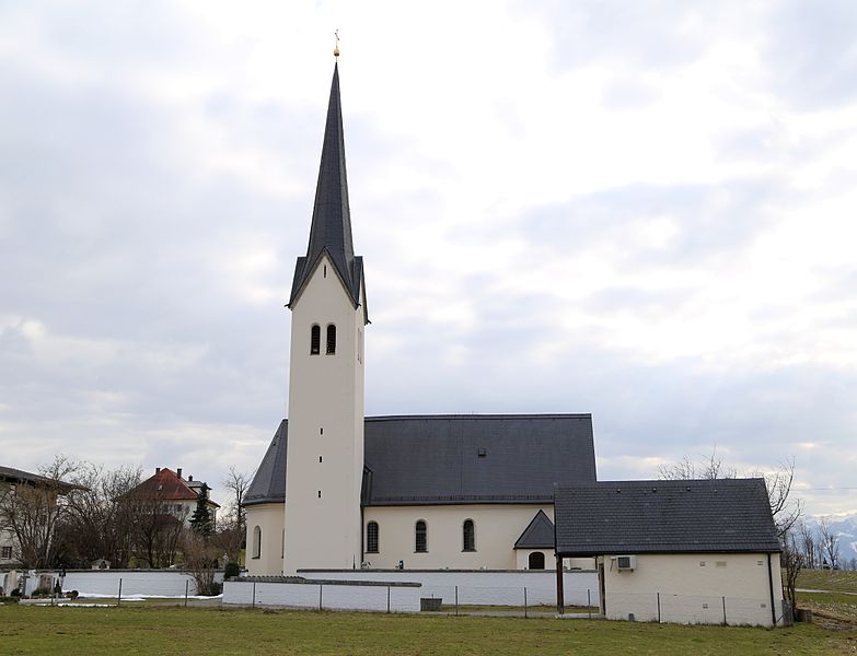
Stephanskirchen (Stephanskirchen)

- municipality of Germany
 Hiking in Stephanskirchen
Stephanskirchen is a picturesque area located in Bavaria, Germany, near the city of Rosenheim. It offers a variety of hiking opportunities that attract outdoor enthusiasts of all skill levels.
Hiking Trails
-
Local Trails: The region features several well-marked hiking trails that allow hikers to explore the scenic landscapes, including lush forests, rolling hills, and beautiful meadows. Many of these trails lead through the Bavarian countryside, providing stunning views of the Alps in the distance.
-
Bavarian Alps: For those willing to venture a bit further, the nearby Bavarian Alps offer more challenging terrain and breathtaking vistas. Popular trails in this area include routes around the Wendelstein Mountain and the Tegernsee.
-
Historical Routes: Some trails may also take you through areas of historical significance, with opportunities to visit charming villages, local churches, and historical sites.
Things to Keep in Mind
-
Trail Difficulty: Check the difficulty level of the trails. Many are suitable for families, while some may be more challenging and better suited for experienced hikers.
-
Weather Conditions: Always check the weather forecast before heading out, as conditions can change rapidly in the mountains.
-
Equipment: Wear appropriate hiking boots and clothing. Carry essentials such as water, snacks, a map, and a first-aid kit.
-
Local Regulations: Respect local wildlife and natural habitats. Follow any guidelines provided by the local hiking associations.
Recommended Activities
-
Picnicking: Many trails have scenic spots perfect for a break or a picnic. Bring along some snacks and enjoy nature.
-
Photography: The stunning landscapes and diverse flora and fauna provide excellent opportunities for photography.
-
Wildlife Watching: Keep an eye out for local wildlife, including deer, various bird species, and more.
Accessibility
Stephanskirchen is accessible by public transport, with connections to Rosenheim and other nearby towns. If you're traveling from larger cities, consider using local trains or buses to reach the starting points of hiking trails.
Hiking in Stephanskirchen and the surrounding areas can be a rewarding experience, offering a blend of natural beauty, tranquility, and physical activity. Enjoy your time in this lovely region!
- Country:

- Postal Code: 83071
- Local Dialing Code: 08036; 08031
- Licence Plate Code: RO
- Coordinates: 47° 51' 0" N, 12° 11' 0" E


- GPS tracks (wikiloc): [Link]
- AboveSeaLevel: 473 м m
- Area: 26.51 sq km
- Population: 8909
- Web site: http://www.stephanskirchen.de
- Wikipedia en: wiki(en)
- Wikipedia: wiki(de)
- Wikidata storage: Wikidata: Q532986
- Wikipedia Commons Category: [Link]
- Freebase ID: [/m/02q7g2t]
- GeoNames ID: Alt: [2827406]
- OSM relation ID: [2186942]
- GND ID: Alt: [4367903-1]
- archINFORM location ID: [16586]
- Bavarikon ID: [ODB_A00001334]
- German municipality key: 09187177
Shares border with regions:

Riedering
- municipality of Germany
Hiking in Riedering
Riedering is a beautiful area located in Bavaria, Germany, offering stunning landscapes and various hiking opportunities. Nestled near the foothills of the Alps, it provides access to picturesque trails that cater to different skill levels. Here are some highlights about hiking in Riedering:...
- Country:
- Postal Code: 83083
- Local Dialing Code: 08036
- Licence Plate Code: RO
- Coordinates: 47° 50' 0" N, 12° 12' 0" E
- GPS tracks (wikiloc): [Link]
- AboveSeaLevel: 493 м m
- Area: 37.94 sq km
- Population: 4336
- Web site: [Link]


Prutting
- municipality of Germany
Hiking in Prutting
Prutting, while not widely known, can refer to several locations or may be a misspelling or lesser-known area. If you meant "Prutting" as a specific spot, please provide more context or check the spelling....
- Country:
- Postal Code: 83134
- Local Dialing Code: 08036
- Licence Plate Code: RO
- Coordinates: 47° 54' 0" N, 12° 12' 0" E
- GPS tracks (wikiloc): [Link]
- AboveSeaLevel: 496 м m
- Area: 16.22 sq km
- Population: 1769
- Web site: [Link]

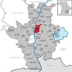
Vogtareuth
- municipality of Germany
Hiking in Vogtareuth
Vogtareuth is a small town located in Bavaria, Germany, and it offers a variety of hiking opportunities that allow you to explore the beautiful scenery of the region. The area is characterized by its picturesque landscapes, including rolling hills, lush meadows, and woodlands, making it a great destination for outdoor enthusiasts....
- Country:
- Postal Code: 83569
- Local Dialing Code: 08038
- Licence Plate Code: RO
- Coordinates: 47° 56' 49" N, 12° 10' 53" E
- GPS tracks (wikiloc): [Link]
- AboveSeaLevel: 484 м m
- Area: 34.24 sq km
- Population: 2192
- Web site: [Link]