Quingey (Quingey)
- commune in Doubs, France
Quingey, a charming village in the Doubs department of France, is known for its picturesque landscapes and proximity to the Jura Mountains, making it an excellent location for hiking enthusiasts. Here are some key points to consider:
Hiking Trails
-
Diverse Terrain: The area around Quingey offers varied terrain, from forested hills to open fields, making it suitable for hikers of all levels. You can find trails that are easy and family-friendly as well as more challenging routes for experienced hikers.
-
Marked Trails: There are several well-marked hiking trails that guide you through the scenic countryside, providing opportunities for wildlife spotting and enjoying the local flora and fauna.
-
Local Highlights: One popular route leads toward the nearby Ognon River, which offers lovely views and spots for a picnic. You can also explore the surrounding valleys and natural reserves.
Seasonal Considerations
- Spring and Summer: These seasons are ideal for hiking due to milder weather and blooming scenery. Be sure to carry plenty of water, as trails can be exposed to the sun.
- Fall: Autumn offers breathtaking foliage, making for stunning views, but be prepared for cooler temperatures.
- Winter: Some trails may be accessible for winter hikes or snowshoeing, but always ensure you check conditions beforehand as snow can impact trail accessibility.
Tips for Hiking in Quingey
- Equipment: Make sure to wear sturdy hiking boots, and carry a map or GPS device as not all areas may have cell service.
- Weather Preparedness: The weather can change rapidly, so dressing in layers is advisable.
- Respect Nature: Follow Leave No Trace principles—take your trash with you and respect the local wildlife.
Nearby Attractions
After a day of hiking, you might want to explore Quingey itself, with its quaint architecture and local eateries. The Doubs region is rich in history, so consider visiting its historical sites and enjoying local cuisine.
If you have more specific interests or need more details about certain trails or activities, feel free to ask!
- Country:

- Postal Code: 25440
- Coordinates: 47° 6' 12" N, 5° 52' 59" E


- GPS tracks (wikiloc): [Link]
- Area: 8.55 sq km
- Population: 1407
- Wikipedia en: wiki(en)
- Wikipedia: wiki(fr)
- Wikidata storage: Wikidata: Q660355
- Wikipedia Commons Category: [Link]
- Freebase ID: [/m/03mgbb_]
- Freebase ID: [/m/03mgbb_]
- GeoNames ID: Alt: [6453862]
- GeoNames ID: Alt: [6453862]
- SIREN number: [212504757]
- SIREN number: [212504757]
- BnF ID: [152527010]
- BnF ID: [152527010]
- VIAF ID: Alt: [245084261]
- VIAF ID: Alt: [245084261]
- PACTOLS thesaurus ID: [pcrtzQVERBafPo]
- PACTOLS thesaurus ID: [pcrtzQVERBafPo]
- INSEE municipality code: 25475
- INSEE municipality code: 25475
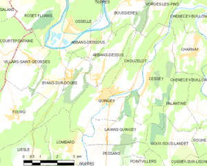
Shares border with regions:


Abbans-Dessus
- commune in Doubs, France
Abbans-Dessus is a picturesque village located in the Doubs department of the Bourgogne-Franche-Comté region in eastern France. It's a great destination for hiking, as it offers beautiful landscapes and various trails for different skill levels. Here are some key points to consider when planning a hiking trip in and around Abbans-Dessus:...
- Country:

- Postal Code: 25440
- Coordinates: 47° 7' 12" N, 5° 52' 55" E


- GPS tracks (wikiloc): [Link]
- Area: 4.43 sq km
- Population: 303


Lavans-Quingey
- commune in Doubs, France
Lavans-Quingey is a charming commune located in the Jura department of France, surrounded by stunning natural landscapes that are ideal for hiking enthusiasts. This area is characterized by its rolling hills, dense forests, and scenic viewpoints, making it a great destination for outdoor activities....
- Country:

- Postal Code: 25440
- Coordinates: 47° 5' 20" N, 5° 52' 37" E


- GPS tracks (wikiloc): [Link]
- Area: 5.9 sq km
- Population: 208


Chouzelot
- commune in Doubs, France
Chouzelot, located in France, is relatively lesser-known compared to more popular hiking destinations, but it can offer some beautiful trails and scenic landscapes. While specific trails may not be widely documented, here are some general tips and suggestions for hiking in the Chouzelot region and surrounding areas:...
- Country:

- Postal Code: 25440
- Coordinates: 47° 6' 26" N, 5° 53' 37" E


- GPS tracks (wikiloc): [Link]
- Area: 6.41 sq km
- Population: 269


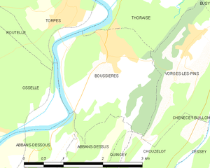
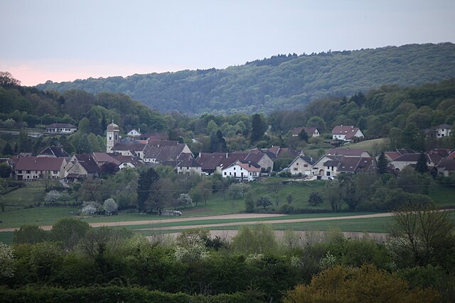
Boussières
- commune in Doubs, France
Boussières is a charming commune located in the Doubs department of the Bourgogne-Franche-Comté region in eastern France. It's surrounded by beautiful natural landscapes, making it a great destination for hiking enthusiasts....
- Country:

- Postal Code: 25320
- Coordinates: 47° 9' 27" N, 5° 54' 5" E


- GPS tracks (wikiloc): [Link]
- Area: 5.58 sq km
- Population: 1089
- Web site: [Link]


Byans-sur-Doubs
- commune in Doubs, France
Byans-sur-Doubs is a charming commune located in the Bourgogne-Franche-Comté region of eastern France, nestled along the banks of the Doubs River. It offers a peaceful environment and picturesque landscapes, making it a great destination for hiking enthusiasts. Here are some aspects to consider when hiking in this area:...
- Country:

- Postal Code: 25320
- Coordinates: 47° 6' 55" N, 5° 51' 19" E


- GPS tracks (wikiloc): [Link]
- Area: 9.91 sq km
- Population: 527


Cessey
- commune in Doubs, France
Cessey is not widely recognized as a specific hiking destination, so it might be a small town or area that isn't heavily documented in hiking literature. However, if you're referring to a particular region or are looking for guidance on hiking in hiking-friendly areas near where "Cessey" might be located, I’d suggest considering a few general tips and information:...
- Country:

- Postal Code: 25440
- Coordinates: 47° 6' 31" N, 5° 54' 51" E


- GPS tracks (wikiloc): [Link]
- Area: 7.53 sq km
- Population: 340


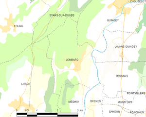
Lombard
- commune in Doubs, France
Lombard is a beautiful area located in the Doubs department of France, known for its stunning landscapes, rich biodiversity, and numerous hiking trails. Here are some details to help you plan your hiking adventure there:...
- Country:

- Postal Code: 25440
- Coordinates: 47° 4' 38" N, 5° 51' 13" E


- GPS tracks (wikiloc): [Link]
- AboveSeaLevel: 295 м m
- Area: 5.92 sq km
- Population: 198

