Boussières (Boussières)
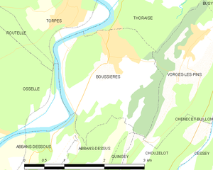
- commune in Doubs, France
Boussières is a charming commune located in the Doubs department of the Bourgogne-Franche-Comté region in eastern France. It's surrounded by beautiful natural landscapes, making it a great destination for hiking enthusiasts.
Hiking Trails
-
Local Trails: There are numerous local trails around Boussières that vary in difficulty. You can find well-marked paths that lead through forests, fields, and along the river banks. These trails often provide beautiful views of the surrounding countryside and are suitable for hikers of all skill levels.
-
Grande Traversée du Jura: This long-distance hike passes through the region, showcasing the stunning Jura mountains. It's a more challenging option for experienced hikers who want to take on a multi-day trek.
-
Circular Routes: Many circular hiking routes are available, allowing for easier planning since you'll return to your starting point. These routes often highlight local flora and fauna, historical landmarks, and panoramic viewpoints.
Tips for Hiking in Boussières
- Season: The best times for hiking are spring and early autumn when the weather is mild, and nature is vibrant.
- Gear: Proper hiking footwear is essential, as some trails can be uneven or muddy. Carry plenty of water, snacks, and a map or GPS device.
- Local Regulations: Always respect local guidelines, especially in protected areas. Take care to follow Leave No Trace principles.
Nearby Attractions
- Natural Sites: The surrounding region features beautiful natural sites, including lakes and forests for wildlife watching.
- Cultural Spots: Consider visiting local historical sites or villages to immerse yourself in the regional culture.
Conclusion
Hiking in Boussières offers a delightful blend of nature and tranquility, making it a perfect spot for both casual walkers and serious hikers. Enjoy the fresh air, stunning vistas, and the peaceful atmosphere that this charming region has to offer!
- Country:

- Postal Code: 25320
- Coordinates: 47° 9' 27" N, 5° 54' 5" E


- GPS tracks (wikiloc): [Link]
- Area: 5.58 sq km
- Population: 1089
- Web site: http://boussieres.fr
- Wikipedia en: wiki(en)
- Wikipedia: wiki(fr)
- Wikidata storage: Wikidata: Q816719
- Wikipedia Commons Category: [Link]
- Freebase ID: [/m/03mgrgz]
- Freebase ID: [/m/03mgrgz]
- GeoNames ID: Alt: [6447855]
- GeoNames ID: Alt: [6447855]
- SIREN number: [212500847]
- SIREN number: [212500847]
- BnF ID: [15252310v]
- BnF ID: [15252310v]
- INSEE municipality code: 25084
- INSEE municipality code: 25084
Shares border with regions:


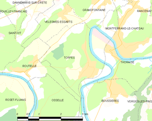
Torpes
- commune in Doubs, France
Torpes is a charming village located in the Doubs department of France, known for its picturesque landscapes and natural beauty. If you're interested in hiking in and around Torpes, here are some key points to consider:...
- Country:

- Postal Code: 25320
- Coordinates: 47° 10' 9" N, 5° 53' 26" E


- GPS tracks (wikiloc): [Link]
- Area: 5.55 sq km
- Population: 1060
- Web site: [Link]


Abbans-Dessous
- commune in Doubs, France
Abbins-Dessous, situated in the Bourgogne-Franche-Comté region of France, offers beautiful landscapes and a variety of hiking opportunities. While it may not be as widely known as some of the major hiking destinations in France, it provides a serene environment for outdoor enthusiasts. Here are some aspects to consider for hiking in this area:...
- Country:

- Postal Code: 25320
- Coordinates: 47° 8' 1" N, 5° 52' 28" E


- GPS tracks (wikiloc): [Link]
- AboveSeaLevel: 260 м m
- Area: 3.2 sq km
- Population: 263


Abbans-Dessus
- commune in Doubs, France
Abbans-Dessus is a picturesque village located in the Doubs department of the Bourgogne-Franche-Comté region in eastern France. It's a great destination for hiking, as it offers beautiful landscapes and various trails for different skill levels. Here are some key points to consider when planning a hiking trip in and around Abbans-Dessus:...
- Country:

- Postal Code: 25440
- Coordinates: 47° 7' 12" N, 5° 52' 55" E


- GPS tracks (wikiloc): [Link]
- Area: 4.43 sq km
- Population: 303


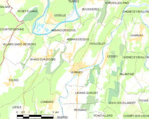
Quingey
- commune in Doubs, France
Quingey, a charming village in the Doubs department of France, is known for its picturesque landscapes and proximity to the Jura Mountains, making it an excellent location for hiking enthusiasts. Here are some key points to consider:...
- Country:

- Postal Code: 25440
- Coordinates: 47° 6' 12" N, 5° 52' 59" E


- GPS tracks (wikiloc): [Link]
- Area: 8.55 sq km
- Population: 1407


Vorges-les-Pins
- commune in Doubs, France
Vorges-les-Pins is a great destination for hiking enthusiasts, offering a variety of trails that cater to different skill levels. While it may not be as well-known as some larger hiking areas in France, its natural beauty and tranquil setting make it a charming spot for outdoor activities....
- Country:

- Postal Code: 25320
- Coordinates: 47° 9' 28" N, 5° 55' 43" E


- GPS tracks (wikiloc): [Link]
- Area: 4.76 sq km
- Population: 596


Thoraise
- commune in Doubs, France
Thoraise is a charming location in France, situated near the city of Besançon in the Bourgogne-Franche-Comté region. While it may not be a widely known hiking destination, the surrounding area offers beautiful landscapes and a variety of trails that cater to hikers of different abilities....
- Country:

- Postal Code: 25320
- Coordinates: 47° 10' 26" N, 5° 54' 11" E


- GPS tracks (wikiloc): [Link]
- Area: 3.99 sq km
- Population: 353

