Rastatt (Landkreis Rastatt)
- administrative district in Baden-Württemberg, Germany
Rastatt district, located in the state of Baden-Württemberg, Germany, offers a variety of hiking opportunities, particularly due to its proximity to the Black Forest and its diverse landscapes. Here are some highlights and tips for hiking in the Rastatt district:
Trails and Areas to Explore
-
Black Forest National Park: Just a short drive away, this national park offers numerous well-marked trails that cater to different skill levels. You can enjoy scenic views, dense forests, and various wildlife.
-
Murgtal Valley: This valley is known for its stunning natural beauty and offers trails along the Murg River. The area is perfect for leisurely hikes, where you can enjoy the lush greenery and charming small towns.
-
Hiking Trails:
- Schwarzwaldhochstraße (Black Forest High Road): This scenic road has many hiking access points and offers trails with breathtaking views of the surrounding forests and valleys.
- Rastatter Altstadt Loop: This urban hike takes you through Rastatt’s historical town, allowing you to combine nature with culture as you explore the town's rich history and architecture.
-
Biodiversity Trails: The Rastatt district has several trails specifically designed to highlight the regional flora and fauna. These trails often include educational signs about the local ecosystem, making it an enriching hiking experience.
Tips for Hiking in Rastatt
-
Seasonal Considerations: Spring and early autumn are ideal times for hiking in this region due to mild temperatures and beautiful scenery. Be cautious of winter weather, especially in higher elevations.
-
Local Amenities: Many trails are located near small villages where you can find cafes and local shops. It’s a good idea to plan some stops along your route.
-
Trail Markings: Most trails in the area are well-marked, but it's still advisable to carry a map or a GPS device, especially if you venture into less-traveled areas.
-
Gear Up: Wear appropriate hiking boots and clothing, as the terrain can vary. Always have enough water and snacks, and consider bringing a small first aid kit.
-
Respect Nature: Follow the Leave No Trace principles. Be mindful of wildlife and stick to marked paths to protect the delicate ecosystems.
Overall, hiking in the Rastatt district offers a great mix of natural beauty, cultural experiences, and outdoor adventures. Whether you’re an experienced hiker or a novice, there’s something for everyone to enjoy in this picturesque part of Germany.
- Country:

- Capital: Rastatt
- Licence Plate Code: RA; BH
- Coordinates: 48° 48' 0" N, 8° 16' 12" E


- GPS tracks (wikiloc): [Link]
- AboveSeaLevel: 236 м m
- Area: 738.75 sq km
- Population: 227474
- Web site: http://www.landkreis-rastatt.de
- Wikipedia en: wiki(en)
- Wikipedia: wiki(de)
- Wikidata storage: Wikidata: Q8182
- Wikipedia Commons Category: [Link]
- Wikipedia Commons Maps Category: [Link]
- Freebase ID: [/m/01hpxx]
- GeoNames ID: Alt: [3220725]
- VIAF ID: Alt: [137211314]
- OSM relation ID: [62388]
- GND ID: Alt: [4048446-4]
- archINFORM location ID: [2573]
- Library of Congress authority ID: Alt: [n81003382]
- TGN ID: [7077340]
- ISNI: Alt: [0000 0004 0399 803X]
- NUTS code: [DE124]
- Ringgold ID: [195961]
- German district key: 08216
Includes regions:
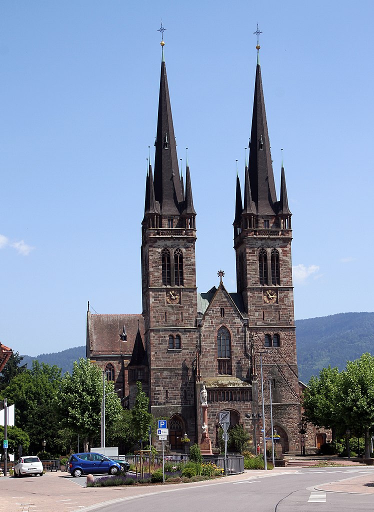
Bühl VVG
- agreed administrative community in the district Landkreis Rastatt, Baden-Württemberg, Germany
Bühl VVG, located in the Baden-Württemberg region of Germany, offers a fantastic environment for hiking enthusiasts. The area is known for its beautiful landscapes that include rolling hills, vineyards, dense forests, and scenic views of the Black Forest and the Rhine Valley....
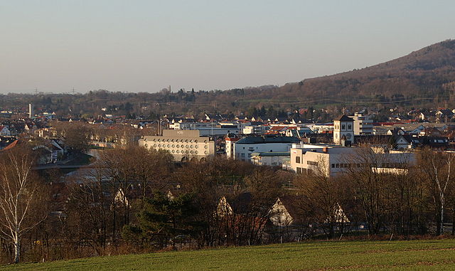

Gaggenau
- municipality in Germany
Gaggenau, located in the Baden-Württemberg region of Germany, is surrounded by natural beauty and offers a variety of hiking options for outdoor enthusiasts. The area is known for its scenic landscapes, including the northern foothills of the Black Forest, picturesque valleys, and lush forests....
- Country:

- Postal Code: 76571
- Local Dialing Code: 07222; 07224; 07225
- Coordinates: 48° 48' 14" N, 8° 19' 10" E


- GPS tracks (wikiloc): [Link]
- AboveSeaLevel: 141 м m
- Area: 65.05 sq km
- Population: 28633
- Web site: [Link]


Kuppenheim
- municipality in Germany
Kuppenheim, located in the state of Baden-Württemberg, Germany, is surrounded by beautiful landscapes that offer a variety of hiking opportunities. Nestled near the Black Forest region, Kuppenheim provides easy access to numerous trails that cater to hikers of all levels....
- Country:

- Postal Code: 76456
- Local Dialing Code: 07222
- Licence Plate Code: RA
- Coordinates: 48° 49' 39" N, 8° 15' 16" E


- GPS tracks (wikiloc): [Link]
- AboveSeaLevel: 127 м m
- Area: 18.08 sq km
- Population: 8276
- Web site: [Link]


Au am Rhein
- municipality in Germany
Au am Rhein is a charming small town located in the state of Baden-Württemberg, Germany, close to the banks of the Rhine River. It's a great location for hiking enthusiasts, especially those looking to explore the beautiful natural scenery of the Rhine valley and surrounding areas....
- Country:

- Postal Code: 76474
- Local Dialing Code: 07245
- Licence Plate Code: RA
- Coordinates: 48° 57' 0" N, 8° 14' 0" E


- GPS tracks (wikiloc): [Link]
- AboveSeaLevel: 107 м m
- Area: 13.29 sq km
- Population: 3226
- Web site: [Link]

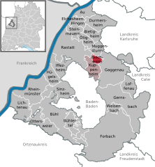
Bischweier
- municipality in Germany
Bischweier is a small town in Germany, located in the state of Baden-Württemberg, near the larger city of Rastatt. Although it may not be as well-known for hiking compared to larger national parks or mountainous regions, there are still some beautiful trails and opportunities for outdoor enthusiasts in and around the area....
- Country:

- Postal Code: 76476
- Local Dialing Code: 07222
- Licence Plate Code: RA
- Coordinates: 48° 50' 16" N, 8° 17' 3" E


- GPS tracks (wikiloc): [Link]
- AboveSeaLevel: 133 м m
- Area: 4.59 sq km
- Population: 3014
- Web site: [Link]


Bühlertal
- municipality in Germany
Bühlertal, a picturesque valley located near the town of Bühl in the Black Forest region of Germany, offers a variety of hiking opportunities for outdoor enthusiasts. Here are some key aspects to consider when hiking in Bühlertal:...
- Country:

- Postal Code: 77830
- Local Dialing Code: 07223
- Licence Plate Code: RA
- Coordinates: 48° 41' 36" N, 8° 10' 43" E


- GPS tracks (wikiloc): [Link]
- AboveSeaLevel: 196 м m
- Area: 17.68 sq km
- Population: 7936
- Web site: [Link]

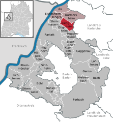
Bietigheim
- municipality in Germany
Bietigheim-Bissingen, located in Baden-Württemberg, Germany, offers a charming environment for hiking enthusiasts. The region is characterized by its picturesque landscapes, including the scenic hills of the Swabian Jura and the beautiful valleys along the Enz River. Here are some highlights and tips for hiking in this area:...
- Country:

- Postal Code: 76467
- Local Dialing Code: 07245
- Licence Plate Code: RA
- Coordinates: 48° 54' 37" N, 8° 15' 11" E


- GPS tracks (wikiloc): [Link]
- AboveSeaLevel: 121 м m
- Area: 13.9 sq km
- Population: 6311
- Web site: [Link]


Lichtenau
- municipality in Germany
Lichtenau, located in the Baden-Württemberg region of Germany, offers a variety of hiking opportunities set against a beautiful natural backdrop. The area is characterized by its picturesque landscapes, dense forests, and rolling hills, which make it an appealing destination for both casual hikers and more experienced outdoor enthusiasts....
- Country:

- Postal Code: 77839
- Local Dialing Code: 07227
- Licence Plate Code: RA
- Coordinates: 48° 43' 34" N, 8° 0' 18" E


- GPS tracks (wikiloc): [Link]
- AboveSeaLevel: 127 м m
- Area: 27.63 sq km
- Population: 4916
- Web site: [Link]


Elchesheim-Illingen
- municipality in Germany
Elchesheim-Illingen is a small municipality located in the state of Baden-Württemberg, Germany. While it might not be as widely known as some larger hiking destinations, it offers charming trails and scenic views, especially for those who enjoy hiking in quieter, less crowded environments....
- Country:

- Postal Code: 76477
- Local Dialing Code: 07245
- Licence Plate Code: RA
- Coordinates: 48° 55' 55" N, 8° 12' 46" E


- GPS tracks (wikiloc): [Link]
- AboveSeaLevel: 110 м m
- Area: 10.14 sq km
- Population: 3211
- Web site: [Link]


Rheinmünster
- municipality in Germany
Rheinmünster, located in the Baden-Württemberg region of Germany, offers picturesque landscapes and a peaceful environment for hiking enthusiasts. The area is known for its lush greenery, rolling hills, and proximity to the Rhine River, making it an ideal destination for nature lovers....
- Country:

- Postal Code: 77836
- Local Dialing Code: 07227
- Licence Plate Code: RA
- Coordinates: 48° 45' 55" N, 8° 2' 58" E


- GPS tracks (wikiloc): [Link]
- AboveSeaLevel: 121 м m
- Area: 42.47 sq km
- Population: 6876
- Web site: [Link]


Forbach
- village and municipality in Baden-Württemberg, Germany
Forbach, located in the Baden-Württemberg region of Germany, is a charming destination for hikers. Nestled in the heart of the Northern Black Forest, it offers a variety of trails suitable for different skill levels and preferences. Here are some highlights regarding hiking in Forbach:...
- Country:

- Postal Code: 76596
- Local Dialing Code: 07228
- Licence Plate Code: RA
- Coordinates: 48° 40' 50" N, 8° 21' 30" E


- GPS tracks (wikiloc): [Link]
- AboveSeaLevel: 332 м m
- Area: 131.82 sq km
- Population: 4783
- Web site: [Link]


Durmersheim
- municipality in Germany
Durmersheim, a small town located in the state of Baden-Württemberg, Germany, offers a variety of hiking opportunities in a picturesque landscape. Nestled near the Rhine River and surrounded by scenic countryside, the region is well-suited for both casual and more adventurous hikers. Here are some highlights and tips for hiking in Durmersheim:...
- Country:

- Postal Code: 76448
- Local Dialing Code: 07245
- Licence Plate Code: RA
- Coordinates: 48° 56' 18" N, 8° 16' 37" E


- GPS tracks (wikiloc): [Link]
- AboveSeaLevel: 119 м m
- Area: 26.15 sq km
- Population: 12255
- Web site: [Link]

Gernsbach VVG
- agreed administrative community in the district Landkreis Rastatt, Baden-Württemberg, Germany
Gernsbach, located in the northern Black Forest region of Baden-Württemberg, Germany, is a beautiful area for hiking enthusiasts. The Gernsbach VVG (Vereinigte Volksbanken Gernsbach) may refer to a local cooperative bank, but if you're looking for hiking trails in and around Gernsbach, the focus would be on the natural landscapes and trails available in that region....

Rastatt VVG
- agreed administrative community in the district Landkreis Rastatt, Baden-Württemberg, Germany
Rastatt, located in the Baden-Württemberg region of Germany, offers a variety of hiking opportunities, especially within the surrounding natural landscapes. The region is characterized by its beautiful woodlands, rolling hills, and proximity to the Black Forest, which is a popular destination for outdoor enthusiasts. Here are some highlights for hiking in the Rastatt area, specifically focusing on the Rastatt-VVG (Verein zur Förderung von Wandern, Wald und Natur):...

Sinzheim VVG
- agreed administrative community in the district Landkreis Rastatt, Baden-Württemberg, Germany
Sinzheim, located in the scenic region of Baden-Württemberg, Germany, offers a variety of hiking opportunities for both beginners and experienced trekkers. The Sinzheim VVG (Volkshochschule Sinzheim-Vereinigung für die Gestaltung) area is characterized by its beautiful landscapes, forests, and rolling hills, providing an excellent setting for outdoor enthusiasts....
Shares border with regions:


Baden-Baden
- town in Baden-Württemberg, Germany
Baden-Baden, located in the Black Forest region of Germany, is a popular hiking destination known for its stunning landscapes, well-marked trails, and temperate climate. Here are some highlights and tips for hiking in and around Baden-Baden:...
- Country:

- Postal Code: 76534; 76533; 76532; 76531; 76530
- Local Dialing Code: 07223; 07221
- Licence Plate Code: BAD
- Coordinates: 48° 45' 43" N, 8° 14' 27" E


- GPS tracks (wikiloc): [Link]
- AboveSeaLevel: 181 м m
- Area: 140.21 sq km
- Population: 54307
- Web site: [Link]


Karlsruhe
- district of Baden-Württemberg, Germany
Karlsruhe, located in the southwest of Germany in the state of Baden-Württemberg, offers a variety of hiking opportunities both in the city and in the surrounding countryside. Here are some key points to consider when hiking in and around Karlsruhe:...
- Country:

- Capital: Karlsruhe
- Licence Plate Code: KA
- Coordinates: 49° 4' 48" N, 8° 34' 48" E


- GPS tracks (wikiloc): [Link]
- AboveSeaLevel: 118 м m
- Area: 1084.95 sq km
- Population: 435841
- Web site: [Link]
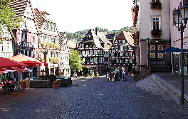

Calw District
- district of Baden-Württemberg, Germany
Calw district, located in the state of Baden-Württemberg, Germany, offers a rich variety of hiking opportunities amidst beautiful natural landscapes. The area is characterized by rolling hills, dense forests, and charming villages, making it a delightful destination for both casual walkers and serious hikers....
- Country:

- Capital: Calw
- Licence Plate Code: CW
- Coordinates: 48° 42' 0" N, 8° 44' 24" E


- GPS tracks (wikiloc): [Link]
- AboveSeaLevel: 648 м m
- Area: 797.54 sq km
- Population: 150709
- Web site: [Link]

