Karlsruhe (Landkreis Karlsruhe)
- district of Baden-Württemberg, Germany
Karlsruhe, located in the southwest of Germany in the state of Baden-Württemberg, offers a variety of hiking opportunities both in the city and in the surrounding countryside. Here are some key points to consider when hiking in and around Karlsruhe:
1. Urban Trails:
- Günther-Klotz-Anlage: This large park in the city provides peaceful walking paths, scenic views, and well-maintained trails. It's a great place for a quick hike without leaving the city.
- Botanical Garden: The Karlsruhe Botanical Garden features numerous pathways winding through diverse plant species, making for a pleasant stroll while learning about flora.
2. Hiking in Nature Parks:
- Palatinate Forest: Just a short drive from Karlsruhe, this vast nature reserve offers extensive hiking trails, stunning landscapes, and opportunities to explore the natural beauty of the region. The trails vary in difficulty and can accommodate both novice and experienced hikers.
- Northern Black Forest: A bit further afield, the Northern Black Forest features more challenging hikes with breathtaking views, dense forests, and traditional German villages.
3. Scenic Routes:
- Zoo and Castle Walk: A leisurely hike can be enjoyed starting from the Karlsruhe Palace, moving through the nearby zoo and botanical gardens.
- Kaiserstraße: The main street in Karlsruhe is lined with shops, cafes, and historical sites, and can be part of a walking tour that combines culture and hiking.
4. Regional Hiking Trails:
- Hiking in the Rhine Valley: The nearby Rhine River offers flat routes ideal for longer hikes or cycling along the riverside paths, often accompanied by scenic vineyards.
- German Wine Route: This famous trail runs through the wine regions of Palatinate and allows hikers to explore vineyards, sample local wines, and enjoy panoramic views.
5. Preparation and Tips:
- Equipment: Ensure you have suitable hiking footwear, a map or GPS device, and enough water and snacks for your trek.
- Weather: Check local weather conditions before heading out, as the region can experience swift weather changes.
- Local Guides: Consider joining local hiking clubs or guided tours if you are unfamiliar with the area to gain insights and enhance your experience.
6. Public Transportation:
- The city's public transportation system makes it relatively easy to reach trailheads or parks without needing a car. Buses and trams frequently run to popular outdoor areas.
Conclusion:
Karlsruhe and its surrounding region offer diverse hiking experiences, catering to different preferences and skill levels. Whether you're interested in urban trails, nature walks, or more challenging hikes through the Black Forest or Palatinate area, there's something for everyone in this beautiful part of Germany.
- Country:

- Capital: Karlsruhe
- Licence Plate Code: KA
- Coordinates: 49° 4' 48" N, 8° 34' 48" E


- GPS tracks (wikiloc): [Link]
- AboveSeaLevel: 118 м m
- Area: 1084.95 sq km
- Population: 435841
- Web site: http://www.landkreis-karlsruhe.de
- Wikipedia en: wiki(en)
- Wikipedia: wiki(de)
- Wikidata storage: Wikidata: Q8178
- Wikipedia Commons Category: [Link]
- Freebase ID: [/m/01hfp0]
- GeoNames ID: Alt: [2892791]
- VIAF ID: Alt: [133702543]
- OSM relation ID: [62393]
- GND ID: Alt: [4029714-7]
- archINFORM location ID: [2469]
- Library of Congress authority ID: Alt: [n81095816]
- TGN ID: [7153195]
- ISNI: Alt: [0000 0004 0621 9839]
- NUTS code: [DE123]
- Ringgold ID: [89526]
- German district key: 08215
Includes regions:

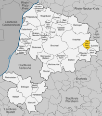
Zaisenhausen
- municipality in Germany
Zaisenhausen, a small village in Germany’s Baden-Württemberg region, is not particularly known as a major hiking destination. However, it offers access to scenic countryside and trails that can provide a pleasant hiking experience for those looking to explore rural Germany....
- Country:

- Postal Code: 75059
- Local Dialing Code: 07258
- Licence Plate Code: KA
- Coordinates: 49° 6' 25" N, 8° 48' 57" E


- GPS tracks (wikiloc): [Link]
- AboveSeaLevel: 175 м m
- Area: 10.11 sq km
- Population: 1734
- Web site: [Link]


Ettlingen
- town in Baden-Württemberg, Germany
Ettlingen, located in Germany’s Baden-Württemberg region, is a fantastic destination for hiking enthusiasts. Nestled at the foothills of the Black Forest, it offers a variety of trails that highlight the natural beauty of the area, historical sites, and charming scenery....
- Country:

- Postal Code: 76275
- Local Dialing Code: 07243
- Licence Plate Code: KA
- Coordinates: 48° 56' 0" N, 8° 24' 0" E


- GPS tracks (wikiloc): [Link]
- AboveSeaLevel: 132 м m
- Area: 56.74 sq km
- Population: 38861
- Web site: [Link]

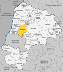
Stutensee
- town in Germany
Stutensee, located in the state of Baden-Württemberg in Germany, is a charming area that offers a variety of hiking opportunities for outdoor enthusiasts. While the town itself is primarily residential, it is surrounded by beautiful landscapes that provide excellent trails for hiking....
- Country:

- Postal Code: 76297
- Local Dialing Code: 07249; 07244; 0721
- Licence Plate Code: KA
- Coordinates: 49° 3' 53" N, 8° 28' 18" E


- GPS tracks (wikiloc): [Link]
- AboveSeaLevel: 114 м m
- Area: 45.68 sq km
- Population: 23829
- Web site: [Link]

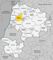
Graben-Neudorf
- municipality in Germany
Graben-Neudorf, located in the state of Baden-Württemberg, Germany, offers a unique blend of scenic views and accessible hiking routes. While it may not be as renowned as some larger national parks, there are still opportunities for hiking and exploring the natural beauty of the area....
- Country:

- Postal Code: 76676
- Local Dialing Code: 07255
- Licence Plate Code: KA
- Coordinates: 49° 9' 33" N, 8° 29' 22" E


- GPS tracks (wikiloc): [Link]
- AboveSeaLevel: 107 м m
- Area: 28.8 sq km
- Population: 11571
- Web site: [Link]
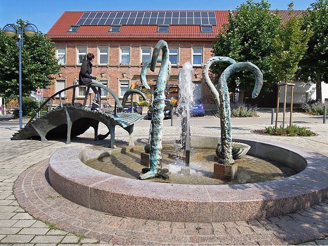

Bad Schönborn
- municipality in Germany
Bad Schönborn, located in the Baden-Württemberg region of Germany, offers a picturesque setting for hiking enthusiasts with its beautiful landscapes and well-marked trails. Here are some highlights and tips for hiking in the area:...
- Country:

- Postal Code: 76669
- Local Dialing Code: 07253
- Licence Plate Code: KA
- Coordinates: 49° 12' 8" N, 8° 38' 51" E


- GPS tracks (wikiloc): [Link]
- AboveSeaLevel: 131 м m
- Area: 24.11 sq km
- Population: 12896
- Web site: [Link]


Östringen
- municipality in Germany
Östringen is a small town in Baden-Württemberg, Germany, surrounded by beautiful landscapes that offer several opportunities for hiking and outdoor activities. The region features a mix of forests, hills, and meadows, creating a diverse environment for hikers of all skill levels....
- Country:

- Postal Code: 76677–76684
- Local Dialing Code: 07259; 07253
- Licence Plate Code: KA
- Coordinates: 49° 13' 10" N, 8° 42' 39" E


- GPS tracks (wikiloc): [Link]
- AboveSeaLevel: 163 м m
- Area: 53.23 sq km
- Population: 12627
- Web site: [Link]
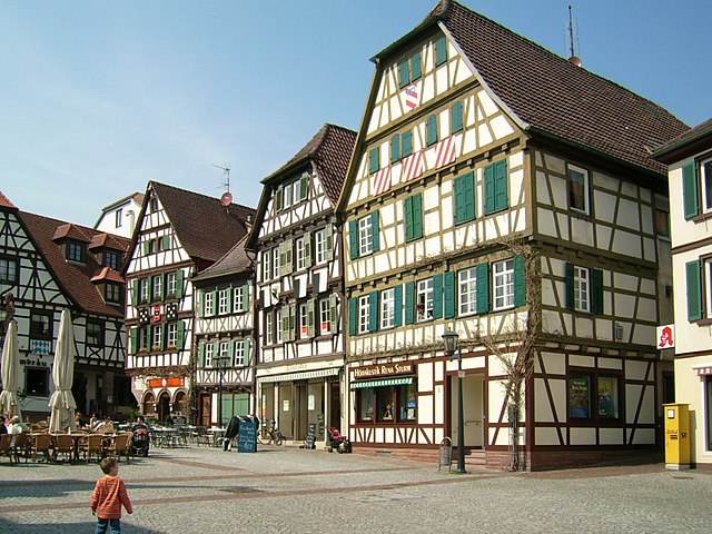

Bretten
- town in Baden-Württemberg federal country, Germany
Bretten, located in the Baden-Württemberg region of Germany, offers beautiful landscapes and a variety of hiking opportunities, particularly in the surrounding areas. While Bretten itself is a charming town with historical sites and local culture, the nearby landscapes provide a great backdrop for outdoor activities....
- Country:

- Postal Code: 75015
- Local Dialing Code: 07258; 07252
- Licence Plate Code: KA
- Coordinates: 49° 2' 11" N, 8° 42' 22" E


- GPS tracks (wikiloc): [Link]
- AboveSeaLevel: 188 м m
- Area: 71.12 sq km
- Population: 29336
- Web site: [Link]


Waghäusel
- municipality in Germany
Waghäusel is a charming town located in the state of Baden-Württemberg, Germany, situated near the Rhine River. While it's not as well-known for hiking as some other regions, there are still opportunities to explore nature and enjoy outdoor activities in and around Waghäusel....
- Country:

- Postal Code: 68753
- Local Dialing Code: 07254
- Licence Plate Code: KA
- Coordinates: 49° 15' 0" N, 8° 31' 1" E


- GPS tracks (wikiloc): [Link]
- AboveSeaLevel: 104 м m
- Area: 42.84 sq km
- Population: 20378
- Web site: [Link]


Pfinztal
- municipality in Germany
Pfinztal, located in the state of Baden-Württemberg, Germany, is an excellent destination for hiking enthusiasts. The area features a variety of picturesque trails that traverse beautiful landscapes, including forests, meadows, and along the Pfinz River. Here are some key highlights about hiking in Pfinztal:...
- Country:

- Postal Code: 76327
- Local Dialing Code: 07240; 0721
- Licence Plate Code: KA
- Coordinates: 48° 59' 16" N, 8° 32' 36" E


- GPS tracks (wikiloc): [Link]
- AboveSeaLevel: 151 м m
- Area: 31.05 sq km
- Population: 17601
- Web site: [Link]


Ubstadt-Weiher
- municipality in Germany
Ubstadt-Weiher is a charming municipality located in Baden-Württemberg, Germany, known for its scenic landscapes and outdoor recreation opportunities. While it may not be as famous as some larger hiking destinations, it offers lovely trails that cater to various hiking abilities....
- Country:

- Postal Code: 76698
- Local Dialing Code: 07253; 07251
- Licence Plate Code: KA
- Coordinates: 49° 9' 56" N, 8° 37' 30" E


- GPS tracks (wikiloc): [Link]
- AboveSeaLevel: 131 м m
- Area: 36.5 sq km
- Population: 12966
- Web site: [Link]

Hambrücken
- municipality in Germany
Hambrücken is a small municipality in the state of Baden-Württemberg, Germany. While it may not be as well-known as some larger hiking destinations, it does offer charming opportunities for outdoor exploration. Here are some key points to consider when hiking around Hambrücken:...
- Country:

- Postal Code: 76707
- Local Dialing Code: 07255
- Licence Plate Code: KA
- Coordinates: 49° 11' 24" N, 8° 32' 26" E


- GPS tracks (wikiloc): [Link]
- AboveSeaLevel: 107 м m
- Area: 10.98 sq km
- Population: 5475
- Web site: [Link]


Eggenstein-Leopoldshafen
- municipality in Germany
 Hiking in Eggenstein-Leopoldshafen
Eggenstein-Leopoldshafen is a small town located in the southwestern part of Germany, near the banks of the Rhine River and close to the city of Karlsruhe. While it is not as renowned for hiking as some of the larger national parks or mountainous regions, there are still several options and nearby attractions that can provide a fulfilling hiking experience....
- Country:

- Postal Code: 76344
- Local Dialing Code: 07247; 0721
- Licence Plate Code: KA
- Coordinates: 49° 4' 40" N, 8° 23' 33" E


- GPS tracks (wikiloc): [Link]
- AboveSeaLevel: 100 м m
- Area: 26.09 sq km
- Population: 15930
- Web site: [Link]


Rheinstetten
- municipality in Germany
Rheinstetten, located in the state of Baden-Württemberg, Germany, is a picturesque town near the city of Karlsruhe. It's surrounded by beautiful landscapes and offers a variety of hiking opportunities. Here’s what you can expect when hiking in and around Rheinstetten:...
- Country:

- Postal Code: 76276–76287
- Local Dialing Code: 07242; 0721
- Licence Plate Code: KA
- Coordinates: 48° 57' 38" N, 8° 17' 23" E


- GPS tracks (wikiloc): [Link]
- AboveSeaLevel: 114 м m
- Area: 32.29 sq km
- Population: 20279
- Web site: [Link]


Walzbachtal
- municipality in Germany
Walzbachtal, located in the state of Baden-Württemberg, Germany, is a hidden gem for hiking enthusiasts. The region offers a variety of trails that cater to different skill levels and preferences, making it a great destination for both casual walkers and experienced hikers....
- Country:

- Postal Code: 75045
- Local Dialing Code: 07203
- Licence Plate Code: KA
- Coordinates: 49° 0' 42" N, 8° 36' 27" E


- GPS tracks (wikiloc): [Link]
- AboveSeaLevel: 193 м m
- Area: 36.69 sq km
- Population: 9483
- Web site: [Link]

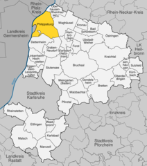
Philippsburg
- town in Germany, in the district of Karlsruhe in Baden-Württemberg
Philippsburg, located in the Baden-Württemberg region of Germany, offers several outdoor activities, including hiking. The area is characterized by its scenic landscapes, charming towns, and proximity to the Rhine River, making it an appealing destination for hikers of various skill levels. Here are some things to consider when hiking in and around Philippsburg:...
- Country:

- Postal Code: 76661
- Local Dialing Code: 07256
- Licence Plate Code: KA
- Coordinates: 49° 14' 13" N, 8° 27' 17" E


- GPS tracks (wikiloc): [Link]
- AboveSeaLevel: 99 м m
- Area: 50.56 sq km
- Population: 12664
- Web site: [Link]


Kronau
- municipality in Germany
Kronau, located in Baden-Württemberg, Germany, offers a variety of hiking opportunities for outdoor enthusiasts. The region is characterized by its beautiful natural landscapes, with forests, fields, and picturesque surroundings....
- Country:

- Postal Code: 76709
- Local Dialing Code: 07253
- Licence Plate Code: KA
- Coordinates: 49° 13' 12" N, 8° 38' 2" E


- GPS tracks (wikiloc): [Link]
- AboveSeaLevel: 110 м m
- Area: 10.9 sq km
- Population: 5535
- Web site: [Link]

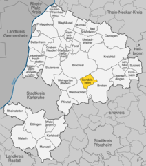
Gondelsheim
- municipality in Germany
Gondelsheim, a small town in Baden-Württemberg, Germany, offers several opportunities for hiking enthusiasts. While it may not be as widely known as some larger hiking destinations, its surrounding areas feature beautiful landscapes and scenic trails that can be quite appealing. Here are a few highlights and tips for hiking in and around Gondelsheim:...
- Country:

- Postal Code: 75053
- Local Dialing Code: 07252
- Licence Plate Code: KA
- Coordinates: 49° 3' 38" N, 8° 39' 26" E


- GPS tracks (wikiloc): [Link]
- AboveSeaLevel: 180 м m
- Area: 14.86 sq km
- Population: 3810
- Web site: [Link]


Kürnbach
- municipality in Germany
Kürnbach is a small municipality located in the Baden-Württemberg region of Germany. While it might not be as well-known as larger hiking destinations, it offers opportunities for scenic walks and enjoying the natural beauty of the area. Here are some tips and insights for hiking in and around Kürnbach:...
- Country:

- Postal Code: 75057
- Local Dialing Code: 07258
- Licence Plate Code: KA
- Coordinates: 49° 4' 39" N, 8° 50' 44" E


- GPS tracks (wikiloc): [Link]
- AboveSeaLevel: 213 м m
- Area: 12.67 sq km
- Population: 2287
- Web site: [Link]


Karlsdorf-Neuthard
- municipality in Germany
Karlsdorf-Neuthard is a charming municipality located in the state of Baden-Württemberg, Germany. While it's not as globally recognized for hiking as some larger areas, it offers several opportunities for outdoor enthusiasts to enjoy nature and the beautiful landscapes of the region....
- Country:

- Postal Code: 76689
- Local Dialing Code: 07251
- Licence Plate Code: KA
- Coordinates: 49° 8' 11" N, 8° 32' 38" E


- GPS tracks (wikiloc): [Link]
- AboveSeaLevel: 109 м m
- Area: 14.01 sq km
- Population: 10042
- Web site: [Link]


Marxzell
- municipality in Germany
Marxzell, located in the northwest of Baden-Württemberg, Germany, is a beautiful destination for hiking enthusiasts. This picturesque area is characterized by its charming rural landscape, rolling hills, dense forests, and scenic views of the surrounding mountains. Here are some highlights and tips for hiking in Marxzell:...
- Country:

- Postal Code: 76359
- Local Dialing Code: 07248
- Licence Plate Code: KA
- Coordinates: 48° 51' 38" N, 8° 27' 34" E


- GPS tracks (wikiloc): [Link]
- AboveSeaLevel: 364 м m
- Area: 34.92 sq km
- Population: 5085
- Web site: [Link]
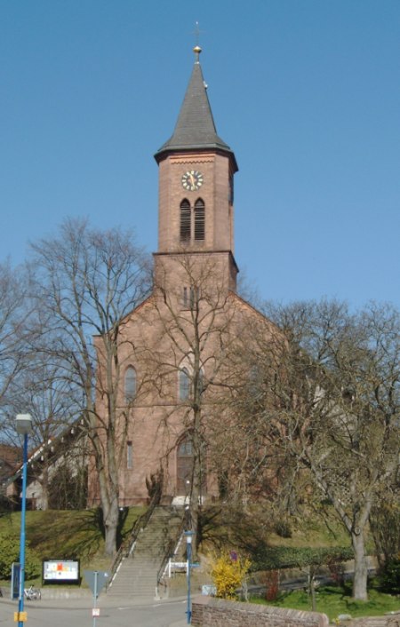

Waldbronn
- municipality in Germany
Waldbronn is a beautiful area in Germany, situated in the North of the black forest region, not far from Karlsruhe. It offers a variety of hiking opportunities that cater to all skill levels, from casual walks to more challenging trails. Here are some aspects of hiking in Waldbronn:...
- Country:

- Postal Code: 76337
- Local Dialing Code: 07243
- Licence Plate Code: KA
- Coordinates: 48° 55' 28" N, 8° 28' 33" E


- GPS tracks (wikiloc): [Link]
- AboveSeaLevel: 267 м m
- Area: 11.35 sq km
- Population: 12251
- Web site: [Link]

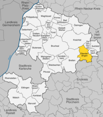
Oberderdingen
- municipality in Germany
Oberderdingen is a charming town located in the state of Baden-Württemberg, Germany. It is situated in the Kraichgau region, which is known for its picturesque landscapes, vineyards, and rolling hills. Hiking in and around Oberderdingen offers a variety of trails suitable for different skill levels, making it a great destination for outdoor enthusiasts....
- Country:

- Postal Code: 75032–75038
- Local Dialing Code: 07258; 07045
- Coordinates: 49° 3' 45" N, 8° 48' 7" E


- GPS tracks (wikiloc): [Link]
- AboveSeaLevel: 190 м m
- Area: 33.57 sq km
- Population: 10426
- Web site: [Link]


Sulzfeld
- Municipality in BadenWürttemberg, Germany
Sulzfeld, located in Baden-Württemberg, is a charming town that offers various hiking opportunities. Nestled in the picturesque landscape of the Kraichgau region, it features a combination of rolling hills, vineyards, and scenic views. Here are some highlights and tips for hiking in and around Sulzfeld:...
- Country:

- Postal Code: 75056
- Local Dialing Code: 07269
- Licence Plate Code: KA
- Coordinates: 49° 6' 12" N, 8° 51' 18" E


- GPS tracks (wikiloc): [Link]
- AboveSeaLevel: 204 м m
- Area: 18.76 sq km
- Population: 4669
- Web site: [Link]


Linkenheim-Hochstetten
- municipality in Baden-Württemberg, Germany
 Hiking in Linkenheim-Hochstetten
Linkenheim-Hochstetten is a charming area located in the state of Baden-Württemberg, Germany, near the banks of the Rhine River. While it may not be as well-known as some larger hiking destinations, it offers a range of scenic trails and beautiful landscapes suitable for hiking enthusiasts. Here are a few points to consider when hiking in Linkenheim-Hochstetten:...
- Country:

- Postal Code: 76351
- Local Dialing Code: 07247
- Licence Plate Code: KA
- Coordinates: 49° 7' 34" N, 8° 24' 36" E


- GPS tracks (wikiloc): [Link]
- AboveSeaLevel: 110 м m
- Area: 23.6 sq km
- Population: 11693
- Web site: [Link]


Kraichtal
- municipality in Germany
Kraichtal, located in Baden-Württemberg, Germany, is a picturesque region well-suited for hiking enthusiasts. The area is characterized by its beautiful landscapes, rolling hills, and lush greenery, making it an attractive destination for both casual walkers and more experienced hikers....
- Country:

- Postal Code: 76703
- Local Dialing Code: 07259; 07258; 07251; 07250
- Licence Plate Code: KA
- Coordinates: 49° 7' 27" N, 8° 42' 53" E


- GPS tracks (wikiloc): [Link]
- AboveSeaLevel: 177 м m
- Area: 80.56 sq km
- Population: 14576
- Web site: [Link]
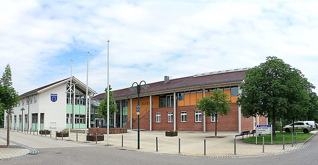

Dettenheim
- municipality in Germany
Dettenheim, a small village in the northern part of Germany, offers a quaint backdrop for hiking enthusiasts. Although it might not be a famous hiking destination, its surrounding areas and the scenic landscape of the region provide some lovely opportunities for outdoor activities....
- Country:

- Postal Code: 76706
- Local Dialing Code: 07255; 07247
- Licence Plate Code: KA
- Coordinates: 49° 9' 41" N, 8° 25' 3" E


- GPS tracks (wikiloc): [Link]
- AboveSeaLevel: 98 м m
- Area: 30.89 sq km
- Population: 6473
- Web site: [Link]

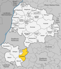
Karlsbad (Baden)
- municipality in Germany
Karlsbad (or Karlovy Vary) in the Czech Republic is a beautiful region for hiking, surrounded by the picturesque landscapes of the Ore Mountains and the Bohemian Highlands. The area is known for its thermal springs, lush forests, and cultural heritage, making it a great destination for outdoor enthusiasts....
- Country:

- Postal Code: 76307
- Local Dialing Code: 07248; 07202
- Licence Plate Code: KA
- Coordinates: 48° 54' 52" N, 8° 30' 23" E


- GPS tracks (wikiloc): [Link]
- AboveSeaLevel: 264 м m
- Area: 38.02 sq km
- Population: 15734
- Web site: [Link]


Malsch
- municipality in the district of Karlsruhe, Baden-Württemberg, Germany
Malsch, located in the Baden-Württemberg region of Germany, is an excellent destination for hiking enthusiasts. The area is characterized by its picturesque landscapes, rolling hills, and dense forests, providing a variety of trails suitable for different skill levels. Here are some key points to consider when hiking in Malsch:...
- Country:

- Postal Code: 76316
- Local Dialing Code: 07246
- Licence Plate Code: KA
- Coordinates: 48° 52' 51" N, 8° 20' 3" E


- GPS tracks (wikiloc): [Link]
- AboveSeaLevel: 145 м m
- Area: 51.24 sq km
- Population: 14023
- Web site: [Link]
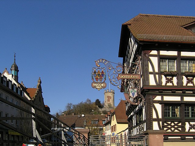

Weingarten
- municipality in Landkreis Karlsruhe, Baden-Württemberg, Germany
Weingarten, located in the Baden-Württemberg region of Germany, is a charming town that offers access to beautiful natural landscapes suitable for hiking. The area around Weingarten features a blend of flat fields, rolling hills, and scenic woodlands, making it an ideal destination for both novice and experienced hikers....
- Country:

- Postal Code: 76356
- Local Dialing Code: 07244
- Licence Plate Code: KA
- Coordinates: 49° 3' 5" N, 8° 31' 50" E


- GPS tracks (wikiloc): [Link]
- AboveSeaLevel: 144 м m
- Area: 29.40 sq km
- Population: 10472
- Web site: [Link]


Forst
- municipality in Baden-Württemberg, Germany
Forst (Baden) is a picturesque town located in the state of Baden-Württemberg, Germany, known for its beautiful landscapes and outdoor recreational opportunities. Hiking in and around Forst offers a variety of trails that cater to different skill levels and preferences. Here are some highlights and tips for hiking in this region:...
- Country:

- Postal Code: 76694
- Local Dialing Code: 07251
- Licence Plate Code: KA
- Coordinates: 49° 9' 12" N, 8° 35' 3" E


- GPS tracks (wikiloc): [Link]
- AboveSeaLevel: 112 м m
- Area: 11.46 sq km
- Population: 7937
- Web site: [Link]


Oberhausen-Rheinhausen
- municipality in Germany
 Hiking in Oberhausen-Rheinhausen
Oberhausen-Rheinhausen is a charming town located in the state of Baden-Württemberg, Germany. While it may not be as widely known as some major hiking destinations, it offers access to scenic trails and beautiful natural landscapes suitable for hiking....
- Country:

- Postal Code: 68794
- Local Dialing Code: 07254
- Licence Plate Code: KA
- Coordinates: 49° 15' 38" N, 8° 29' 6" E


- GPS tracks (wikiloc): [Link]
- AboveSeaLevel: 99 м m
- Area: 18.95 sq km
- Population: 9463
- Web site: [Link]


Bruchsal
- town in Baden-Württemberg, Germany
Bruchsal, located in the state of Baden-Württemberg, Germany, may not be the first place that comes to mind for hiking, but it offers some charming options for outdoor enthusiasts. Here’s what you need to know if you're considering hiking in and around Bruchsal:...
- Country:

- Postal Code: 76646
- Local Dialing Code: 07257; 07251
- Licence Plate Code: KA
- Coordinates: 49° 8' 0" N, 8° 36' 0" E


- GPS tracks (wikiloc): [Link]
- AboveSeaLevel: 135 м m
- Area: 93.03 sq km
- Population: 44104
- Web site: [Link]
Shares border with regions:


Karlsruhe
- German city in the state of Baden-Württemberg
Karlsruhe, located in the southwestern part of Germany, is not only an urban center but also a great starting point for various hiking adventures. While the city itself has several parks and walking paths, the surrounding regions offer beautiful trails for all levels of hikers. Here are some key areas and trails to consider:...
- Country:

- Postal Code: 76228; 76227; 76189; 76187; 76185; 76199; 76149; 76139; 76135; 76133; 76137; 76131; 76229
- Local Dialing Code: 721
- Licence Plate Code: KA
- Coordinates: 49° 1' 0" N, 8° 24' 0" E


- GPS tracks (wikiloc): [Link]
- AboveSeaLevel: 118 м m
- Area: 173.42 sq km
- Population: 309999
- Web site: [Link]


Rastatt
- administrative district in Baden-Württemberg, Germany
Rastatt district, located in the state of Baden-Württemberg, Germany, offers a variety of hiking opportunities, particularly due to its proximity to the Black Forest and its diverse landscapes. Here are some highlights and tips for hiking in the Rastatt district:...
- Country:

- Capital: Rastatt
- Licence Plate Code: RA; BH
- Coordinates: 48° 48' 0" N, 8° 16' 12" E


- GPS tracks (wikiloc): [Link]
- AboveSeaLevel: 236 м m
- Area: 738.75 sq km
- Population: 227474
- Web site: [Link]
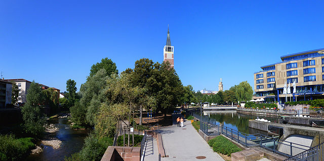

Enz
- district of Baden-Württemberg, Germany
Enzkreis, located in Baden-Württemberg, Germany, is a wonderful area for hiking enthusiasts, offering a mix of picturesque landscapes, historic towns, and diverse trail options. Here’s an overview of some aspects to consider when hiking in this region:...
- Country:

- Capital: Pforzheim
- Licence Plate Code: PF
- Coordinates: 48° 54' 0" N, 8° 45' 0" E


- GPS tracks (wikiloc): [Link]
- AboveSeaLevel: 298 м m
- Area: 573.69 sq km
- Web site: [Link]
