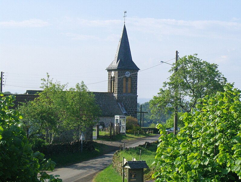
Raulhac (Raulhac)

- commune in Cantal, France
- Country:

- Postal Code: 15800
- Coordinates: 44° 53' 58" N, 2° 39' 22" E


- GPS tracks (wikiloc): [Link]
- Area: 16.98 sq km
- Population: 282
- Wikipedia en: wiki(en)
- Wikipedia: wiki(fr)
- Wikidata storage: Wikidata: Q242386
- Wikipedia Commons Category: [Link]
- Freebase ID: [/m/03mb9kr]
- GeoNames ID: Alt: [2984359]
- SIREN number: [211501598]
- BnF ID: [15248329h]
- VIAF ID: Alt: [241190950]
- PACTOLS thesaurus ID: [pcrt14TLf4d92N]
- INSEE municipality code: 15159
Shares border with regions:


Taussac
- commune in Aveyron, France
- Country:
- Postal Code: 12600
- Coordinates: 44° 49' 44" N, 2° 38' 31" E
- GPS tracks (wikiloc): [Link]
- Area: 39.3 sq km
- Population: 488
- Web site: [Link]


Jou-sous-Monjou
- commune in Cantal, France
- Country:
- Postal Code: 15800
- Coordinates: 44° 56' 16" N, 2° 39' 53" E
- GPS tracks (wikiloc): [Link]
- Area: 6.16 sq km
- Population: 110
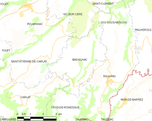
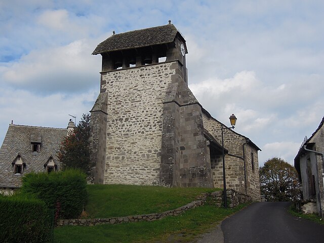
Badailhac
- commune in Cantal, France
- Country:
- Postal Code: 15800
- Coordinates: 44° 55' 9" N, 2° 37' 29" E
- GPS tracks (wikiloc): [Link]
- Area: 12.48 sq km
- Population: 132


Mur-de-Barrez
- commune in Aveyron, France
- Country:
- Postal Code: 12600
- Coordinates: 44° 50' 32" N, 2° 39' 42" E
- GPS tracks (wikiloc): [Link]
- AboveSeaLevel: 803 м m
- Area: 20.18 sq km
- Population: 785
- Web site: [Link]

Cros-de-Ronesque
- commune in Cantal, France
- Country:
- Postal Code: 15130
- Coordinates: 44° 52' 20" N, 2° 36' 38" E
- GPS tracks (wikiloc): [Link]
- Area: 16.23 sq km
- Population: 141


Pailherols
- commune in Cantal, France
- Country:
- Postal Code: 15800
- Coordinates: 44° 57' 3" N, 2° 41' 3" E
- GPS tracks (wikiloc): [Link]
- Area: 25.98 sq km
- Population: 133