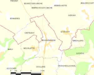
Rebreuve-sur-Canche (Rebreuve-sur-Canche)
- commune in Pas-de-Calais, France
- Country:

- Postal Code: 62270
- Coordinates: 50° 15' 53" N, 2° 20' 27" E


- GPS tracks (wikiloc): [Link]
- Area: 8.28 sq km
- Population: 203
- Wikipedia en: wiki(en)
- Wikipedia: wiki(fr)
- Wikidata storage: Wikidata: Q993034
- Wikipedia Commons Category: [Link]
- Freebase ID: [/m/02z89df]
- GeoNames ID: Alt: [2984264]
- SIREN number: [216206946]
- BnF ID: [15269135j]
- VIAF ID: Alt: [154888255]
- Library of Congress authority ID: Alt: [n88672100]
- INSEE municipality code: 62694
Shares border with regions:


Séricourt
- commune in Pas-de-Calais, France
- Country:

- Postal Code: 62270
- Coordinates: 50° 17' 42" N, 2° 18' 54" E


- GPS tracks (wikiloc): [Link]
- Area: 2.45 sq km
- Population: 55


Rebreuviette
- commune in Pas-de-Calais, France
- Country:

- Postal Code: 62270
- Coordinates: 50° 15' 44" N, 2° 21' 39" E


- GPS tracks (wikiloc): [Link]
- Area: 8.42 sq km
- Population: 274


Ivergny
- commune in Pas-de-Calais, France
- Country:

- Postal Code: 62810
- Coordinates: 50° 14' 20" N, 2° 23' 33" E


- GPS tracks (wikiloc): [Link]
- Area: 7.34 sq km
- Population: 261


Houvin-Houvigneul
- commune in Pas-de-Calais, France
- Country:

- Postal Code: 62270
- Coordinates: 50° 17' 53" N, 2° 23' 4" E


- GPS tracks (wikiloc): [Link]
- Area: 8.66 sq km
- Population: 225


Bouquemaison
- commune in Somme, France
- Country:

- Postal Code: 80600
- Coordinates: 50° 12' 41" N, 2° 20' 14" E


- GPS tracks (wikiloc): [Link]
- Area: 7.15 sq km
- Population: 520


Sibiville
- commune in Pas-de-Calais, France
- Country:

- Postal Code: 62270
- Coordinates: 50° 17' 55" N, 2° 19' 25" E


- GPS tracks (wikiloc): [Link]
- Area: 7.35 sq km
- Population: 111


Le Souich
- commune in Pas-de-Calais, France
- Country:

- Postal Code: 62810
- Coordinates: 50° 13' 22" N, 2° 22' 1" E


- GPS tracks (wikiloc): [Link]
- Area: 5.11 sq km
- Population: 156


Canettemont
- commune in Pas-de-Calais, France
- Country:

- Postal Code: 62270
- Coordinates: 50° 16' 41" N, 2° 21' 56" E


- GPS tracks (wikiloc): [Link]
- Area: 1.79 sq km
- Population: 69


Bonnières
- commune in Pas-de-Calais, France
- Country:

- Postal Code: 62270
- Coordinates: 50° 14' 39" N, 2° 15' 37" E


- GPS tracks (wikiloc): [Link]
- Area: 27.16 sq km
- Population: 656


Bouret-sur-Canche
- commune in Pas-de-Calais, France
- Country:

- Postal Code: 62270
- Coordinates: 50° 16' 8" N, 2° 19' 27" E


- GPS tracks (wikiloc): [Link]
- Area: 4.87 sq km
- Population: 259
