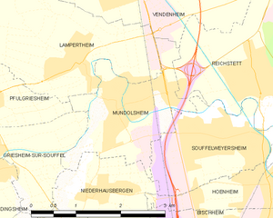
Reichstett (Reichstett)
- commune in Bas-Rhin, France
- Country:

- Postal Code: 67116
- Coordinates: 48° 38' 45" N, 7° 45' 8" E


- GPS tracks (wikiloc): [Link]
- AboveSeaLevel: 140 м m
- Area: 7.61 sq km
- Population: 4442
- Web site: http://www.reichstett.fr
- Wikipedia en: wiki(en)
- Wikipedia: wiki(fr)
- Wikidata storage: Wikidata: Q21346
- Wikipedia Commons Category: [Link]
- Freebase ID: [/m/03m4d01]
- Freebase ID: [/m/03m4d01]
- GeoNames ID: Alt: [2984135]
- GeoNames ID: Alt: [2984135]
- SIREN number: [216703892]
- SIREN number: [216703892]
- BnF ID: [15271531j]
- BnF ID: [15271531j]
- VIAF ID: Alt: [136099502]
- VIAF ID: Alt: [136099502]
- Library of Congress authority ID: Alt: [n85003453]
- Library of Congress authority ID: Alt: [n85003453]
- PACTOLS thesaurus ID: [pcrt8aT80iMO6W]
- PACTOLS thesaurus ID: [pcrt8aT80iMO6W]
- WOEID: [619048]
- WOEID: [619048]
- INSEE municipality code: 67389
- INSEE municipality code: 67389
Shares border with regions:


Bischheim
- commune in Bas-Rhin, France
- Country:

- Postal Code: 67800
- Coordinates: 48° 36' 50" N, 7° 45' 7" E


- GPS tracks (wikiloc): [Link]
- Area: 4.41 sq km
- Population: 17188
- Web site: [Link]


Vendenheim
- commune in Bas-Rhin, France
- Country:

- Postal Code: 67550
- Coordinates: 48° 40' 3" N, 7° 42' 47" E


- GPS tracks (wikiloc): [Link]
- Area: 15.89 sq km
- Population: 5512
- Web site: [Link]


La Wantzenau
- commune in Bas-Rhin, France
- Country:

- Postal Code: 67610
- Coordinates: 48° 39' 29" N, 7° 49' 42" E


- GPS tracks (wikiloc): [Link]
- Area: 25.39 sq km
- Population: 5768
- Web site: [Link]


Hoenheim
- commune in Bas-Rhin, France
- Country:

- Postal Code: 67800
- Coordinates: 48° 37' 27" N, 7° 45' 17" E


- GPS tracks (wikiloc): [Link]
- Area: 3.42 sq km
- Population: 11230
- Web site: [Link]


Souffelweyersheim
- commune in Bas-Rhin, France
- Country:

- Postal Code: 67460
- Coordinates: 48° 38' 6" N, 7° 44' 27" E


- GPS tracks (wikiloc): [Link]
- Area: 4.51 sq km
- Population: 7795
- Web site: [Link]


Mundolsheim
- commune in Bas-Rhin, France
- Country:

- Postal Code: 67450
- Coordinates: 48° 38' 37" N, 7° 42' 51" E


- GPS tracks (wikiloc): [Link]
- Area: 4.09 sq km
- Population: 4766
- Web site: [Link]
