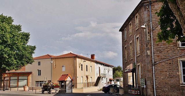
Renaison (Renaison)
- commune in Loire, France
- Country:

- Postal Code: 42370
- Coordinates: 46° 3' 7" N, 3° 55' 29" E


- GPS tracks (wikiloc): [Link]
- AboveSeaLevel: 382 м m
- Area: 23.04 sq km
- Population: 3046
- Web site: http://www.renaison.fr
- Wikipedia en: wiki(en)
- Wikipedia: wiki(fr)
- Wikidata storage: Wikidata: Q642333
- Wikipedia Commons Category: [Link]
- Freebase ID: [/m/03nwbl7]
- Freebase ID: [/m/03nwbl7]
- GeoNames ID: Alt: [2984024]
- GeoNames ID: Alt: [2984024]
- SIREN number: [214201824]
- SIREN number: [214201824]
- BnF ID: [15259750w]
- BnF ID: [15259750w]
- PACTOLS thesaurus ID: [pcrt024XEXB2GP]
- PACTOLS thesaurus ID: [pcrt024XEXB2GP]
- INSEE municipality code: 42182
- INSEE municipality code: 42182
Shares border with regions:
Arcon
- commune in Loire, France
- Country:

- Postal Code: 42370
- Coordinates: 46° 0' 37" N, 3° 53' 17" E


- GPS tracks (wikiloc): [Link]
- Area: 19.19 sq km
- Population: 109


Saint-Romain-la-Motte
- commune in Loire, France
- Country:

- Postal Code: 42640
- Coordinates: 46° 5' 4" N, 3° 58' 53" E


- GPS tracks (wikiloc): [Link]
- Area: 27.56 sq km
- Population: 1457


Saint-Haon-le-Châtel
- commune in Loire, France
- Country:

- Postal Code: 42370
- Coordinates: 46° 3' 57" N, 3° 54' 54" E


- GPS tracks (wikiloc): [Link]
- Area: 0.87 sq km
- Population: 622


Saint-Haon-le-Vieux
- commune in Loire, France
- Country:

- Postal Code: 42370
- Coordinates: 46° 4' 28" N, 3° 54' 29" E


- GPS tracks (wikiloc): [Link]
- Area: 16.34 sq km
- Population: 964
- Web site: [Link]


Saint-André-d'Apchon
- commune in Loire, France
- Country:

- Postal Code: 42370
- Coordinates: 46° 1' 56" N, 3° 55' 49" E


- GPS tracks (wikiloc): [Link]
- Area: 13.44 sq km
- Population: 1961
- Web site: [Link]


Pouilly-les-Nonains
- commune in Loire, France
- Country:

- Postal Code: 42155
- Coordinates: 46° 2' 18" N, 3° 58' 54" E


- GPS tracks (wikiloc): [Link]
- Area: 10.23 sq km
- Population: 2048
- Web site: [Link]
Saint-Rirand
- commune in Loire, France
- Country:

- Postal Code: 42370
- Coordinates: 46° 4' 34" N, 3° 50' 55" E


- GPS tracks (wikiloc): [Link]
- Area: 16.43 sq km
- Population: 145
Les Noës
- commune in Loire, France
- Country:

- Postal Code: 42370
- Coordinates: 46° 2' 28" N, 3° 51' 7" E


- GPS tracks (wikiloc): [Link]
- AboveSeaLevel: 640 м m
- Area: 15.68 sq km
- Population: 206
