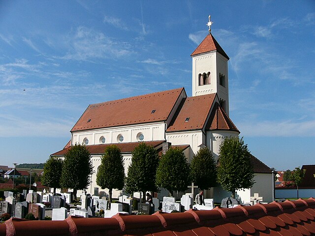
Rennertshofen (Rennertshofen)

- municipality of Germany
 Hiking in Rennertshofen
Rennertshofen is a charming village located in Bavaria, Germany, and it serves as a great starting point for various hiking adventures. The region features beautiful landscapes, rolling hills, and scenic countryside that appeal to outdoor enthusiasts.
Hiking Trails:
-
Local Trails: There are several marked trails around Rennertshofen that vary in difficulty and length, attracting both beginner and experienced hikers. You can expect stunning views of the Bavarian countryside, lush forests, and perhaps even some local wildlife.
-
Wanderwege (Hiking Paths): The area is well-known for its well-maintained hiking paths. The local tourism office often provides maps and details on the best routes.
-
Longer Routes: For those looking for a more extended hike, you can explore paths that connect to nearby towns or natural sites. These trails often lead to picturesque spots such as older villages, historical landmarks, or nature reserves.
Best Time to Hike:
- Spring and Fall: These seasons are ideal for hiking around Rennertshofen. The weather is usually mild, and you can enjoy beautiful foliage in the fall or blooming flowers in spring.
- Summer: While summer can be warm, it's perfect for enjoying long daylight hours. Early morning hikes will help you avoid the midday heat.
- Winter: Some trails may be accessible in winter for snowshoeing or cross-country skiing, depending on snowfall.
What to Bring:
- Footwear: Sturdy hiking boots are essential for comfortable and safe trekking.
- Clothing: Dress in layers to adapt to changing weather conditions. Waterproof gear may be necessary, especially in spring or fall.
- Water and Snacks: Always carry enough water and some energy-boosting snacks.
- Navigation: A physical map or a hiking app can help navigate the trails, especially if you're unfamiliar with the area.
Local Attractions:
After hiking, you might want to explore some local attractions such as historical buildings, traditional Bavarian restaurants, or nearby lakes for relaxation.
Always check local regulations and trail conditions before you head out, and enjoy the breathtaking scenery that Rennertshofen has to offer!
- Country:

- Postal Code: 86643
- Local Dialing Code: 08434
- Licence Plate Code: ND
- Coordinates: 48° 45' 0" N, 11° 2' 0" E


- GPS tracks (wikiloc): [Link]
- AboveSeaLevel: 394 м m
- Area: 93.07 sq km
- Population: 4221
- Web site: http://www.rennertshofen.de
- Wikipedia en: wiki(en)
- Wikipedia: wiki(de)
- Wikidata storage: Wikidata: Q505627
- Wikipedia Commons Category: [Link]
- Freebase ID: [/m/02q4z2d]
- GeoNames ID: Alt: [2848181]
- VIAF ID: Alt: [455145424570286831206]
- OSM relation ID: [943661]
- GND ID: Alt: [4297102-0]
- Bavarikon ID: [ODB_A00001265]
- German municipality key: 09185153
Shares border with regions:
Tagmersheim
- municipality of Germany
Hiking in Tagmersheim
Tagmersheim is a lovely village located in Bavaria, Germany, that offers a range of hiking opportunities for outdoor enthusiasts. Nestled in a picturesque landscape, it provides access to scenic trails that showcase the region’s natural beauty....
- Country:
- Postal Code: 86704
- Local Dialing Code: 09094
- Licence Plate Code: DON
- Coordinates: 48° 49' 0" N, 10° 58' 0" E
- GPS tracks (wikiloc): [Link]
- AboveSeaLevel: 500 м m
- Area: 15.94 sq km
- Population: 1025
- Web site: [Link]


Mörnsheim
- municipality of Germany
Hiking in Mörnsheim
Mörnsheim is a small town located in thebeautiful Altmühltal region of Bavaria, Germany, known for its stunning landscapes, rich history, and excellent hiking opportunities. The area is characterized by limestone hills, deep valleys, and the picturesque Altmühl River, making it a perfect destination for outdoor enthusiasts....
- Country:
- Postal Code: 91804
- Local Dialing Code: 09145
- Licence Plate Code: EI
- Coordinates: 48° 52' 59" N, 11° 0' 0" E
- GPS tracks (wikiloc): [Link]
- AboveSeaLevel: 408 м m
- Area: 33.48 sq km
- Population: 1862
- Web site: [Link]