Neuburg-Schrobenhausen (Landkreis Neuburg-Schrobenhausen)
- district of Bavaria, Germany
 Hiking in Neuburg-Schrobenhausen
Neuburg-Schrobenhausen is a picturesque district in Bavaria, Germany, offering a mix of beautiful landscapes, rich history, and outdoor activities. When it comes to hiking in this area, there are several trails and natural attractions to explore. Here’s what you should know:
Scenic Trails
-
Danube River Trails: The Danube River runs through the region, providing stunning views and a variety of hiking trails. You can enjoy flat paths along the river or venture into the forests nearby.
-
Nature Reserves: The area has several nature reserves where hiking trails are well-marked. These trails often wind through forests, wetlands, and meadows, making for an enjoyable hiking experience.
-
Local Parks: Parks in towns and cities, such as the one in Neuburg an der Donau, often feature trails suitable for hiking, walking, and leisurely strolls.
Main Highlights
-
Neuburg Castle: When hiking near Neuburg an der Donau, consider visiting the historical Neuburg Castle. The surrounding area provides ample opportunities for hikes with scenic views of the castle and the Danube.
-
Bavarian countryside: The picturesque landscape dotted with farms, rivers, and quaint villages offers a sense of tranquility and beauty that is perfect for hiking.
Tips for Hiking
-
Trail Maps: Before heading out, obtain a map of the trails. Local tourist offices can provide valuable information and guidance on current trail conditions.
-
Weather Considerations: Check the weather forecast before your hike, as conditions can change rapidly, especially in the mountains or near the river.
-
Proper Gear: Wear sturdy hiking shoes and dress in layers. Bringing water and snacks is essential for longer hikes.
-
Respect Nature: Stay on marked trails, respect wildlife, and follow Leave No Trace principles to help preserve the area's natural beauty.
Accessibility
Most trails in the Neuburg-Schrobenhausen region are accessible for various skill levels, from casual walkers to more experienced hikers. Ensure you choose a trail that matches your fitness level and experience.
Overall, hiking in Neuburg-Schrobenhausen offers a wonderful way to experience the natural beauty and cultural heritage of Bavaria. Whether you’re looking for a short walk or a more extended adventure, there is something for every hiking enthusiast in this region.
- Country:

- Capital: Neuburg an der Donau
- Licence Plate Code: SOB; ND
- Coordinates: 48° 40' 12" N, 11° 10' 12" E


- GPS tracks (wikiloc): [Link]
- AboveSeaLevel: 378 м m
- Area: 740.00 sq km
- Population: 76493
- Web site: http://www.neuburg-schrobenhausen.de/
- Wikipedia en: wiki(en)
- Wikipedia: wiki(de)
- Wikidata storage: Wikidata: Q10493
- Wikipedia Commons Category: [Link]
- Freebase ID: [/m/0242nk]
- GeoNames ID: Alt: [2866064]
- VIAF ID: Alt: [154788037]
- OSM relation ID: [62655]
- GND ID: Alt: [4041723-2]
- archINFORM location ID: [5665]
- Library of Congress authority ID: Alt: [n82031004]
- TGN ID: [7124014]
- Bavarikon ID: [ODB_A00001252]
- ISNI: Alt: [0000 0004 0376 2406]
- NUTS code: [DE21I]
- Ringgold ID: [163052]
- German district key: 09185
Includes regions:


Neuburg an der Donau
- town in Bavaria, Germany
 Hiking in Neuburg an der Donau
Neuburg an der Donau is a charming town in Bavaria, Germany, situated along the banks of the Danube River. It's a great area for hiking enthusiasts, offering various trails that showcase the stunning landscapes of the region, historical sites, and natural beauty....
- Country:

- Postal Code: 86633
- Local Dialing Code: 08431
- Licence Plate Code: ND
- Coordinates: 48° 44' 0" N, 11° 11' 0" E


- GPS tracks (wikiloc): [Link]
- AboveSeaLevel: 383 м m
- Area: 81.32 sq km
- Population: 29587
- Web site: [Link]


Burgheim
- municipality of Germany
Burgheim is a small municipality in Bavaria, Germany, located near the outskirts of Augsburg. While it may not be a widely known hiking destination, it offers access to beautiful landscapes typical of the Bavarian countryside....
- Country:

- Postal Code: 86666
- Local Dialing Code: 08432
- Licence Plate Code: ND
- Coordinates: 48° 42' 0" N, 11° 1' 0" E


- GPS tracks (wikiloc): [Link]
- AboveSeaLevel: 404 м m
- Area: 49.73 sq km
- Population: 4056
- Web site: [Link]


Rohrenfels
- municipality of Germany
Rohrenfels is a scenic area that offers a variety of hiking opportunities for outdoor enthusiasts. Nestled in the picturesque landscapes, it provides a mix of natural beauty, historical sites, and diverse trails suited for different skill levels. Here are some highlights about hiking in Rohrenfels:...
- Country:

- Postal Code: 86701
- Local Dialing Code: 08431
- Licence Plate Code: ND
- Coordinates: 48° 41' 0" N, 11° 10' 0" E


- GPS tracks (wikiloc): [Link]
- AboveSeaLevel: 390 м m
- Area: 17.52 sq km
- Population: 1057
- Web site: [Link]

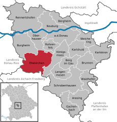
Ehekirchen
- municipality of Germany
Ehekirchen is a small municipality in Bavaria, Germany, located near the town of Ingolstadt. While the area itself is not particularly known for extensive hiking trails, it does provide access to a range of natural landscapes suitable for outdoor activities....
- Country:

- Postal Code: 86676
- Local Dialing Code: 08435
- Licence Plate Code: ND
- Coordinates: 48° 38' 0" N, 11° 6' 0" E


- GPS tracks (wikiloc): [Link]
- AboveSeaLevel: 415 м m
- Area: 62.79 sq km
- Population: 3118
- Web site: [Link]


Berg im Gau
- municipality of Germany
Berg im Gau, located in Bavaria, Germany, is surrounded by beautiful natural landscapes that offer various hiking opportunities. While the area may not be as widely known as some of the larger German hiking regions, it has its own charms and scenic routes that cater to nature enthusiasts....
- Country:

- Postal Code: 86562
- Local Dialing Code: 08454; 08433
- Licence Plate Code: ND
- Coordinates: 48° 38' 0" N, 11° 15' 0" E


- GPS tracks (wikiloc): [Link]
- AboveSeaLevel: 410 м m
- Area: 22.59 sq km
- Population: 1005
- Web site: [Link]
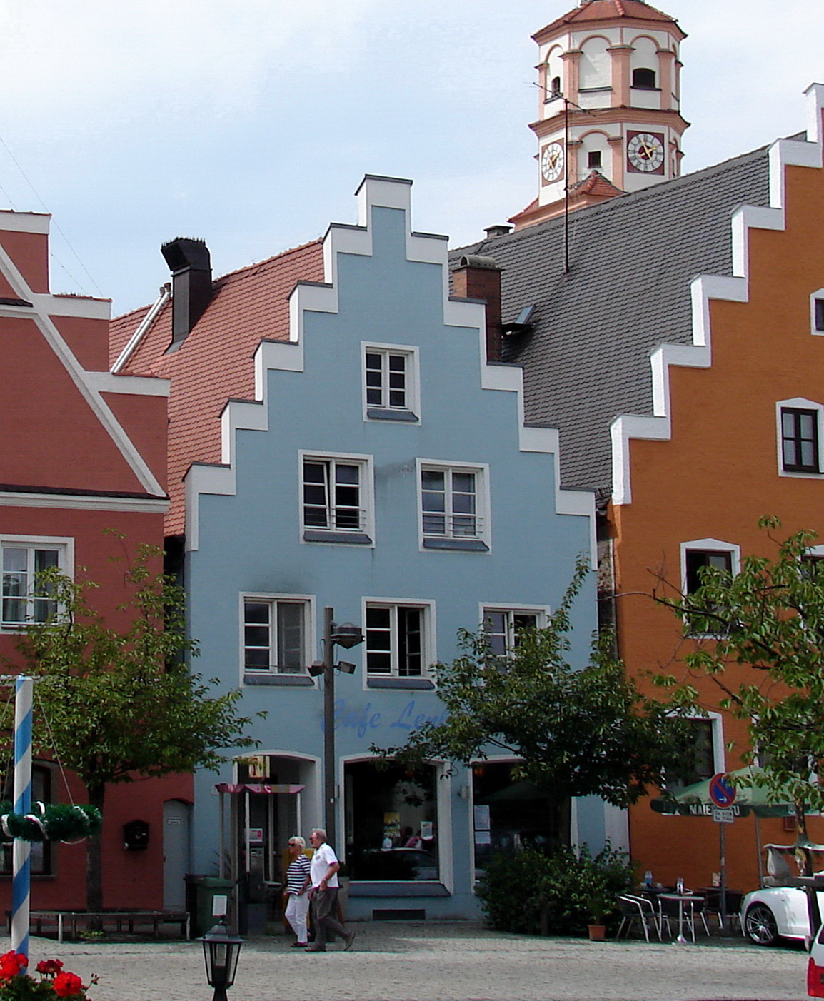

Schrobenhausen
- town in Bavaria, Germany
Schrobenhausen, located in Bavaria, Germany, is an excellent destination for hiking, especially for those who enjoy picturesque landscapes, historical sites, and tranquil countryside. Here are some highlights and considerations for hiking in and around Schrobenhausen:...
- Country:

- Postal Code: 86529
- Local Dialing Code: 08252
- Coordinates: 48° 34' 1" N, 11° 15' 30" E


- GPS tracks (wikiloc): [Link]
- AboveSeaLevel: 418 м m
- Area: 75.31 sq km
- Population: 14618
- Web site: [Link]


Karlskron
- municipality in Neuburg-Schrobenhausen, Bavaria, Germany
Karlskrona, located on the southeastern coast of Sweden, is known for its picturesque archipelago and historical significance. It's a great destination for hiking enthusiasts who want to explore beautiful landscapes, coastal views, and charming towns....
- Country:

- Postal Code: 85123
- Local Dialing Code: 08454; 08453; 08450
- Licence Plate Code: ND
- Coordinates: 48° 40' 0" N, 11° 25' 0" E


- GPS tracks (wikiloc): [Link]
- AboveSeaLevel: 370 м m
- Area: 38.45 sq km
- Population: 3465
- Web site: [Link]

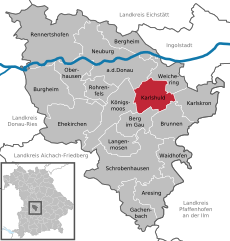
Karlshuld
- municipality of Germany
Karlshuld is a small district located in Bavaria, Germany, and while it may not be as widely known for extensive hiking trails as some larger national parks or mountainous regions, it offers a peaceful natural setting that can be great for walking, hiking, and enjoying the outdoors....
- Country:

- Postal Code: 86668
- Local Dialing Code: 08454
- Licence Plate Code: ND
- Coordinates: 48° 41' 0" N, 11° 18' 0" E


- GPS tracks (wikiloc): [Link]
- AboveSeaLevel: 375 м m
- Area: 29.09 sq km
- Population: 3790
- Web site: [Link]


Rennertshofen
- municipality of Germany
Rennertshofen is a charming village located in Bavaria, Germany, and it serves as a great starting point for various hiking adventures. The region features beautiful landscapes, rolling hills, and scenic countryside that appeal to outdoor enthusiasts....
- Country:

- Postal Code: 86643
- Local Dialing Code: 08434
- Licence Plate Code: ND
- Coordinates: 48° 45' 0" N, 11° 2' 0" E


- GPS tracks (wikiloc): [Link]
- AboveSeaLevel: 394 м m
- Area: 93.07 sq km
- Population: 4221
- Web site: [Link]


Königsmoos
- municipality of Germany
Königsmoos is a beautiful area located in Bavaria, Germany, known for its unique landscape of moorland and wetlands. Hiking in Königsmoos offers a distinct experience, blending natural beauty with opportunities to observe wildlife. Here are some key points about hiking in Königsmoos:...
- Country:

- Postal Code: 86669
- Local Dialing Code: 08433
- Licence Plate Code: ND
- Coordinates: 48° 40' 0" N, 11° 13' 0" E


- GPS tracks (wikiloc): [Link]
- AboveSeaLevel: 379 м m
- Area: 40.97 sq km
- Population: 3226
- Web site: [Link]


Gachenbach
- municipality of Germany
Gachenbach is a small village in Bavaria, Germany, and while it may not be one of the most well-known hiking destinations, it offers various opportunities to enjoy the beautiful Bavarian countryside. Here are some general points about hiking in and around Gachenbach:...
- Country:

- Postal Code: 86565
- Local Dialing Code: 08259
- Licence Plate Code: ND
- Coordinates: 48° 30' 0" N, 11° 14' 0" E


- GPS tracks (wikiloc): [Link]
- AboveSeaLevel: 452 м m
- Area: 30.24 sq km
- Population: 1839
- Web site: [Link]


Langenmosen
- municipality of Germany
Langenmosen is a charming area that offers beautiful hiking opportunities. Nestled in the scenic landscapes of Germany, it boasts picturesque trails that wind through forests, meadows, and along rivers. Here are some highlights to consider if you're planning to hike in Langenmosen:...
- Country:

- Postal Code: 86571
- Local Dialing Code: 08433
- Licence Plate Code: ND
- Coordinates: 48° 36' 0" N, 11° 13' 0" E


- GPS tracks (wikiloc): [Link]
- AboveSeaLevel: 403 м m
- Area: 23.89 sq km
- Population: 1305
- Web site: [Link]

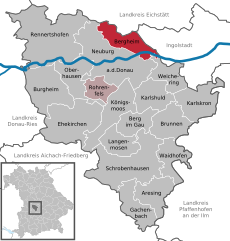
Bergheim
- municipality of Germany
Bergheim, situated in Bavaria, Germany, is surrounded by picturesque landscapes and offers a variety of hiking opportunities. The region is characterized by its lush greenery, rolling hills, and charming villages, making it a great spot for outdoor enthusiasts....
- Country:

- Postal Code: 86673
- Local Dialing Code: 08431
- Licence Plate Code: ND
- Coordinates: 48° 46' 0" N, 11° 16' 0" E


- GPS tracks (wikiloc): [Link]
- AboveSeaLevel: 389 м m
- Area: 28.95 sq km
- Population: 1490
- Web site: [Link]

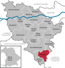
Aresing
- municipality of Germany
Aresing, located in Bavaria, Germany, is not as widely recognized as some other hiking destinations, but it offers beautiful landscapes and trails for outdoor enthusiasts. The region features a mix of rolling hills, forests, and agricultural fields, making it ideal for a variety of hiking experiences....
- Country:

- Postal Code: 86561
- Local Dialing Code: 08252
- Licence Plate Code: ND
- Coordinates: 48° 32' 0" N, 11° 18' 0" E


- GPS tracks (wikiloc): [Link]
- AboveSeaLevel: 426 м m
- Area: 29.89 sq km
- Population: 2341
- Web site: [Link]


Brunnen
- municipality in the district of Neuburg-Schrobenhausen in Bavaria in Germany
Brunnen, located in Bavaria, is a charming town that serves as a great base for hiking enthusiasts looking to explore the surrounding natural beauty of the region. The area is characterized by stunning landscapes, including rolling hills, lush forests, and scenic lakes....
- Country:

- Postal Code: 86564
- Local Dialing Code: 08454
- Licence Plate Code: ND, SOB
- Coordinates: 48° 38' 0" N, 11° 18' 0" E


- GPS tracks (wikiloc): [Link]
- AboveSeaLevel: 391 м m
- Area: 32.12 sq km
- Population: 1440
- Web site: [Link]

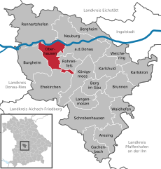
Oberhausen
- municipality near Neuburg/Donau in Bavaria, Germany
Hiking in and around Oberhausen, near Neuburg an der Donau, offers a wonderful experience with scenic views, historical landmarks, and natural beauty....
- Country:

- Postal Code: 86697
- Local Dialing Code: 08431
- Licence Plate Code: ND
- Coordinates: 48° 43' 0" N, 11° 6' 0" E


- GPS tracks (wikiloc): [Link]
- AboveSeaLevel: 420 м m
- Area: 31.94 sq km
- Population: 2972
- Web site: [Link]

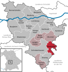
Waidhofen
- municipality of Germany
Waidhofen, located in Bavaria, Germany, is a charming area surrounded by beautiful landscapes, making it a great destination for hiking enthusiasts. The region offers a variety of trails that cater to different skill levels, from easy paths suitable for families to more challenging routes for experienced hikers....
- Country:

- Postal Code: 86579
- Local Dialing Code: 08443
- Licence Plate Code: ND
- Coordinates: 48° 34' 45" N, 11° 20' 20" E


- GPS tracks (wikiloc): [Link]
- AboveSeaLevel: 404 м m
- Area: 27.32 sq km
- Population: 1711
- Web site: [Link]


Weichering
- municipality of Germany
Weichering is a small municipality located in Bavaria, Germany, offering beautiful landscapes and a peaceful environment, making it suitable for hiking enthusiasts. While it may not be as widely known as some larger hiking destinations, it has its own charm and potential for outdoor activities....
- Country:

- Postal Code: 86706
- Local Dialing Code: 08454
- Licence Plate Code: ND
- Coordinates: 48° 43' 0" N, 11° 19' 0" E


- GPS tracks (wikiloc): [Link]
- AboveSeaLevel: 374 м m
- Area: 24.59 sq km
- Population: 1854
- Web site: [Link]
Shares border with regions:


Aichach-Friedberg
- district in Bavaria, Germany
Aichach-Friedberg is a beautiful region located in Bavaria, Germany, known for its diverse landscapes, charming villages, and historical sites. Hiking in this area offers a variety of trails that cater to different skill levels, making it an excellent destination for both novice hikers and experienced outdoor enthusiasts....
- Country:

- Capital: Aichach
- Licence Plate Code: FDB; AIC
- Coordinates: 48° 25' 12" N, 11° 4' 48" E


- GPS tracks (wikiloc): [Link]
- AboveSeaLevel: 483 м m
- Area: 781.00 sq km
- Population: 101792
- Web site: [Link]
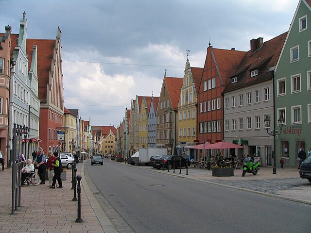
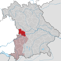
Donau-Ries
- district in Bavaria, Germany
Donau-Ries is a beautiful region in Bavaria, Germany, known for its stunning landscapes, rich history, and cultural significance. Spanning both the Danube River and the Ries crater, this area offers diverse hiking opportunities for both beginners and more experienced trekkers....
- Country:

- Capital: Donauwörth
- Licence Plate Code: NÖ; DON
- Coordinates: 48° 49' 48" N, 10° 40' 12" E


- GPS tracks (wikiloc): [Link]
- AboveSeaLevel: 508 м m
- Area: 1275.00 sq km
- Population: 117483
- Web site: [Link]
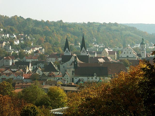
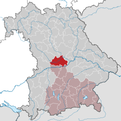
Eichstätt
- district of Bavaria, Germany
Eichstätt, located in Bavaria, Germany, is known for its scenic landscapes, historical towns, and rich natural beauty, making it a fantastic destination for hiking enthusiasts. Here are some highlights and tips for hiking in the Eichstätt district:...
- Country:

- Capital: Eichstätt
- Licence Plate Code: EI
- Coordinates: 48° 55' 12" N, 11° 19' 48" E


- GPS tracks (wikiloc): [Link]
- AboveSeaLevel: 475 м m
- Area: 1214.00 sq km
- Population: 97347
- Web site: [Link]


Pfaffenhofen
- district of Bavaria, Germany
Pfaffenhofen is a district in Bavaria, Germany, known for its picturesque landscapes and outdoor recreational opportunities, including hiking. The region features a mix of rolling hills, forests, rivers, and farmland, providing a variety of scenic routes for hikers of all skill levels....
- Country:

- Capital: Pfaffenhofen an der Ilm
- Licence Plate Code: PAF
- Coordinates: 48° 30' 0" N, 11° 30' 0" E


- GPS tracks (wikiloc): [Link]
- AboveSeaLevel: 439 м m
- Area: 760.00 sq km
- Population: 126244
- Web site: [Link]
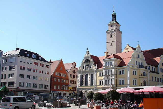

Ingolstadt
- town in Bavaria, Germany
Hiking in and around Ingolstadt, a city located in Bavaria, Germany, offers a variety of scenic routes and natural landscapes to explore. While Ingolstadt itself is more urban, it’s conveniently situated near several natural attractions and parks. Here are some key points to consider when hiking in this region:...
- Country:

- Postal Code: 85055; 85053; 85051; 85057; 85049
- Local Dialing Code: 08459; 08458; 08450; 0841; 08424
- Licence Plate Code: IN
- Coordinates: 48° 45' 49" N, 11° 25' 34" E


- GPS tracks (wikiloc): [Link]
- AboveSeaLevel: 368 м m
- Area: 133.35 sq km
- Population: 137072
- Web site: [Link]
