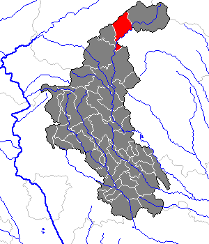
Rettenegg (Rettenegg)

- municipality in Austria
 Hiking in Rettenegg
Rettenegg is a beautiful area located in Styria, Austria, known for its stunning landscapes and diverse hiking opportunities. Nestled in the foothills of the Eastern Alps, it offers a unique blend of lush forests, serene meadows, and panoramic mountain views.
Hiking Highlights in Rettenegg:
-
Scenic Trails: The region boasts an extensive network of trails, suitable for all levels of hikers – from beginners to seasoned trekkers. Many trails lead through enchanting forests and provide breathtaking views of the surrounding mountains.
-
Flora and Fauna: As you hike, you may encounter diverse wildlife and various plant species native to the region. The changing seasons bring different colors and sights, making each hike a unique experience.
-
Local Culture: Hiking in Rettenegg not only offers natural beauty but also a chance to discover local traditions. Some trails pass by traditional farms or small villages, allowing hikers to engage with the local culture.
-
Recommended Routes: A popular route is the hike to the nearby Hochwechsel, which can be challenging but rewards hikers with spectacular views from the summit. There are also gentler hikes suitable for families, like paths that loop around lakes or meadows.
-
Hiking Season: The best time for hiking in Rettenegg is generally from late spring to early autumn (May to September), when the weather is mild and the trails are accessible. Always check local conditions, as weather can change quickly in mountainous areas.
-
Safety Tips: Ensure you have proper hiking gear, including sturdy footwear, water, and snacks. It’s also advisable to inform someone about your hiking plan and expected return time.
-
Trail Maps: Consider picking up a local hiking map or using a navigation app to explore the area more effectively.
-
Facilities: There are typically several accommodation options in and around Rettenegg if you wish to extend your stay. Additionally, local restaurants often serve traditional Styrian dishes, perfect for a post-hike meal.
Always check local resources for trail conditions and specific guidance when planning your hike in Rettenegg. Happy hiking!
- Country:

- Postal Code: 8674
- Local Dialing Code: 03173
- Licence Plate Code: WZ
- Coordinates: 47° 31' 33" N, 15° 46' 49" E


- GPS tracks (wikiloc): [Link]
- AboveSeaLevel: 862 м m
- Area: 78.87 sq km
- Population: 741
- Web site: http://www.rettenegg.at
- Wikipedia en: wiki(en)
- Wikipedia: wiki(de)
- Wikidata storage: Wikidata: Q120046
- Wikipedia Commons Category: [Link]
- Freebase ID: [/m/03gwmh0]
- GeoNames ID: Alt: [7872520]
- VIAF ID: Alt: [244748044]
- Austrian municipality key: [61743]
Shares border with regions:
Spital am Semmering
- municipality in Austria
Hiking in Spital am Semmering
Spital am Semmering is a picturesque village located in the Styrian region of Austria, surrounded by stunning mountain scenery, making it an excellent destination for hiking enthusiasts. Here are some highlights and tips for hiking in this beautiful area:...
- Country:
- Postal Code: 8684
- Local Dialing Code: 03853
- Licence Plate Code: MZ
- Coordinates: 47° 36' 58" N, 15° 45' 14" E
- GPS tracks (wikiloc): [Link]
- AboveSeaLevel: 800 м m
- Area: 72.59 sq km
- Population: 1595
- Web site: [Link]
Waldbach-Mönichwald
- municipality in Austria
Hiking in Waldbach-Mönichwald
Waldbach-Mönichwald is a beautiful area in Austria that offers a variety of hiking opportunities for outdoor enthusiasts. Nestled in the Styrian region, this area is characterized by stunning landscapes, lush green forests, and peaceful meadows....
- Country:
- Postal Code: 8251, 8252, 8253
- Local Dialing Code: 03336
- Licence Plate Code: HF
- Coordinates: 47° 26' 50" N, 15° 52' 57" E
- GPS tracks (wikiloc): [Link]
- AboveSeaLevel: 574 м m
- Area: 53.97 sq km
- Population: 1523
- Web site: [Link]

Ratten
- municipality in Austria
Hiking in Ratten
Ratten is a charming village located in the Styrian region of Austria, known for its beautiful natural landscapes and outdoor activities such as hiking. The surrounding area offers various trails suitable for different levels of hikers, from beginners to more experienced adventurers....
- Country:
- Postal Code: 8673
- Local Dialing Code: 03173
- Licence Plate Code: WZ
- Coordinates: 47° 29' 0" N, 15° 43' 0" E
- GPS tracks (wikiloc): [Link]
- AboveSeaLevel: 765 м m
- Area: 28.72 sq km
- Population: 1122
- Web site: [Link]
Trattenbach
- municipality in Austria
Hiking in Trattenbach
Trattenbach, located in Austria, is surrounded by beautiful natural landscapes, making it a great destination for hiking enthusiasts. The region is characterized by lush forests, rolling hills, and clear streams, providing a variety of trails suitable for different skill levels....
- Country:
- Postal Code: 2881
- Local Dialing Code: 02641
- Licence Plate Code: NK
- Coordinates: 47° 35' 43" N, 15° 53' 13" E
- GPS tracks (wikiloc): [Link]
- AboveSeaLevel: 777 м m
- Area: 30.91 sq km
- Population: 545
- Web site: [Link]
Aspangberg-St. Peter
- municipality in Austria
Hiking in Aspangberg-St. Peter
Aspangberg-Sankt Peter, located in the Lower Austria region of Austria, is a fantastic destination for hiking enthusiasts. It offers a mix of stunning natural landscapes, picturesque villages, and a variety of trails suitable for different skill levels. Here are some highlights and tips for hiking in this area:...
- Country:
- Local Dialing Code: 02642
- Licence Plate Code: NK
- Coordinates: 47° 33' 2" N, 16° 1' 9" E
- GPS tracks (wikiloc): [Link]
- AboveSeaLevel: 490 м m
- Area: 81.49 sq km
- Population: 1888
- Web site: [Link]
Ganz
- former municipality in Austria
Hiking in Ganz
Hiking in Ganz, located in Styria, Austria, offers a variety of scenic trails amidst stunning natural landscapes. Though Ganz itself is a smaller community, it serves as a good base for exploring the surrounding areas rich in hiking opportunities....
- Country:
- Postal Code: 8680
- Local Dialing Code: 03852
- Licence Plate Code: MZ
- Coordinates: 47° 34' 54" N, 15° 40' 41" E
- GPS tracks (wikiloc): [Link]
- AboveSeaLevel: 750 м m
Mönichwald
- former municipality in Austria
Hiking in Mönichwald
Mönichwald, located in the eastern part of Austria in Styria, is a beautiful area known for its picturesque landscapes, lush forests, and tranquil atmosphere. Here are some aspects to consider if you're planning a hiking trip in Mönichwald:...
- Country:
- Local Dialing Code: 03336
- Licence Plate Code: HB
- Coordinates: 47° 26' 50" N, 15° 52' 57" E
- GPS tracks (wikiloc): [Link]
- AboveSeaLevel: 574 м m
- Area: 35.14 sq km
- Population: 864
Sankt Jakob im Walde
- municipality in Austria
Hiking in Sankt Jakob im Walde
Sankt Jakob im Walde, located in Styria, Austria, is a beautiful destination for hiking enthusiasts. The region is characterized by lush forests, rolling hills, and scenic views, making it an ideal spot for outdoor activities....
- Country:
- Licence Plate Code: HB
- Coordinates: 47° 27' 58" N, 15° 47' 8" E
- GPS tracks (wikiloc): [Link]
- AboveSeaLevel: 913 м m
- Area: 30.25 sq km
- Population: 1056
- Web site: [Link]