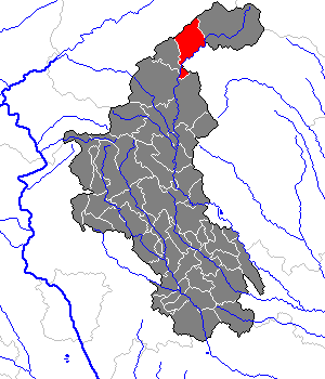
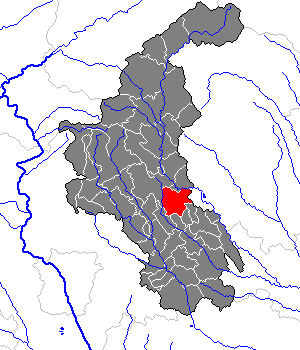
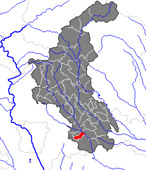
Weiz District (Bezirk Weiz)

- district of Austria
 Hiking in Weiz District
The Weiz District in Austria is a beautiful area for hiking enthusiasts, known for its stunning landscapes, rolling hills, and scenic views. Here are key highlights and insights about hiking in the region:
Natural Beauty
- Diverse Terrain: The Weiz District features a mix of forests, meadows, and hills, which makes it a great environment for various hiking trails suitable for all levels of experience.
- Scenic Views: Many trails offer panoramic views of the surrounding mountains, valleys, and villages. The vistas can be particularly stunning in the autumn when foliage changes color.
Popular Hiking Trails
- Gschmaier Trails: A selection of well-marked paths offering different levels of difficulty, perfect for families and beginners.
- Schöckl Mountain: Located slightly outside of Weiz, this mountain offers trails with varying difficulty and fantastic viewpoints. The summit can also be accessed via a cable car for those looking for a less strenuous option.
- Teichalm and Schwarzlsee: These areas are popular for hiking and feature trails that combine nature with lovely lakeside views, ideal for a relaxing day out.
Practical Information
- Trail Marking: Hiking trails in Weiz are generally well-marked with standard Austrian trail signs, making navigation easier.
- Best Time to Hike: Spring and autumn are ideal seasons for hiking in Weiz due to mild weather and beautiful scenery. Summer can be warmer, while winter may bring snow that might restrict access to higher trails.
- Equipment: Good hiking shoes and weather-appropriate clothing are recommended, as trails can vary in condition.
Local Tips
- Maps and Guides: It’s advisable to have a local hiking map or use a hiking app to help you navigate the trails. Local tourism offices can provide valuable resources.
- Cultural Spots: While hiking, take the opportunity to explore local villages and historical sites, such as churches and traditional Austrian architecture along the routes.
Safety
- Always inform someone about your hiking plan, especially if you are going on a less trafficked trail. Make sure to check the weather conditions before heading out.
Overall, Weiz District offers a charming and rewarding experience for hikers, with trails that showcase the natural beauty of Styria. Whether you are a seasoned hiker or a casual walker, you are likely to find a good route that meets your preferences!
- Country:

- Capital: Weiz
- Licence Plate Code: WZ
- Coordinates: 47° 13' 8" N, 15° 41' 24" E


- GPS tracks (wikiloc): [Link]
- AboveSeaLevel: 915 м m
- Area: 1098 sq km
- Population: 86007
- Web site: http://www.bh-weiz.steiermark.at
- Wikipedia en: wiki(en)
- Wikipedia: wiki(de)
- Wikidata storage: Wikidata: Q665571
- Wikipedia Commons Category: [Link]
- Wikipedia Commons Maps Category: [Link]
- Freebase ID: [/m/06yl0s]
- GeoNames ID: Alt: [2761530]
- VIAF ID: Alt: [153637536]
- archINFORM location ID: [14701]
- Library of Congress authority ID: Alt: [n82254943]
Includes regions:


Rettenegg
- municipality in Austria
Hiking in Rettenegg
Rettenegg is a beautiful area located in Styria, Austria, known for its stunning landscapes and diverse hiking opportunities. Nestled in the foothills of the Eastern Alps, it offers a unique blend of lush forests, serene meadows, and panoramic mountain views....
- Country:
- Postal Code: 8674
- Local Dialing Code: 03173
- Licence Plate Code: WZ
- Coordinates: 47° 31' 33" N, 15° 46' 49" E
- GPS tracks (wikiloc): [Link]
- AboveSeaLevel: 862 м m
- Area: 78.87 sq km
- Population: 741
- Web site: [Link]
Naintsch
- former municipality in Austria
Hiking in Naintsch
Naintsch is a charming area that offers a variety of outdoor activities, including hiking. While it may not be as well-known as some other hiking destinations, it provides beautiful landscapes and opportunities for both leisurely walks and more challenging hikes....
- Country:
- Local Dialing Code: 03175
- Licence Plate Code: WZ
- Coordinates: 47° 20' 16" N, 15° 36' 35" E
- GPS tracks (wikiloc): [Link]
- AboveSeaLevel: 1032 м m
- Area: 27.58 sq km
- Population: 596


Sankt Ruprecht an der Raab
- municipality in Austria
Hiking in Sankt Ruprecht an der Raab
Sankt Ruprecht an der Raab, located in Styria, Austria, offers several hiking opportunities that showcase the region's beautiful natural landscapes. Surrounded by rolling hills, forests, and the Raab River, here are a few highlights for hiking in this area:...
- Country:
- Postal Code: 8181
- Local Dialing Code: 03178
- Licence Plate Code: WZ
- Coordinates: 47° 9' 14" N, 15° 39' 44" E
- GPS tracks (wikiloc): [Link]
- AboveSeaLevel: 388 м m
- Area: 41.08 sq km
- Population: 5300
- Web site: [Link]

Gutenberg-Stenzengreith
- municipality in Austria
Hiking in Gutenberg-Stenzengreith
Gutenberg-Stenzengreith is a beautiful area in Austria, nestled in the region of Styria. It's known for its stunning landscapes, tranquil nature, and a variety of hiking trails that cater to different experience levels....
- Country:
- Postal Code: 8160, 8061, 8162
- Licence Plate Code: WZ
- Coordinates: 47° 12' 32" N, 15° 33' 47" E
- GPS tracks (wikiloc): [Link]
- AboveSeaLevel: 569 м m
- Area: 27.8 sq km
- Population: 1773
- Web site: [Link]
Pischelsdorf am Kulm
- municipality in Austria
Hiking in Pischelsdorf am Kulm
Pischelsdorf am Kulm is a picturesque village located in the Styria region of Austria, surrounded by beautiful landscapes that offer plenty of opportunities for hiking enthusiasts. The area is characterized by rolling hills, scenic views, and a mix of woodlands and open fields making it a great spot for both casual walkers and more serious hikers....
- Country:
- Postal Code: 8212
- Local Dialing Code: 03113
- Licence Plate Code: WZ
- Coordinates: 47° 10' 26" N, 15° 48' 24" E
- GPS tracks (wikiloc): [Link]
- AboveSeaLevel: 378 м m
- Area: 28.14 sq km
- Population: 3712
- Web site: [Link]


Fladnitz an der Teichalm
- municipality in Austria
Hiking in Fladnitz an der Teichalm
Fladnitz an der Teichalm, located in the Styria region of Austria, is a beautiful destination for hikers due to its stunning landscapes, diverse trails, and serene natural environment. The area is known for its picturesque lakes, rolling hills, and dense forests, making it a perfect spot for both leisurely walks and challenging hikes....
- Country:
- Postal Code: 8163
- Local Dialing Code: 03179
- Licence Plate Code: WZ
- Coordinates: 47° 17' 9" N, 15° 28' 41" E
- GPS tracks (wikiloc): [Link]
- AboveSeaLevel: 692 м m
- Area: 34.81 sq km
- Population: 1792
- Web site: [Link]


Mitterdorf an der Raab
- municipality in Austria
Hiking in Mitterdorf an der Raab
Mitterdorf an der Raab is a charming village located in Austria, within the Styria region. The area is known for its picturesque landscapes, rolling hills, and lovely vineyards, making it a great destination for hiking enthusiasts. Here are some highlights and tips for hiking in Mitterdorf an der Raab:...
- Country:
- Postal Code: 8181
- Local Dialing Code: 03178
- Licence Plate Code: WZ
- Coordinates: 47° 10' 16" N, 15° 36' 59" E
- GPS tracks (wikiloc): [Link]
- AboveSeaLevel: 427 м m
- Area: 20.94 sq km
- Population: 2056
- Web site: [Link]


Unterfladnitz
- former municipality in Austria
Hiking in Unterfladnitz
Unterfladnitz, located in Austria, is a charming area that offers a variety of hiking opportunities for outdoor enthusiasts. The region features scenic landscapes, rolling hills, and lush greenery, making it a delightful destination for hikers of all skill levels....
- Country:
- Postal Code: 8181
- Local Dialing Code: 03178
- Licence Plate Code: WZ
- Coordinates: 47° 10' 48" N, 15° 39' 36" E
- GPS tracks (wikiloc): [Link]
- AboveSeaLevel: 406 м m
- Area: 15.83 sq km
- Population: 1575
Hofstätten an der Raab
- municipality in Austria
Hiking in Hofstätten an der Raab
Hofstätten an der Raab is a picturesque village located in Styria, Austria, surrounded by beautiful natural landscapes that offer excellent opportunities for hiking. This area is characterized by rolling hills, lush forests, and the tranquil waters of the Raab River, making it an ideal destination for outdoor enthusiasts....
- Country:
- Postal Code: 8200
- Local Dialing Code: 03112
- Licence Plate Code: WZ
- Coordinates: 47° 4' 31" N, 15° 44' 49" E
- GPS tracks (wikiloc): [Link]
- AboveSeaLevel: 358 м m
- Area: 15.22 sq km
- Population: 2253
- Web site: [Link]


Fischbach
- municipality in the district of Weiz, in Styria, Austria
Hiking in Fischbach
Fischbach, located in the Styria region of Austria, offers beautiful hiking opportunities, surrounded by picturesque landscapes and mountains. Here are some highlights and tips for hiking in this area:...
- Country:
- Postal Code: 8654
- Local Dialing Code: 03170
- Licence Plate Code: WZ
- Coordinates: 47° 26' 31" N, 15° 39' 2" E
- GPS tracks (wikiloc): [Link]
- AboveSeaLevel: 1050 м m
- Area: 61.65 sq km
- Population: 1528
- Web site: [Link]
Gasen
- municipality in Austria
Hiking in Gasen
Gasen, located in the state of Styria, Austria, offers a beautiful natural landscape that is perfect for hiking enthusiasts. The area is characterized by its lush forests, rolling hills, and stunning views of the Eastern Alps, making it a delightful destination for both beginners and experienced hikers....
- Country:
- Postal Code: 8616
- Local Dialing Code: 03171
- Licence Plate Code: WZ
- Coordinates: 47° 22' 59" N, 15° 33' 58" E
- GPS tracks (wikiloc): [Link]
- AboveSeaLevel: 800 м m
- Area: 33.93 sq km
- Population: 915
- Web site: [Link]
Anger
- municipality in the district of Weiz in Styria, Austria
Hiking in Anger
Anger, located in Styria, Austria, is a charming town that serves as a great base for hiking enthusiasts looking to explore the stunning landscapes of the region. Styria is known for its beautiful hills, forests, and picturesque villages, making it a fantastic area for various hiking trails....
- Country:
- Postal Code: 8184
- Local Dialing Code: 03175
- Licence Plate Code: WZ
- Coordinates: 47° 16' 25" N, 15° 41' 24" E
- GPS tracks (wikiloc): [Link]
- AboveSeaLevel: 479 м m
- Area: 1.97 sq km
- Population: 4098
- Web site: [Link]

Birkfeld
- former municipality in Austria
Hiking in Birkfeld
Birkfeld, located in Austria’s Styria region, is a charming destination for hiking enthusiasts. The area is surrounded by lush forests, rolling hills, and scenic landscapes, making it ideal for outdoor activities....
- Country:
- Local Dialing Code: 03174
- Licence Plate Code: WZ
- Coordinates: 47° 21' 17" N, 15° 41' 42" E
- GPS tracks (wikiloc): [Link]
- AboveSeaLevel: 639 м m
- Area: 4.26 sq km
- Population: 4992
- Web site: [Link]


Passail
- municipality in Austria
Hiking in Passail
Passail, located in Austria, is surrounded by stunning natural landscapes, making it a fantastic destination for hiking enthusiasts. The region is characterized by its rolling hills, lush forests, and picturesque meadows, offering a variety of trails suitable for different skill levels....
- Country:
- Postal Code: 8162
- Local Dialing Code: 03179
- Licence Plate Code: WZ
- Coordinates: 47° 16' 54" N, 15° 30' 49" E
- GPS tracks (wikiloc): [Link]
- AboveSeaLevel: 653 м m
- Area: 13.8 sq km
- Population: 4261
- Web site: [Link]

Ratten
- municipality in Austria
Hiking in Ratten
Ratten is a charming village located in the Styrian region of Austria, known for its beautiful natural landscapes and outdoor activities such as hiking. The surrounding area offers various trails suitable for different levels of hikers, from beginners to more experienced adventurers....
- Country:
- Postal Code: 8673
- Local Dialing Code: 03173
- Licence Plate Code: WZ
- Coordinates: 47° 29' 0" N, 15° 43' 0" E
- GPS tracks (wikiloc): [Link]
- AboveSeaLevel: 765 м m
- Area: 28.72 sq km
- Population: 1122
- Web site: [Link]


Nitscha
- former municipality in Austria
Hiking in Nitscha
It seems like there might be a typo or misunderstanding in your request, as "Nitscha" doesn't correspond to a well-known hiking destination. However, if you're referring to a specific national park, region, or another area with a similar name, please let me know!...
- Country:
- Postal Code: 8200
- Local Dialing Code: 03112
- Licence Plate Code: WZ
- Coordinates: 47° 7' 40" N, 15° 44' 58" E
- GPS tracks (wikiloc): [Link]
- AboveSeaLevel: 359 м m
- Area: 14.12 sq km
- Population: 1435


Sankt Kathrein am Offenegg
- municipality in Austria
Hiking in Sankt Kathrein am Offenegg
Sankt Kathrein am Offenegg is a charming village located in the heart of Austria, particularly known for its beautiful natural landscapes and outdoor activities. Nestled in the Styrian region, it's an excellent destination for hiking enthusiasts....
- Country:
- Postal Code: 8171
- Local Dialing Code: 03179
- Licence Plate Code: WZ
- Coordinates: 47° 17' 58" N, 15° 34' 36" E
- GPS tracks (wikiloc): [Link]
- AboveSeaLevel: 972 м m
- Area: 40.24 sq km
- Population: 1086
- Web site: [Link]

Gleisdorf
- municipality in Austria
Hiking in Gleisdorf
Gleisdorf is a charming town located in Styria, Austria, surrounded by beautiful landscapes that make it an excellent destination for hiking enthusiasts. The area offers a variety of hiking trails that cater to different skill levels, from easy walks suitable for families to more challenging hikes for seasoned adventurers....
- Country:
- Postal Code: 8200, 8302
- Licence Plate Code: WZ
- Coordinates: 47° 6' 14" N, 15° 42' 30" E
- GPS tracks (wikiloc): [Link]
- AboveSeaLevel: 365 м m
- Area: 38.8 sq km
- Population: 10763
- Web site: [Link]
Krottendorf
- former municipality in Austria
Hiking in Krottendorf
Krottendorf is a charming area that offers various opportunities for hiking enthusiasts. While specific trails can vary, here are some general highlights you can expect when hiking in this region:...
- Country:
- Postal Code: 8160
- Local Dialing Code: 03172
- Coordinates: 47° 12' 43" N, 15° 38' 59" E
- GPS tracks (wikiloc): [Link]
- AboveSeaLevel: 435 м m
- Area: 12.44 sq km
- Population: 2383


Albersdorf-Prebuch
- municipality in Austria
Hiking in Albersdorf-Prebuch
Albersdorf-Prebuch is a charming area in Austria, located in Styria, that offers a variety of hiking opportunities for outdoor enthusiasts. The region is characterized by its picturesque landscapes, rolling hills, and lush forests, making it a perfect destination for hikes of all skill levels....
- Country:
- Postal Code: 8200
- Local Dialing Code: 03112
- Licence Plate Code: WZ
- Coordinates: 47° 7' 35" N, 15° 41' 37" E
- GPS tracks (wikiloc): [Link]
- AboveSeaLevel: 366 м m
- Area: 14.16 sq km
- Population: 2037
- Web site: [Link]


Strallegg
- municipality in Austria
Hiking in Strallegg
Strallegg is a picturesque area located in Styria, Austria, known for its beautiful landscapes and outdoor recreational opportunities. The region offers a variety of hiking trails suitable for all levels of hikers, from novice to experienced adventurers....
- Country:
- Local Dialing Code: 03174
- Licence Plate Code: WZ
- Coordinates: 47° 24' 42" N, 15° 43' 21" E
- GPS tracks (wikiloc): [Link]
- AboveSeaLevel: 850 м m
- Area: 41.97 sq km
- Population: 1925
- Web site: [Link]
Gschaid bei Birkfeld
- former municipality in Austria
Hiking in Gschaid bei Birkfeld
Gschaid bei Birkfeld, located in the Styria region of Austria, offers beautiful landscapes and diverse hiking opportunities. The area is characterized by rolling hills, lush forests, and picturesque meadows, making it ideal for nature lovers and outdoor enthusiasts....
- Country:
- Postal Code: 8190
- Local Dialing Code: 03174
- Licence Plate Code: WZ
- Coordinates: 47° 20' 59" N, 15° 43' 15" E
- GPS tracks (wikiloc): [Link]
- AboveSeaLevel: 560 м m
- Area: 15.05 sq km
- Population: 932
Etzersdorf-Rollsdorf
- former municipality in Austria
Hiking in Etzersdorf-Rollsdorf
Etzersdorf-Rollsdorf is a picturesque area located in Austria, known for its beautiful landscapes and outdoor recreational opportunities. While it may not be as widely known as some major hiking destinations, it offers a variety of trails suitable for different skill levels, making it a great spot for both novice and experienced hikers....
- Country:
- Postal Code: 8160, 8181
- Local Dialing Code: 03177
- Licence Plate Code: WZ
- Coordinates: 47° 11' 24" N, 15° 41' 56" E
- GPS tracks (wikiloc): [Link]
- AboveSeaLevel: 366 м m
- Area: 13.44 sq km
- Population: 1116
Baierdorf bei Anger
- former municipality in Austria
Hiking in Baierdorf bei Anger
Baierdorf bei Anger is a picturesque village located in Styria, Austria, surrounded by beautiful landscapes that offer a range of hiking opportunities. Here are some highlights for hiking in this region:...
- Country:
- Postal Code: 8184
- Local Dialing Code: 03175
- Licence Plate Code: WZ
- Coordinates: 47° 17' 4" N, 15° 42' 35" E
- GPS tracks (wikiloc): [Link]
- AboveSeaLevel: 663 м m
- Area: 16.31 sq km
- Population: 1632


Thannhausen
- municipality in Austria
Hiking in Thannhausen
Thannhausen, located in Styria, Austria, offers a variety of hiking opportunities amidst picturesque landscapes. The region is characterized by rolling hills, lush forests, and beautiful meadows, making it a perfect destination for outdoor enthusiasts....
- Country:
- Postal Code: 8160
- Local Dialing Code: 03172
- Licence Plate Code: WZ
- Coordinates: 47° 14' 16" N, 15° 38' 23" E
- GPS tracks (wikiloc): [Link]
- AboveSeaLevel: 480 м m
- Area: 33.47 sq km
- Population: 2429
- Web site: [Link]
Preßguts
- former municipality in Austria
Hiking in Preßguts
Preßguts is a small village in Austria, located in the scenic region of Styria. The area is surrounded by beautiful landscapes, characterized by rolling hills, forests, and picturesque valleys, making it an excellent location for hiking enthusiasts....
- Country:
- Postal Code: 8211
- Local Dialing Code: 03113
- Licence Plate Code: WZ
- Coordinates: 47° 10' 16" N, 15° 44' 13" E
- GPS tracks (wikiloc): [Link]
- AboveSeaLevel: 360 м m
- Area: 6.41 sq km
- Population: 402
Waisenegg
- former municipality in Austria
Hiking in Waisenegg
Waisenegg, located in Austria, is a charming destination for hikers, offering diverse landscapes and stunning views. The area is characterized by its lush forests, rolling hills, and mountain scenery, which make it ideal for outdoor enthusiasts....
- Country:
- Postal Code: 8190
- Local Dialing Code: 03174
- Licence Plate Code: WZ
- Coordinates: 47° 23' 39" N, 15° 41' 2" E
- GPS tracks (wikiloc): [Link]
- AboveSeaLevel: 747 м m
- Area: 26.04 sq km
- Population: 1069

Puch bei Weiz
- municipality in Austria
Hiking in Puch bei Weiz
Puch bei Weiz is a beautiful area in Styria, Austria, that offers a variety of hiking opportunities amidst stunning natural scenery. The region is characterized by its rolling hills, lush forests, and picturesque landscapes, making it an ideal destination for outdoor enthusiasts....
- Country:
- Postal Code: 8182
- Local Dialing Code: 03177
- Licence Plate Code: WZ
- Coordinates: 47° 13' 27" N, 15° 43' 30" E
- GPS tracks (wikiloc): [Link]
- AboveSeaLevel: 449 м m
- Area: 24.8 sq km
- Population: 2091
- Web site: [Link]


Sankt Margarethen an der Raab
- municipality in Austria
Hiking in Sankt Margarethen an der Raab
Sankt Margarethen an der Raab, located in the Styria region of Austria, offers a variety of hiking opportunities that showcase the beautiful landscapes and nature of the area. The region is characterized by rolling hills, lush forests, and picturesque meadows, making it an excellent destination for both casual and experienced hikers....
- Country:
- Postal Code: 8321
- Local Dialing Code: 03115
- Licence Plate Code: WZ
- Coordinates: 47° 3' 0" N, 15° 45' 0" E
- GPS tracks (wikiloc): [Link]
- AboveSeaLevel: 380 м m
- Area: 43.02 sq km
- Population: 4074
- Web site: [Link]


Gutenberg an der Raabklamm
- former municipality in Austria
Hiking in Gutenberg an der Raabklamm
Gutenberg an der Raabklamm is a picturesque area in Austria, known for its stunning landscapes and natural beauty, making it a popular destination for hiking enthusiasts. The Raabklamm itself is a gorge carved out by the Raab River, featuring impressive rock formations, lush vegetation, and scenic views that attract nature lovers....
- Country:
- Local Dialing Code: 03172
- Licence Plate Code: WZ
- Coordinates: 47° 12' 32" N, 15° 33' 47" E
- GPS tracks (wikiloc): [Link]
- AboveSeaLevel: 569 м m
- Area: 14.51 sq km
- Population: 1755


Gersdorf an der Feistritz
- municipality in Austria
Hiking in Gersdorf an der Feistritz
Gersdorf an der Feistritz is a charming municipality located in Styria, Austria. It's a great destination for nature lovers and hiking enthusiasts, as the area is characterized by beautiful landscapes, rolling hills, lush forests, and clear streams....
- Country:
- Postal Code: 8212
- Local Dialing Code: 03113
- Licence Plate Code: WZ
- Coordinates: 47° 9' 36" N, 15° 51' 0" E
- GPS tracks (wikiloc): [Link]
- AboveSeaLevel: 333 м m
- Area: 19.0 sq km
- Population: 1699
- Web site: [Link]


Floing
- municipality in Austria
Hiking in Floing
Floing is a picturesque area located in Styria, Austria, renowned for its stunning natural landscapes and various hiking opportunities. The region offers a blend of scenic trails, lush forests, and panoramic views of the surrounding mountains. Here are some highlights to consider if you're planning to hike in Floing:...
- Country:
- Postal Code: 8183
- Local Dialing Code: 03177
- Licence Plate Code: WZ
- Coordinates: 47° 15' 49" N, 15° 44' 48" E
- GPS tracks (wikiloc): [Link]
- AboveSeaLevel: 639 м m
- Area: 13.17 sq km
- Population: 1195
- Web site: [Link]


Feistritz bei Anger
- former municipality in Austria
Hiking in Feistritz bei Anger
Feistritz bei Anger is a picturesque area in Styria, Austria, known for its stunning natural landscapes and a variety of hiking opportunities. Here's what you can expect when hiking in this region:...
- Country:
- Postal Code: 8184
- Local Dialing Code: 03175
- Licence Plate Code: WZ
- Coordinates: 47° 15' 31" N, 15° 42' 44" E
- GPS tracks (wikiloc): [Link]
- AboveSeaLevel: 455 м m
- Area: 8.04 sq km
- Population: 1069

Sankt Kathrein am Hauenstein
- municipality in Austria
Hiking in Sankt Kathrein am Hauenstein
Sankt Kathrein am Hauenstein is a beautiful area in Austria that offers a range of hiking opportunities, set against a picturesque backdrop of the Styrian Alps. The region is noted for its lush landscapes, scenic views, and well-maintained hiking trails suitable for various skill levels....
- Country:
- Postal Code: 8672
- Local Dialing Code: 03173
- Licence Plate Code: WZ
- Coordinates: 47° 29' 22" N, 15° 41' 38" E
- GPS tracks (wikiloc): [Link]
- AboveSeaLevel: 822 м m
- Area: 19.29 sq km
- Population: 633
- Web site: [Link]


Pischelsdorf in der Steiermark
- former municipality in Austria
Hiking in Pischelsdorf in der Steiermark
Pischelsdorf in der Steiermark is a charming village located in the Styria region of Austria. It's surrounded by picturesque landscapes, making it a great location for hiking enthusiasts. Here are some highlights and tips for hiking in and around Pischelsdorf:...
- Country:
- Postal Code: 8212
- Local Dialing Code: 03113
- Licence Plate Code: WZ
- Coordinates: 47° 10' 43" N, 15° 48' 26" E
- GPS tracks (wikiloc): [Link]
- AboveSeaLevel: 378 м m
- Area: 17.31 sq km
- Population: 2556


Sinabelkirchen
- municipality in Austria
Hiking in Sinabelkirchen
Sinabelkirchen, located in the Styrian region of Austria, offers beautiful landscapes and a variety of hiking opportunities. Nestled in a picturesque area, it serves as a gateway to the surrounding hills and forests, making it an ideal spot for outdoor enthusiasts....
- Country:
- Postal Code: 8261
- Local Dialing Code: 03118
- Licence Plate Code: WZ
- Coordinates: 47° 6' 13" N, 15° 49' 41" E
- GPS tracks (wikiloc): [Link]
- AboveSeaLevel: 323 м m
- Area: 37.01 sq km
- Population: 4223
- Web site: [Link]
Ungerdorf
- former municipality in Austria
Hiking in Ungerdorf
Ungerdorf, often referred to as a quaint village nestled in the scenic landscapes of a mountainous region, offers a variety of hiking opportunities for both beginners and seasoned trekkers. Here’s what you need to know about hiking in and around Ungerdorf:...
- Country:
- Postal Code: 8200
- Local Dialing Code: 03112
- Licence Plate Code: WZ
- Coordinates: 47° 5' 11" N, 15° 40' 42" E
- GPS tracks (wikiloc): [Link]
- AboveSeaLevel: 387 м m
- Area: 5.02 sq km
- Population: 866


Haslau bei Birkfeld
- former municipality in Austria
Hiking in Haslau bei Birkfeld
Haslau bei Birkfeld is a picturesque village located in the Styria region of Austria, surrounded by beautiful nature, rolling hills, and lush forests, making it an excellent destination for hiking enthusiasts. Here’s what you need to know about hiking in and around Haslau bei Birkfeld:...
- Country:
- Local Dialing Code: 03174
- Licence Plate Code: WZ
- Coordinates: 47° 21' 44" N, 15° 39' 7" E
- GPS tracks (wikiloc): [Link]
- AboveSeaLevel: 639 м m
- Area: 14.01 sq km
- Population: 438
Hohenau an der Raab
- former municipality in Austria
Hiking in Hohenau an der Raab
Hohenau an der Raab is a picturesque village located in Styria, Austria, known for its beautiful landscapes and opportunities for outdoor activities, particularly hiking. The region surrounding Hohenau offers a variety of trails that cater to different experience levels, making it a great destination for both beginners and seasoned hikers....
- Country:
- Postal Code: 8162
- Local Dialing Code: 03179
- Licence Plate Code: WZ
- Coordinates: 47° 18' 3" N, 15° 32' 46" E
- GPS tracks (wikiloc): [Link]
- AboveSeaLevel: 680 м m
- Area: 37.8 sq km
- Population: 1331
Neudorf bei Passail
- former municipality in Austria
Hiking in Neudorf bei Passail
Neudorf bei Passail is a charming village located in the Styria region of Austria, and it serves as a great starting point for various hiking adventures in the surrounding area. The region is characterized by its picturesque landscapes, rolling hills, and lush forests, making it a popular destination for nature enthusiasts....
- Country:
- Local Dialing Code: 03179
- Licence Plate Code: WZ
- Coordinates: 47° 13' 48" N, 15° 27' 0" E
- GPS tracks (wikiloc): [Link]
- AboveSeaLevel: 800 м m
- Area: 12.71 sq km
- Population: 492
Oberrettenbach
- former municipality in Austria
Hiking in Oberrettenbach
Oberrettenbach is a beautiful destination for hiking, located in the Tyrol region of Austria. The area is known for its stunning alpine scenery, lush forests, and crystal-clear streams, making it an attractive spot for outdoor enthusiasts....
- Country:
- Postal Code: 8212
- Local Dialing Code: 03113
- Coordinates: 47° 8' 28" N, 15° 49' 47" E
- GPS tracks (wikiloc): [Link]
- AboveSeaLevel: 350 м m
- Area: 11.04 sq km
- Population: 477


Miesenbach bei Birkfeld
- municipality in Austria
Hiking in Miesenbach bei Birkfeld
Miesenbach bei Birkfeld, located in Styria, Austria, offers a beautiful setting for hiking enthusiasts. The area is characterized by its lush forests, rolling hills, and scenic landscapes, making it an ideal spot for both casual walkers and more experienced hikers....
- Country:
- Postal Code: 8190
- Local Dialing Code: 03174
- Licence Plate Code: WZ
- Coordinates: 47° 22' 12" N, 15° 45' 38" E
- GPS tracks (wikiloc): [Link]
- AboveSeaLevel: 827 м m
- Area: 14.62 sq km
- Population: 696
- Web site: [Link]


Mortantsch
- municipality in Austria
Hiking in Mortantsch
Mortantsch is a picturesque village in Styria, Austria, located near the city of Graz. It's surrounded by stunning landscapes, making it a great destination for hiking enthusiasts. Here are a few key points about hiking in Mortantsch:...
- Country:
- Postal Code: 8160
- Local Dialing Code: 03172
- Licence Plate Code: WZ
- Coordinates: 47° 12' 28" N, 15° 34' 44" E
- GPS tracks (wikiloc): [Link]
- AboveSeaLevel: 550 м m
- Area: 17.58 sq km
- Population: 2182
- Web site: [Link]


Laßnitzthal
- former municipality in Austria
Hiking in Laßnitzthal
Laßnitzthal is a picturesque area located in Austria, known for its beautiful landscapes, diverse flora and fauna, and well-maintained hiking trails. Here are some key points to consider when hiking in Laßnitzthal:...
- Country:
- Local Dialing Code: 0 31 33
- Licence Plate Code: WZ
- Coordinates: 47° 4' 56" N, 15° 38' 46" E
- GPS tracks (wikiloc): [Link]
- AboveSeaLevel: 392 м m
- Area: 7.59 sq km
- Population: 1070


Koglhof
- former municipality in Austria
Hiking in Koglhof
Koglhof, located in Austria, offers a variety of hiking opportunities for outdoor enthusiasts. Nestled in a picturesque landscape, the area is characterized by rolling hills, lush forests, and stunning views of the surrounding countryside. Here are some highlights for hiking in Koglhof:...
- Country:
- Local Dialing Code: 03174
- Licence Plate Code: WZ
- Coordinates: 47° 19' 11" N, 15° 41' 25" E
- GPS tracks (wikiloc): [Link]
- AboveSeaLevel: 600 м m
- Area: 30.29 sq km
- Population: 1103


Ilztal
- municipality in Austria
Hiking in Ilztal
Ilztal, located in Bavaria, Germany, is known for its beautiful landscapes and rich natural features, making it a great destination for hiking enthusiasts. The region is characterized by its picturesque valleys, forests, and rivers, and offers a variety of trails that cater to different skill levels....
- Country:
- Postal Code: 8211
- Licence Plate Code: WZ
- Coordinates: 47° 8' 44" N, 15° 46' 16" E
- GPS tracks (wikiloc): [Link]
- AboveSeaLevel: 330 м m
- Area: 16.03 sq km
- Population: 2148
- Web site: [Link]

Naas
- municipality in Austria
Hiking in Naas
Naas, located in Styria, Austria, offers a variety of wonderful hiking opportunities that showcase the region's stunning landscapes, diverse flora, and rich cultural heritage. Here are some key points to consider when hiking in this area:...
- Country:
- Postal Code: 8160
- Local Dialing Code: 03172
- Licence Plate Code: WZ
- Coordinates: 47° 15' 0" N, 15° 35' 40" E
- GPS tracks (wikiloc): [Link]
- AboveSeaLevel: 400 м m
- Area: 20.75 sq km
- Population: 1377
- Web site: [Link]

Labuch
- former municipality in Austria
Hiking in Labuch
Labuch is not a widely known hiking destination, and it may be a less popular or local name for an area. However, I can give you general information about hiking in any region, as well as tips on how to prepare for hikes in lesser-known areas....
- Country:
- Postal Code: 8200
- Local Dialing Code: 03112
- Licence Plate Code: WZ
- Coordinates: 47° 4' 38" N, 15° 41' 40" E
- GPS tracks (wikiloc): [Link]
- AboveSeaLevel: 400 м m
- Area: 7.25 sq km
- Population: 799


Arzberg
- former municipality in Austria
Hiking in Arzberg
Arzberg, located in the Styria region of Austria, offers a serene hiking experience amidst beautiful natural landscapes. Known for its rolling hills, lush forests, and stunning views, it’s an excellent destination for both casual walkers and experienced hikers....
- Country:
- Postal Code: 8162
- Local Dialing Code: 03179
- Licence Plate Code: WZ
- Coordinates: 47° 14' 55" N, 15° 31' 8" E
- GPS tracks (wikiloc): [Link]
- AboveSeaLevel: 579 м m
- Area: 15 sq km
- Population: 544


Markt Hartmannsdorf
- municipality in Austria
Hiking in Markt Hartmannsdorf
Markt Hartmannsdorf is located in Austria's Styria region, an area known for its beautiful landscapes, rolling hills, and rich natural resources. Hiking in and around Markt Hartmannsdorf offers several opportunities for outdoor enthusiasts....
- Country:
- Postal Code: 8311
- Local Dialing Code: 03114
- Licence Plate Code: WZ
- Coordinates: 47° 3' 15" N, 15° 50' 32" E
- GPS tracks (wikiloc): [Link]
- AboveSeaLevel: 331 м m
- Area: 29.25 sq km
- Population: 2950
- Web site: [Link]


Hirnsdorf
- former municipality in Austria
Hiking in Hirnsdorf
Hirnsdorf is a charming village located in Austria, often appreciated for its beautiful natural landscapes and serene hiking opportunities. While specific trails can vary in level of difficulty and length, here are some general insights into hiking in the area:...
- Country:
- Postal Code: 8221
- Local Dialing Code: 03113
- Licence Plate Code: WZ
- Coordinates: 47° 11' 35" N, 15° 49' 42" E
- GPS tracks (wikiloc): [Link]
- AboveSeaLevel: 358 м m
- Area: 4.53 sq km
- Population: 677
Ludersdorf-Wilfersdorf
- municipality in Austria
Hiking in Ludersdorf-Wilfersdorf
Ludersdorf-Wilfersdorf, situated in Austria, offers beautiful landscapes and a variety of hiking trails that cater to different skill levels. The area is characterized by rolling hills, lush forests, and stunning views of the surrounding countryside, making it a great destination for outdoor enthusiasts....
- Country:
- Postal Code: 8200
- Local Dialing Code: 03112
- Licence Plate Code: WZ
- Coordinates: 47° 6' 18" N, 15° 40' 34" E
- GPS tracks (wikiloc): [Link]
- AboveSeaLevel: 365 м m
- Area: 12.82 sq km
- Population: 2397
- Web site: [Link]


Reichendorf
- former municipality in Austria
Hiking in Reichendorf
Reichendorf, a scenic area nestled in the beautiful landscapes, offers a variety of hiking opportunities suitable for different skill levels. While specifics may vary, here are some general features you can expect when hiking in this region:...
- Country:
- Postal Code: 8212
- Local Dialing Code: 03113
- Licence Plate Code: WZ
- Coordinates: 47° 11' 20" N, 15° 45' 6" E
- GPS tracks (wikiloc): [Link]
- AboveSeaLevel: 390 м m
- Area: 4.93 sq km
- Population: 629


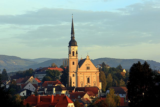
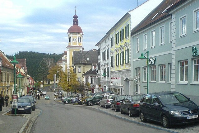
Weiz
- municipality in Austria
Hiking in Weiz
Weiz, located in Styria, Austria, is surrounded by beautiful landscapes that make it a great destination for hiking enthusiasts. The region features a variety of trails that cater to different skill levels, from easy walks suitable for families to more challenging hikes for seasoned trekkers....
- Country:
- Postal Code: 8160
- Local Dialing Code: 03172
- Licence Plate Code: WZ
- Coordinates: 47° 13' 8" N, 15° 37' 31" E
- GPS tracks (wikiloc): [Link]
- AboveSeaLevel: 477 м m
- Area: 5.07 sq km
- Population: 11431
- Web site: [Link]


Kulm bei Weiz
- former municipality in Austria
Hiking in Kulm bei Weiz
Kulm bei Weiz is a charming area located in the Steiermark region of Austria, known for its beautiful landscapes and excellent hiking opportunities. The region is characterized by rolling hills, lush forests, and panoramic views of the surrounding countryside, making it a great destination for outdoor enthusiasts....
- Country:
- Postal Code: 8182
- Local Dialing Code: 03113
- Licence Plate Code: WZ
- Coordinates: 47° 12' 9" N, 15° 46' 18" E
- GPS tracks (wikiloc): [Link]
- AboveSeaLevel: 497 м m
- Area: 5.9 sq km
- Population: 486
Stenzengreith
- former municipality in Austria
Hiking in Stenzengreith
Stenzengreith is a charming destination for hiking enthusiasts, located in Austria's picturesque Styria region. It offers a variety of trails that cater to different skill levels, ensuring that both beginners and experienced hikers can enjoy the stunning landscapes, lush forests, and scenic views of the surrounding countryside....
- Country:
- Local Dialing Code: 03132
- Licence Plate Code: WZ
- Coordinates: 47° 12' 0" N, 15° 30' 36" E
- GPS tracks (wikiloc): [Link]
- AboveSeaLevel: 988 м m
- Area: 13.13 sq km
- Population: 521
Shares border with regions:


Graz-Umgebung District
- district in Austria
Hiking in Graz-Umgebung District
Graz-Umgebung District, located around the city of Graz in Austria, offers a wide range of hiking opportunities, featuring scenic landscapes, lush forests, and picturesque hilltops. Here are some highlights and recommendations for hiking in this area:...
- Country:
- Capital: Graz
- Licence Plate Code: GU
- Coordinates: 47° 3' 43" N, 15° 24' 54" E
- GPS tracks (wikiloc): [Link]
- AboveSeaLevel: 522 м m
- Area: 1100.7 sq km
- Population: 148830
- Web site: [Link]