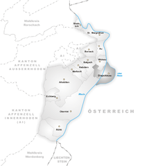
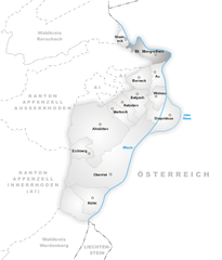
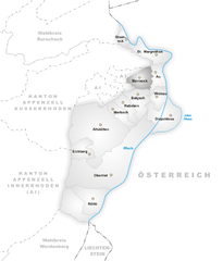
Rheintal Constituency (Wahlkreis Rheintal)

- district in Switzerland
 Hiking in Rheintal Constituency
Rheintal, located in Switzerland, is part of the canton of St. Gallen and is known for its beautiful landscapes along the Rhine River. The area offers a range of hiking opportunities suitable for different experience levels. Here are some highlights for hiking in the Rheintal region:
Trails and Routes
-
Rhein-Wanderweg (Rhine Hiking Trail): This trail follows the Rhine River and provides stunning views of the river and the surrounding hills. It’s suitable for all ages and can be done in segments.
-
Flumserberg: A short drive from Rheintal, Flumserberg offers several hiking trails with breathtaking views of the Churfirsten range and Lake Walensee. You can choose from easy paths to more challenging alpine hikes.
-
Churfirsten Ridge: This area has spectacular hikes that offer panoramic views of the entire region. The ascent can be challenging, but it rewards hikers with stunning vistas.
-
Hiking to the Vilan: The Vilan mountain offers a moderately difficult hike, providing views of the Rhine Valley and towards Liechtenstein.
Preparation and Tips
- Maps and Signage: Trails are well-marked, but it's always a good idea to carry a map or download a hiking app for GPS tracking.
- Weather: Check the weather before heading out, as conditions in the mountains can change rapidly.
- Proper Gear: Wear sturdy hiking boots and bring layers to adapt to changing temperatures. A good backpack with water, snacks, and a first-aid kit is recommended.
- Respect Nature: Stay on marked trails and follow local guidelines to preserve the natural environment.
Best Hiking Seasons
Late spring to early autumn is the best time for hiking in Rheintal, as the weather is generally stable, and the trails are clear of snow.
Local Attractions
After a day of hiking, explore local villages, sample Swiss cuisine, or visit cultural sites in the region to experience the local heritage.
Whether you are a seasoned hiker or a beginner, Rheintal offers something for everyone, combining outdoor adventure with spectacular natural beauty.
- Country:

- Capital: Altstätten
- Licence Plate Code: SG
- Coordinates: 47° 22' 40" N, 9° 34' 45" E


- GPS tracks (wikiloc): [Link]
- AboveSeaLevel: 412 м m
- Area: 138.37 sq km
- Wikipedia en: wiki(en)
- Wikipedia: wiki(de)
- Wikidata storage: Wikidata: Q188220
- Wikipedia Commons Category: [Link]
- Freebase ID: [/m/03cnqfz]
- GeoNames ID: Alt: [7285000]
- archINFORM location ID: [42749]
Includes regions:


Rebstein
- municipality in Switzerland
Hiking in Rebstein
Rebstein is a small municipality located in the canton of St. Gallen in Switzerland, known for its beautiful landscapes and proximity to various hiking trails. Its location near the Rhine River and the foothills of the Alps offers hikers a diverse range of experiences....
- Country:
- Postal Code: 9445
- Local Dialing Code: 071
- Licence Plate Code: SG
- Coordinates: 47° 23' 37" N, 9° 35' 23" E
- GPS tracks (wikiloc): [Link]
- AboveSeaLevel: 410 м m
- Area: 4.26 sq km
- Population: 4387
- Web site: [Link]


Oberriet
- municipality in Switzerland
Hiking in Oberriet
Oberriet, located in the picturesque region of eastern Switzerland, offers a unique hiking experience characterized by stunning landscapes, charming villages, and a variety of trails suitable for different skill levels. Here are some key points to consider for hiking in Oberriet:...
- Country:
- Postal Code: 9463
- Local Dialing Code: 071
- Licence Plate Code: SG
- Coordinates: 47° 20' 6" N, 9° 33' 49" E
- GPS tracks (wikiloc): [Link]
- AboveSeaLevel: 421 м m
- Area: 34.51 sq km
- Population: 8839
- Web site: [Link]


Balgach
- municipality of Switzerland
Hiking in Balgach
Balgach, a small area in Switzerland, may not be as widely known as some of the country’s more famous hiking destinations, but it offers some beautiful landscapes and trails for outdoor enthusiasts. When exploring hiking in and around Balgach, here are a few key points to consider:...
- Country:
- Postal Code: 9436
- Local Dialing Code: 071
- Licence Plate Code: SG
- Coordinates: 47° 24' 3" N, 9° 36' 29" E
- GPS tracks (wikiloc): [Link]
- AboveSeaLevel: 406 м m
- Area: 6.52 sq km
- Population: 4650
- Web site: [Link]


Widnau
- municipality in Switzerland
Hiking in Widnau
Widnau is a charming municipality located in the canton of St. Gallen, Switzerland, near the border with Austria. Its stunning surroundings make it a great destination for hiking enthusiasts. Here are a few highlights to consider when hiking in Widnau:...
- Country:
- Postal Code: 9443
- Local Dialing Code: 071
- Licence Plate Code: SG
- Coordinates: 47° 23' 59" N, 9° 38' 0" E
- GPS tracks (wikiloc): [Link]
- AboveSeaLevel: 405 м m
- Area: 4.22 sq km
- Population: 9576
- Web site: [Link]

Diepoldsau
- municipality in Switzerland
Hiking in Diepoldsau
Diepoldsau is a charming village located in the canton of St. Gallen in Switzerland, near the borders of Austria and Liechtenstein. It offers beautiful landscapes ideal for hiking enthusiasts who enjoy a mix of nature, culture, and picturesque scenery. Here are some aspects of hiking in and around Diepoldsau:...
- Country:
- Postal Code: 9444
- Local Dialing Code: 071
- Licence Plate Code: SG
- Coordinates: 47° 23' 2" N, 9° 38' 49" E
- GPS tracks (wikiloc): [Link]
- AboveSeaLevel: 407 м m
- Area: 11.23 sq km
- Population: 6502
- Web site: [Link]

St. Margrethen
- municipality in Switzerland
Hiking in St. Margrethen
St. Margrethen is a picturesque town located in the canton of St. Gallen in Switzerland, near the shores of Lake Constance. The area offers several opportunities for hiking enthusiasts, with trails that vary in difficulty and length, catering to different skill levels....
- Country:
- Postal Code: 9430
- Local Dialing Code: 071
- Licence Plate Code: SG
- Coordinates: 47° 27' 12" N, 9° 37' 34" E
- GPS tracks (wikiloc): [Link]
- AboveSeaLevel: 408 м m
- Area: 6.85 sq km
- Population: 5889
- Web site: [Link]


Au
- municipality in the canton of St. Gallen, Switzerland
Hiking in Au
Au, a small municipality in the canton of St. Gallen in Switzerland, offers beautiful landscapes, scenic trails, and a variety of hiking opportunities suitable for different skill levels. The area is characterized by lush green hills, serene lakes, and stunning mountains, making it a great spot for nature lovers and outdoor enthusiasts....
- Country:
- Postal Code: 9434
- Local Dialing Code: 071
- Licence Plate Code: SG
- Coordinates: 47° 25' 35" N, 9° 38' 13" E
- GPS tracks (wikiloc): [Link]
- AboveSeaLevel: 403 м m
- Area: 4.69 sq km
- Population: 7622
- Web site: [Link]


Eichberg
- municipality in the canton of St. Gallen, Switzerland
Hiking in Eichberg
Eichberg, located near the city of St. Gallen in Switzerland, offers a variety of hiking opportunities in a picturesque alpine setting. The region is known for its stunning landscapes, lush green meadows, and panoramic views of the surrounding mountains....
- Country:
- Postal Code: 9453
- Local Dialing Code: 071
- Licence Plate Code: SG
- Coordinates: 47° 20' 35" N, 9° 31' 51" E
- GPS tracks (wikiloc): [Link]
- AboveSeaLevel: 481 м m
- Area: 5.43 sq km
- Population: 1524
- Web site: [Link]


Rüthi
- municipality in Switzerland
Hiking in Rüthi
Rüthi, located in the Swiss canton of St. Gallen, is a wonderful area for hiking, offering a mix of scenic views, diverse landscapes, and well-maintained trails. Here are some key points to consider when hiking in Rüthi:...
- Country:
- Postal Code: 9464
- Local Dialing Code: 071
- Licence Plate Code: SG
- Coordinates: 47° 17' 45" N, 9° 32' 14" E
- GPS tracks (wikiloc): [Link]
- AboveSeaLevel: 431 м m
- Area: 9.34 sq km
- Population: 2357
- Web site: [Link]

Berneck
- municipality in the canton of St. Gallen, Switzerland
Hiking in Berneck
Berneck, located in the canton of St. Gallen in Switzerland, offers a beautiful setting for hiking enthusiasts. This small town is nestled along the Rhine River and is surrounded by lush forested hills and scenic landscapes, making it an ideal destination for a variety of hiking experiences....
- Country:
- Postal Code: 9442
- Local Dialing Code: 071
- Licence Plate Code: SG
- Coordinates: 47° 25' 29" N, 9° 36' 45" E
- GPS tracks (wikiloc): [Link]
- AboveSeaLevel: 417 м m
- Area: 5.63 sq km
- Population: 3956
- Web site: [Link]


Marbach
- municipality in the canton of St. Gallen, Switzerland
Hiking in Marbach
Marbach, located in the St. Gallen region of Switzerland, is a beautiful destination for hiking enthusiasts. Nestled in the Alpine foothills, this area offers a variety of trails suited for different skill levels, from easy walks to more challenging hikes. Here are some key points to consider when hiking in Marbach:...
- Country:
- Postal Code: 9437
- Local Dialing Code: 071
- Licence Plate Code: SG
- Coordinates: 47° 23' 30" N, 9° 34' 5" E
- GPS tracks (wikiloc): [Link]
- AboveSeaLevel: 413 м m
- Area: 4.42 sq km
- Population: 2055
- Web site: [Link]


Altstätten
- municipality in Switzerland
Hiking in Altstätten
Altstätten, located in the eastern part of Switzerland, is a charming town nestled near the Appenzell region, offering a variety of hiking opportunities that cater to all levels of hikers. The surrounding landscape is characterized by rolling hills, lush forests, and stunning mountain views, making it a fantastic destination for outdoor enthusiasts....
- Country:
- Postal Code: 9450
- Local Dialing Code: 071
- Licence Plate Code: SG
- Coordinates: 47° 22' 41" N, 9° 32' 56" E
- GPS tracks (wikiloc): [Link]
- AboveSeaLevel: 465 м m
- Area: 39.11 sq km
- Population: 11549
- Web site: [Link]


Rheineck
- municipality in the canton of St. Gallen, Switzerland
Hiking in Rheineck
Rheineck, located in the canton of St. Gallen in Switzerland, offers a variety of hiking opportunities that cater to different skill levels and preferences. The area is known for its beautiful landscapes, including rolling hills, lush forests, and stunning views of Lake Constance and the surrounding mountains. Here are some highlights and tips for hiking in Rheineck:...
- Country:
- Postal Code: 9424
- Local Dialing Code: 071
- Licence Plate Code: SG
- Coordinates: 47° 28' 12" N, 9° 35' 0" E
- GPS tracks (wikiloc): [Link]
- AboveSeaLevel: 399 м m
- Area: 2.18 sq km
- Population: 3485
- Web site: [Link]