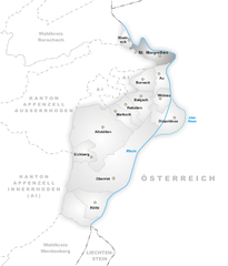
St. Margrethen (St. Margrethen)
- municipality in Switzerland
St. Margrethen is a picturesque town located in the canton of St. Gallen in Switzerland, near the shores of Lake Constance. The area offers several opportunities for hiking enthusiasts, with trails that vary in difficulty and length, catering to different skill levels.
Hiking Trails:
-
Along Lake Constance: The shoreline provides beautiful, flat trails perfect for leisurely walks, ideal for families and those looking for a gentler hike. The views of the lake and mountains are stunning, especially at sunset.
-
St. Margrethen Forest: This area is great for those looking for a mix of forest trails and open landscapes. There are several marked paths that allow hikers to explore the natural beauty of the region.
-
Nearby Hills: St. Margrethen is close to hills like the Berg Risen and Hohenems, offering more challenging hikes with rewarding views. These trails can take you through varied terrain and provide a solid workout.
-
Connecting to Other Trails: The region often serves as a gateway to longer hikes, connecting to trails leading to other picturesque villages or into the Swiss Alps.
Things to Consider:
- Weather: Always check the local weather conditions before heading out, as mountain weather can change rapidly.
- Trail Markings: Look for the Swiss hiking trail signs that indicate the difficulty level and estimated hiking time.
- Equipment: Wear appropriate hiking shoes and bring enough water, snacks, and a first aid kit.
Best Time to Hike:
Spring (April to June) and early autumn (September to October) are particularly beautiful, with pleasant temperatures and fewer crowds. Summer can be warm, while winter hiking is popular if you are prepared for snow and icy conditions.
Local Tips:
- Visit the local tourist information center for maps and recommendations on specific trails.
- Consider exploring nearby towns and attractions, like the historic sites along Lake Constance, after your hike.
Overall, St. Margrethen offers a great mix of scenic paths and outdoor activities for hikers of all levels!
- Country:

- Postal Code: 9430
- Local Dialing Code: 071
- Licence Plate Code: SG
- Coordinates: 47° 27' 12" N, 9° 37' 34" E


- GPS tracks (wikiloc): [Link]
- AboveSeaLevel: 408 м m
- Area: 6.85 sq km
- Population: 5889
- Web site: http://www.stmargrethen.ch
- Wikipedia en: wiki(en)
- Wikipedia: wiki(de)
- Wikidata storage: Wikidata: Q66243
- Wikipedia Commons Category: [Link]
- Freebase ID: [/m/03qkgn]
- GeoNames ID: Alt: [7287243]
- VIAF ID: Alt: [241589404]
- OSM relation ID: [1683943]
- archINFORM location ID: [10749]
- HDS ID: [1337]
- Swiss municipality code: [3236]
- Digital Atlas of the Roman Empire ID: [10801]
Shares border with regions:


Walzenhausen
- municipality in Switzerland
Walzenhausen, located in Switzerland, is an excellent destination for hiking enthusiasts. Situated in the canton of Appenzell, it offers stunning views of the surrounding landscapes, including the Rhine Valley and the Swiss Alps....
- Country:

- Postal Code: 9428
- Local Dialing Code: 071
- Licence Plate Code: AR
- Coordinates: 47° 26' 37" N, 9° 35' 51" E


- GPS tracks (wikiloc): [Link]
- AboveSeaLevel: 824 м m
- Area: 6.98 sq km
- Population: 1994
- Web site: [Link]


Au
- municipality in the canton of St. Gallen, Switzerland
Au, a small municipality in the canton of St. Gallen in Switzerland, offers beautiful landscapes, scenic trails, and a variety of hiking opportunities suitable for different skill levels. The area is characterized by lush green hills, serene lakes, and stunning mountains, making it a great spot for nature lovers and outdoor enthusiasts....
- Country:

- Postal Code: 9434
- Local Dialing Code: 071
- Licence Plate Code: SG
- Coordinates: 47° 25' 35" N, 9° 38' 13" E


- GPS tracks (wikiloc): [Link]
- AboveSeaLevel: 403 м m
- Area: 4.69 sq km
- Population: 7622
- Web site: [Link]


Lutzenberg
- municipality in Switzerland
Lutzenberg is a charming community located in the Appenzell District of Switzerland, known for its picturesque landscapes and proximity to the beautiful Appenzell region. Hiking in Lutzenberg offers stunning vistas of rolling hills, lush forests, and scenic views of the Swiss Alps....
- Country:

- Postal Code: 9426
- Local Dialing Code: 071
- Licence Plate Code: AR
- Coordinates: 47° 27' 29" N, 9° 35' 1" E


- GPS tracks (wikiloc): [Link]
- AboveSeaLevel: 523 м m
- Area: 2.26 sq km
- Population: 1253
- Web site: [Link]


Rheineck
- municipality in the canton of St. Gallen, Switzerland
Rheineck, located in the canton of St. Gallen in Switzerland, offers a variety of hiking opportunities that cater to different skill levels and preferences. The area is known for its beautiful landscapes, including rolling hills, lush forests, and stunning views of Lake Constance and the surrounding mountains. Here are some highlights and tips for hiking in Rheineck:...
- Country:

- Postal Code: 9424
- Local Dialing Code: 071
- Licence Plate Code: SG
- Coordinates: 47° 28' 12" N, 9° 35' 0" E


- GPS tracks (wikiloc): [Link]
- AboveSeaLevel: 399 м m
- Area: 2.18 sq km
- Population: 3485
- Web site: [Link]

