Roccavignale (Roccavignale)
.svg)
- Italian comune
 Hiking in Roccavignale
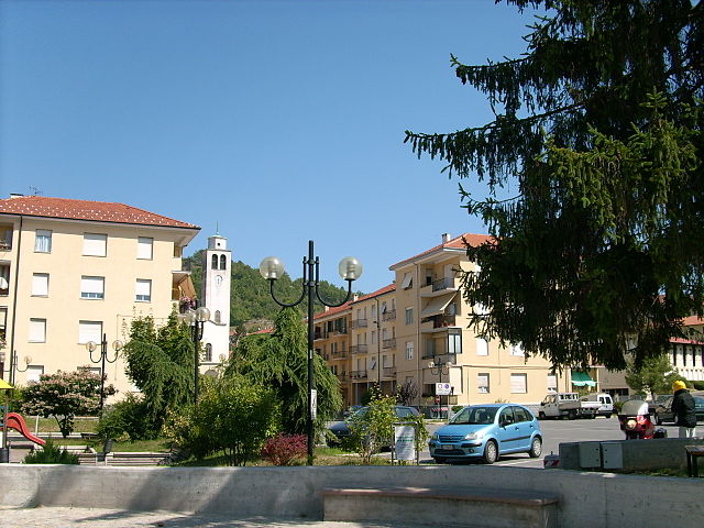
Roccavignale is a charming village located in the province of Savona in the Liguria region of northwest Italy. The area is characterized by its stunning landscapes, rolling hills, and picturesque views, making it a great destination for hiking enthusiasts.
Hiking Opportunities in Roccavignale:
-
Trails and Routes:
- The region offers various hiking trails, ranging from easy walks to more challenging hikes. Many of these trails will lead you through lush forests, vineyards, and olive groves.
- You're likely to find paths that connect Roccavignale to nearby towns, such as Alto, Garessio, and others in the surrounding area, which can create lovely day hikes.
-
Natural Scenery:
- While hiking, you’ll encounter beautiful landscapes, including breathtaking views of the surrounding hills and valleys. Be sure to bring a camera to capture the beauty of the Italian countryside.
-
Wildlife:
- The region is rich in biodiversity, so keep an eye out for various local wildlife. Birdwatching can also be a rewarding activity in the area.
-
Historical Sites:
- As you hike, you may come across ancient ruins, churches, and historical landmarks, providing insight into the local culture and history.
-
Fitness Levels:
- There are hikes catering to different fitness levels, so whether you’re a beginner or an experienced hiker, you’ll find a suitable trail.
Tips for Hiking in Roccavignale:
- Gear Up: Wear appropriate hiking footwear and carry essentials such as water, snacks, a first-aid kit, and a map or GPS device.
- Weather Check: Always check the weather conditions before heading out, as the terrain can become slippery or challenging in wet conditions.
- Respect Nature: Follow local guidelines to preserve the natural beauty of the area, including sticking to marked paths and taking any litter with you.
- Consider Guided Tours: If you prefer a guided experience, consider joining a local hiking group or tour that can offer expert insight into the area.
Conclusion:
Hiking in Roccavignale poses a wonderful opportunity to explore the natural beauty and cultural history of one of Italy's lesser-known gems. Enjoy your adventure, take in the splendid views, and embrace the peace that nature has to offer!
- Country:

- Postal Code: 17017
- Local Dialing Code: 019
- Licence Plate Code: SV
- Coordinates: 44° 21' 42" N, 8° 11' 34" E


- GPS tracks (wikiloc): [Link]
- AboveSeaLevel: 521 м m
- Area: 17.71 sq km
- Population: 766
- Web site: http://www.comune.roccavignale.sv.it
- Wikipedia en: wiki(en)
- Wikipedia: wiki(it)
- Wikidata storage: Wikidata: Q271216
- Wikipedia Commons Gallery: [Link]
- Wikipedia Commons Category: [Link]
- Freebase ID: [/m/0gb_4b]
- GeoNames ID: Alt: [6542750]
- OSM relation ID: [43055]
- UN/LOCODE: [ITRCV]
- ISTAT ID: 009054
- Italian cadastre code: H452
Shares border with regions:

Castelnuovo di Ceva
- Italian comune
Hiking in Castelnuovo di Ceva
Castelnuovo di Ceva is a charming municipality located in the Piedmont region of northern Italy, surrounded by beautiful landscapes that are perfect for hiking enthusiasts. Its proximity to the Alps and picturesque countryside offers a variety of trails, making it an appealing destination for hikers of all levels....
- Country:
- Postal Code: 12070
- Local Dialing Code: 0174
- Licence Plate Code: CN
- Coordinates: 44° 21' 0" N, 8° 8' 0" E
- GPS tracks (wikiloc): [Link]
- AboveSeaLevel: 743 м m
- Area: 6.26 sq km
- Population: 119
- Web site: [Link]
Montezemolo
- Italian comune
Hiking in Montezemolo
Montezemolo, located in the Piedmont region of Italy, offers a variety of hiking opportunities that showcase the beautiful landscapes, vineyards, and natural features of the area. Here are some aspects to consider when planning a hike there:...
- Country:
- Postal Code: 12070
- Local Dialing Code: 0174
- Licence Plate Code: CN
- Coordinates: 44° 23' 0" N, 8° 8' 0" E
- GPS tracks (wikiloc): [Link]
- AboveSeaLevel: 734 м m
- Area: 6.75 sq km
- Population: 252
- Web site: [Link]

Cengio
- Italian comune
Hiking in Cengio
Cengio is a charming municipality located in the Liguria region of Italy, which offers a variety of hiking opportunities amidst its beautiful landscapes. The area features rolling hills, lush forests, and scenic views, making it a great destination for outdoor enthusiasts....
- Country:
- Postal Code: 17056
- Local Dialing Code: 019
- Licence Plate Code: SV
- Coordinates: 44° 23' 16" N, 8° 12' 30" E
- GPS tracks (wikiloc): [Link]
- AboveSeaLevel: 360 м m
- Area: 18.96 sq km
- Population: 3453
- Web site: [Link]


Millesimo
- Italian comune
Hiking in Millesimo
Millesimo, located in the Piedmont region of Italy, is known for its picturesque landscapes and beautiful hiking trails. This area is a great destination for hikers of all experience levels, offering various trails that wind through scenic countryside, vineyards, and historical sites....
- Country:
- Postal Code: 17017
- Local Dialing Code: 019
- Licence Plate Code: SV
- Coordinates: 44° 21' 52" N, 8° 12' 21" E
- GPS tracks (wikiloc): [Link]
- AboveSeaLevel: 451 м m
- Area: 15.96 sq km
- Population: 3326
- Web site: [Link]


Murialdo
- Italian comune
Hiking in Murialdo
Murialdo is a small village located in the Liguria region of Italy, known for its beautiful landscapes and outdoor activities, including hiking. The surrounding area is characterized by a mix of lush forests, rolling hills, and stunning views, making it a great destination for hikers of all skill levels....
- Country:
- Postal Code: 17013
- Local Dialing Code: 019
- Licence Plate Code: SV
- Coordinates: 44° 18' 58" N, 8° 9' 41" E
- GPS tracks (wikiloc): [Link]
- AboveSeaLevel: 524 м m
- Area: 39.22 sq km
- Population: 837
- Web site: [Link]