Rochebrune (Rochebrune)
- commune in Hautes-Alpes, France
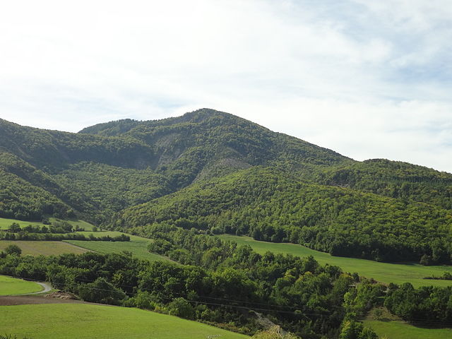
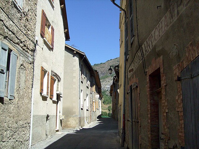
Rochebrune is a beautiful area located in the Hautes-Alpes region of southeastern France, known for its stunning alpine scenery, diverse trails, and opportunities for outdoor activities. Here’s an overview of what you can expect when hiking in Rochebrune:
Hiking Trails
- Variety of Trails: Rochebrune offers a range of hiking trails suited for different skill levels, from easy walks suitable for families to more challenging hikes for experienced adventurers.
- Scenic Views: Many trails provide spectacular views of the surrounding mountains, valleys, and sometimes even glimpses of local wildlife.
- Marked Paths: Trails are generally well-marked, but it's always a good idea to carry a map or use a GPS app for additional navigation support.
Popular Hiking Destinations
- Col de Rochebrune: A popular starting point for hikes. The ascent offers incredible panoramic views and leads to various connectable trails.
- Lac de la Douche: A beautiful alpine lake that can be reached via a moderate hike, making it a perfect spot for a picnic or a rest.
- Les Crêtes de Rochebrune: This trail takes you along ridge lines with breathtaking views. It may require some scrambling, making it suitable for more experienced hikers.
Best Time to Hike
- Summer (June to September): This is the peak hiking season when trails are generally clear of snow, and the weather is warm. Flowers are in bloom, making the surroundings even more picturesque.
- Fall (October): The changing foliage offers beautiful autumn colors, making it a great time for photography.
- Winter: Some trails may be accessible for snowshoeing or winter hiking, but always check local conditions and be prepared for snow and ice.
Preparation Tips
- Gear: Dress in layers and wear sturdy hiking boots. Bring plenty of water, snacks, and possibly a first aid kit.
- Weather: Check the weather forecast before heading out as conditions can change rapidly in the mountains.
- Safety: Hike with a partner when possible and let someone know your intended route and expected return time.
Local Amenities
- Accommodation: There are various lodges, guesthouses, and campsites in and around Rochebrune for overnight stays.
- Guided Tours: If you're not familiar with the area or prefer to hike with a knowledgeable guide, consider joining a guided hiking tour.
Overall, Rochebrune is a wonderful destination for hiking enthusiasts looking to explore the beauty of the Alps. Whether you’re planning a day hike or a longer trek, the area offers a wealth of natural beauty and outdoor adventure!
- Country:

- Postal Code: 05190
- Coordinates: 44° 27' 22" N, 6° 10' 37" E


- GPS tracks (wikiloc): [Link]
- Area: 12.37 sq km
- Population: 170
- Wikipedia en: wiki(en)
- Wikipedia: wiki(fr)
- Wikidata storage: Wikidata: Q1340832
- Wikipedia Commons Category: [Link]
- Freebase ID: [/m/03m81pn]
- Freebase ID: [/m/03m81pn]
- GeoNames ID: Alt: [6425622]
- GeoNames ID: Alt: [6425622]
- SIREN number: [210501219]
- SIREN number: [210501219]
- INSEE municipality code: 05121
- INSEE municipality code: 05121
Shares border with regions:

Théus
- commune in Hautes-Alpes, France
Théus, a small village in the Hautes-Alpes region of France, offers a variety of hiking opportunities amidst beautiful Alpine scenery. Here’s what you need to know if you're planning to hike in or around Théus:...
- Country:

- Postal Code: 05190
- Coordinates: 44° 28' 34" N, 6° 11' 18" E


- GPS tracks (wikiloc): [Link]
- Area: 16.71 sq km
- Population: 202


La Bréole
- former commune in Alpes-de-Haute-Provence, France
La Bréole is a picturesque village located in the Alpes-de-Haute-Provence region of southeastern France. It sits at an altitude of approximately 1,100 meters and offers a variety of hiking opportunities that cater to different skill levels....
- Country:

- Postal Code: 04340
- Coordinates: 44° 27' 24" N, 6° 17' 40" E


- GPS tracks (wikiloc): [Link]
- Area: 39.66 sq km
- Population: 358
- Web site: [Link]

Remollon
- commune in Hautes-Alpes, France
Remollon is a charming village located in the French Alps, specifically in the Hautes-Alpes department. It provides a wonderful base for hiking enthusiasts looking to explore the stunning natural landscapes of the region. Here’s what you should know about hiking in Remollon:...
- Country:

- Postal Code: 05190
- Coordinates: 44° 28' 3" N, 6° 10' 3" E


- GPS tracks (wikiloc): [Link]
- Area: 6.45 sq km
- Population: 434
- Web site: [Link]

Piégut
- commune in Alpes-de-Haute-Provence, France
Piégut is a charming commune in the Dordogne department of southwestern France, known for its beautiful natural landscapes and rural charm. Hiking in this region can be a delightful experience for outdoor enthusiasts....
- Country:

- Postal Code: 05130
- Coordinates: 44° 27' 7" N, 6° 7' 41" E


- GPS tracks (wikiloc): [Link]
- Area: 11.12 sq km
- Population: 169

Espinasses
- commune in Hautes-Alpes, France
Espinasses is a charming village located in the French Alps, in the department of Hautes-Alpes. It offers a variety of hiking opportunities suitable for different skill levels, surrounded by stunning natural beauty....
- Country:

- Postal Code: 05190
- Coordinates: 44° 28' 0" N, 6° 13' 29" E


- GPS tracks (wikiloc): [Link]
- Area: 13.86 sq km
- Population: 728
- Web site: [Link]

Gigors
- commune in Alpes-de-Haute-Provence, France
Gigors is a charming village located in the Provence-Alpes-Côte d'Azur region of France, near the picturesque Vercors Massif. While it may not be as widely known as some larger hiking destinations, it offers a range of scenic trails and beautiful landscapes that make it an appealing spot for hiking enthusiasts....
- Country:

- Postal Code: 04250
- Coordinates: 44° 25' 9" N, 6° 9' 34" E


- GPS tracks (wikiloc): [Link]
- Area: 13.69 sq km
- Population: 58

Bellaffaire
- commune in Alpes-de-Haute-Provence, France
It seems there may be a misunderstanding regarding the location "Bellaffaire." There isn't a widely recognized hiking area or national park by that name that I am aware of as of my last training cut-off in October 2023. It's possible that it could be a lesser-known local area, a private property, or perhaps a misspelling of a nearby location....
- Country:

- Postal Code: 04250
- Coordinates: 44° 25' 10" N, 6° 10' 36" E


- GPS tracks (wikiloc): [Link]
- Area: 13.12 sq km
- Population: 149
- Web site: [Link]

Bréziers
- commune in Hautes-Alpes, France
Bréziers is a charming town in the Occitanie region of southern France. While it is not as widely known for hiking as some other areas in France, it is surrounded by beautiful landscapes that can offer some great hiking opportunities....
- Country:

- Postal Code: 05190
- Coordinates: 44° 25' 35" N, 6° 11' 58" E


- GPS tracks (wikiloc): [Link]
- Area: 30.35 sq km
- Population: 210
